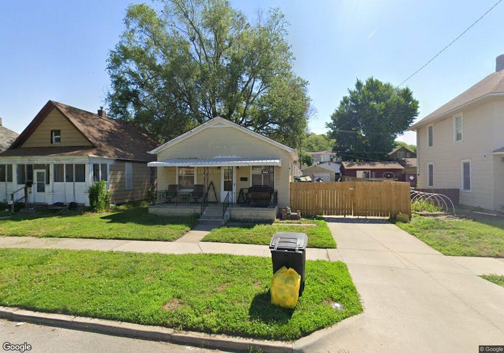
6019 Gordon Ave Saint Joseph, MO 64504
Southside NeighborhoodEstimated Value: $83,000 - $131,000
2
Beds
1
Bath
1,092
Sq Ft
$103/Sq Ft
Est. Value
About This Home
This home is located at 6019 Gordon Ave, Saint Joseph, MO 64504 and is currently estimated at $112,965, approximately $103 per square foot. 6019 Gordon Ave is a home located in Buchanan County with nearby schools including Hosea Elementary School, Spring Garden Middle School, and Benton High School.
Ownership History
Date
Name
Owned For
Owner Type
Purchase Details
Closed on
Feb 12, 2016
Sold by
Russell Joseph R and Russell Kimberley
Bought by
Morehead Jordan M
Current Estimated Value
Home Financials for this Owner
Home Financials are based on the most recent Mortgage that was taken out on this home.
Original Mortgage
$49,500
Outstanding Balance
$39,317
Interest Rate
3.92%
Mortgage Type
New Conventional
Estimated Equity
$73,648
Purchase Details
Closed on
Jul 12, 2006
Sold by
Cardwell Ivan J and Cardwell Dorinda J
Bought by
Russell Joseph R
Home Financials for this Owner
Home Financials are based on the most recent Mortgage that was taken out on this home.
Original Mortgage
$59,200
Interest Rate
6.6%
Mortgage Type
New Conventional
Create a Home Valuation Report for This Property
The Home Valuation Report is an in-depth analysis detailing your home's value as well as a comparison with similar homes in the area
Home Values in the Area
Average Home Value in this Area
Purchase History
| Date | Buyer | Sale Price | Title Company |
|---|---|---|---|
| Morehead Jordan M | -- | Preferred Title | |
| Russell Joseph R | -- | Hall Abstract & Title Co Inc |
Source: Public Records
Mortgage History
| Date | Status | Borrower | Loan Amount |
|---|---|---|---|
| Open | Morehead Jordan M | $49,500 | |
| Previous Owner | Russell Joseph R | $59,200 |
Source: Public Records
Tax History
| Year | Tax Paid | Tax Assessment Tax Assessment Total Assessment is a certain percentage of the fair market value that is determined by local assessors to be the total taxable value of land and additions on the property. | Land | Improvement |
|---|---|---|---|---|
| 2025 | $610 | $8,490 | $1,690 | $6,800 |
| 2024 | $581 | $8,090 | $1,690 | $6,400 |
| 2023 | $581 | $8,090 | $1,690 | $6,400 |
| 2022 | $537 | $8,090 | $1,690 | $6,400 |
| 2021 | $539 | $8,090 | $1,690 | $6,400 |
| 2020 | $536 | $8,090 | $1,690 | $6,400 |
| 2019 | $517 | $8,090 | $1,690 | $6,400 |
| 2018 | $467 | $8,090 | $1,690 | $6,400 |
| 2017 | $463 | $8,090 | $0 | $0 |
| 2015 | $0 | $8,090 | $0 | $0 |
| 2014 | $507 | $8,090 | $0 | $0 |
Source: Public Records
Map
Nearby Homes
- 118 Alabama St
- 212 Ohio St
- 5002-5026 King Hill Ave
- 6211 Washington St
- 214 Michigan St
- 6303 King Hill Ave
- 205 Michigan Ave
- 505 Virginia St
- 510 Ohio St
- 501 Ohio St
- 6316 Morris St
- 6309 Morris St
- 6322 Morris St
- 315 Yale St
- 715 W Valley St
- 210 Illinois Ave
- 6408 Sherman St
- 6507 Sherman St
- 6620 Vancil Pkwy
- 910 W Valley St
- 6017 Gordon Ave
- 6021 Gordon Ave
- 6015 Gordon Ave
- 6029 Gordon Ave
- 6013 Gordon Ave
- 6020 Pryor Ave
- 6022 Pryor Ave
- 6018 Pryor Ave
- 6024 Pryor Ave
- 6009 Gordon Ave
- 6014 Pryor Ave
- 6026 Gordon Ave
- 6024 Gordon Ave
- 6028 Gordon Ave
- 6036 Pryor Ave
- 6030 Gordon Ave
- 6016 Gordon Ave
- 6010 Pryor Ave
- 6005 Gordon Ave
- 6010 Gordon Ave
Your Personal Tour Guide
Ask me questions while you tour the home.