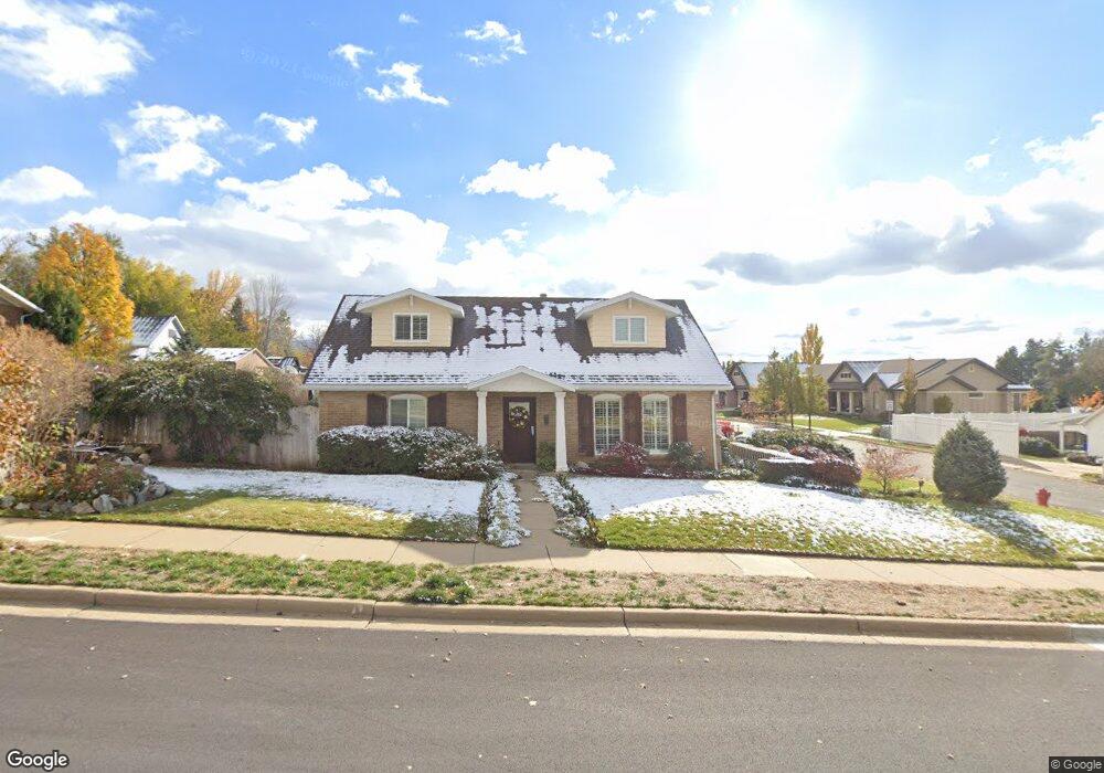
602 Pheasant Way Centerville, UT 84014
Estimated Value: $550,817 - $638,000
4
Beds
3
Baths
2,060
Sq Ft
$283/Sq Ft
Est. Value
About This Home
This home is located at 602 Pheasant Way, Centerville, UT 84014 and is currently estimated at $582,454, approximately $282 per square foot. 602 Pheasant Way is a home located in Davis County with nearby schools including Centerville Elementary, Centerville Jr High, and Viewmont High School.
Ownership History
Date
Name
Owned For
Owner Type
Purchase Details
Closed on
Sep 21, 2023
Sold by
Stephens Brent E and Stephens Stephanie
Bought by
Brent & Stephanie Stephens Revocable Family T and Stephens
Current Estimated Value
Create a Home Valuation Report for This Property
The Home Valuation Report is an in-depth analysis detailing your home's value as well as a comparison with similar homes in the area
Purchase History
| Date | Buyer | Sale Price | Title Company |
|---|---|---|---|
| Brent & Stephanie Stephens Revocable Family T | -- | None Listed On Document |
Source: Public Records
Tax History
| Year | Tax Paid | Tax Assessment Tax Assessment Total Assessment is a certain percentage of the fair market value that is determined by local assessors to be the total taxable value of land and additions on the property. | Land | Improvement |
|---|---|---|---|---|
| 2025 | $3,099 | $296,451 | $157,273 | $139,178 |
| 2024 | $2,940 | $285,999 | $141,862 | $144,137 |
| 2023 | $2,719 | $478,000 | $232,041 | $245,959 |
| 2022 | $2,858 | $276,650 | $117,302 | $159,348 |
| 2021 | $2,553 | $385,000 | $179,733 | $205,267 |
| 2020 | $2,202 | $332,000 | $175,220 | $156,780 |
| 2019 | $2,214 | $326,000 | $174,540 | $151,460 |
| 2018 | $2,055 | $299,000 | $161,897 | $137,103 |
| 2016 | $1,763 | $142,560 | $54,912 | $87,648 |
| 2015 | $1,739 | $132,605 | $54,912 | $77,693 |
| 2014 | $1,694 | $132,158 | $55,013 | $77,145 |
| 2013 | -- | $119,029 | $41,993 | $77,036 |
Source: Public Records
Map
Nearby Homes
- 295 E 500 N
- 563 N 220 E
- 380 E 400 N
- 252 N 400 E
- 984 N 500 E
- 66 Brookside Ln
- 775 Pheasantbrook Cir
- 56 W 200 N
- 360 E Center St
- 16 S 200 E
- 282 W 605 N Unit A
- 282 W 605 N Unit I
- 281 W 650 N Unit B
- 132 W 200 N
- 292 W 680 N
- 303 W 650 N Unit I
- 328 E 1100 S
- 781 Pheasantbrook Dr
- 271 Brookfield Ln
- 1290 Oakridge Dr
- 582 Pheasant Way
- 364 London Rd
- 575 Pheasant Way
- 306 London Rd
- 343 London Rd
- 583 Pheasant Way
- 298 London Rd
- 613 N 400 E
- 562 Pheasant Way
- 562 Pheasant Way Unit 2
- 585 N 400 E
- 631 Pheasant Way
- 563 Pheasant Way
- 605 N 400 E
- 383 London Rd
- 278 London Rd
- 654 Pheasant Way
- 281 London Rd
- 569 N 400 E
- 558 Pheasant Way
Your Personal Tour Guide
Ask me questions while you tour the home.