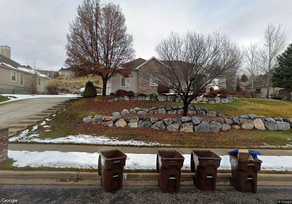
602 W 600 N Alpine, UT 84004
Estimated Value: $1,131,000 - $1,510,000
6
Beds
3
Baths
4,748
Sq Ft
$269/Sq Ft
Est. Value
About This Home
This home is located at 602 W 600 N, Alpine, UT 84004 and is currently estimated at $1,276,119, approximately $268 per square foot. 602 W 600 N is a home located in Utah County with nearby schools including Westfield School, Timberline Middle School, and Lone Peak High School.
Ownership History
Date
Name
Owned For
Owner Type
Purchase Details
Closed on
Dec 3, 2020
Sold by
Wilkey Julie L
Bought by
Lambson Charles T and Lambson Cheryl K
Current Estimated Value
Purchase Details
Closed on
Jan 28, 2002
Sold by
Wilkey Mark E
Bought by
Wilkey Julie L
Purchase Details
Closed on
Feb 23, 2000
Sold by
Mountain West Development Llc
Bought by
Wilkey Mark E and Wilkey Julie L
Home Financials for this Owner
Home Financials are based on the most recent Mortgage that was taken out on this home.
Original Mortgage
$125,000
Interest Rate
8.15%
Create a Home Valuation Report for This Property
The Home Valuation Report is an in-depth analysis detailing your home's value as well as a comparison with similar homes in the area
Home Values in the Area
Average Home Value in this Area
Purchase History
| Date | Buyer | Sale Price | Title Company |
|---|---|---|---|
| Lambson Charles T | -- | Investors Title Ins Agcy Inc | |
| Wilkey Julie L | -- | -- | |
| Wilkey Mark E | -- | Timp Title Insurance Agency |
Source: Public Records
Mortgage History
| Date | Status | Borrower | Loan Amount |
|---|---|---|---|
| Previous Owner | Wilkey Mark E | $125,000 |
Source: Public Records
Tax History
| Year | Tax Paid | Tax Assessment Tax Assessment Total Assessment is a certain percentage of the fair market value that is determined by local assessors to be the total taxable value of land and additions on the property. | Land | Improvement |
|---|---|---|---|---|
| 2025 | $5,120 | $644,545 | -- | -- |
| 2024 | $5,120 | $596,695 | $0 | $0 |
| 2023 | $4,653 | $582,175 | $0 | $0 |
| 2022 | $5,186 | $630,245 | $0 | $0 |
| 2021 | $3,939 | $743,600 | $374,200 | $369,400 |
| 2020 | $3,841 | $709,600 | $340,200 | $369,400 |
| 2019 | $3,499 | $674,700 | $305,300 | $369,400 |
| 2018 | $1,749 | $657,200 | $287,800 | $369,400 |
| 2017 | $994 | $354,255 | $0 | $0 |
| 2016 | $662 | $306,020 | $0 | $0 |
| 2015 | $1,223 | $288,255 | $0 | $0 |
| 2014 | $3,161 | $279,620 | $0 | $0 |
Source: Public Records
Map
Nearby Homes
- 820 Eagleview Dr
- 522 N Pfeifferhorn Dr
- 591 N Pfeifferhorn Dr
- 151 Glacier Lily Dr
- 5886 W Timber Ridge Ln
- 35 Sledhill Cir Unit 2
- 19 E Elk Ct
- 475 Grove Dr
- 30 S Main St
- 48 N 100 E
- 259 Twin River Loop
- 250 S Main St Unit 20
- 250 S Main St Unit 7
- 512 Eastridge Cir
- 102 E Deer Crest Ln
- 381 E Watkins Cir Unit 28
- 382 E Heritage Hills Dr
- 11886 Harvest Moon Ln
- 1319 N Eastview Ln Unit 214
- 1333 N Eastview Ln
- 602 W 600 N Unit 4
- 602 W Hog Hollow Rd
- 624 W 600 N
- 624 W 600 N Unit 5
- 574 W 600 N
- 574 W 600 N Unit 3
- 574 W Hog Hollow Rd
- 702 Summit Way
- 684 Summit Way
- 548 W 600 N
- 548 W 600 N Unit 2
- 646 W 600 N
- 646 W 600 N Unit 6
- 702 N Summit Way
- 575 W 600 N
- 615 W 600 N
- 615 W 600 N Unit 1
- 645 W 600 N
- 718 Summit Way
- 687 N Summit Way Unit 25
Your Personal Tour Guide
Ask me questions while you tour the home.