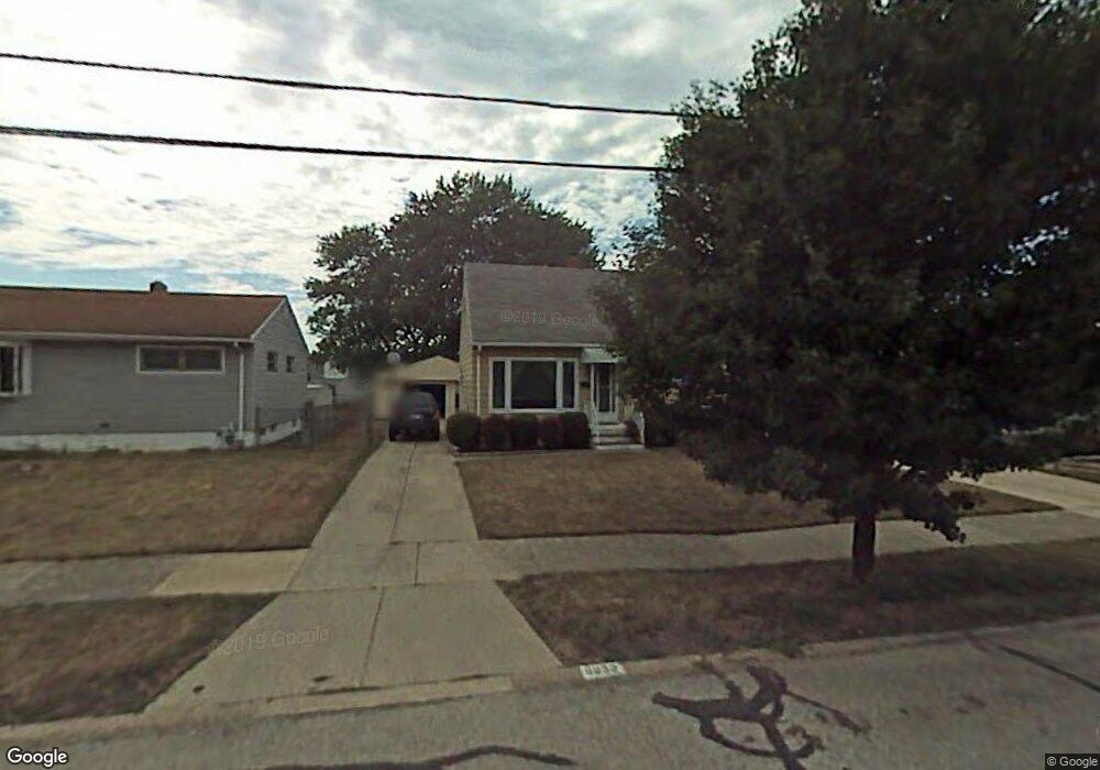
6022 Morrow Dr Brookpark, OH 44142
Estimated Value: $194,150 - $246,000
3
Beds
1
Bath
1,131
Sq Ft
$194/Sq Ft
Est. Value
About This Home
This home is located at 6022 Morrow Dr, Brookpark, OH 44142 and is currently estimated at $219,538, approximately $194 per square foot. 6022 Morrow Dr is a home located in Cuyahoga County with nearby schools including Berea-Midpark Middle School, Berea-Midpark High School, and Huber Heights Preparatory Academy Parma Academy.
Ownership History
Date
Name
Owned For
Owner Type
Purchase Details
Closed on
May 14, 2001
Sold by
Klingbell Kimberly A
Bought by
Arko William G
Current Estimated Value
Home Financials for this Owner
Home Financials are based on the most recent Mortgage that was taken out on this home.
Original Mortgage
$92,000
Outstanding Balance
$34,251
Interest Rate
6.99%
Estimated Equity
$185,287
Purchase Details
Closed on
Aug 22, 1997
Sold by
Grd Kenneth R Smith
Bought by
Klingbell Kimberly A and Arko William G
Home Financials for this Owner
Home Financials are based on the most recent Mortgage that was taken out on this home.
Original Mortgage
$90,900
Interest Rate
7.56%
Mortgage Type
New Conventional
Purchase Details
Closed on
Jan 1, 1975
Bought by
Smith Elmer H and Smith Dorothy A
Create a Home Valuation Report for This Property
The Home Valuation Report is an in-depth analysis detailing your home's value as well as a comparison with similar homes in the area
Home Values in the Area
Average Home Value in this Area
Purchase History
| Date | Buyer | Sale Price | Title Company |
|---|---|---|---|
| Arko William G | $15,000 | City Title Company Agency In | |
| Klingbell Kimberly A | $101,000 | -- | |
| Smith Elmer H | -- | -- |
Source: Public Records
Mortgage History
| Date | Status | Borrower | Loan Amount |
|---|---|---|---|
| Open | Arko William G | $92,000 | |
| Previous Owner | Klingbell Kimberly A | $90,900 |
Source: Public Records
Tax History
| Year | Tax Paid | Tax Assessment Tax Assessment Total Assessment is a certain percentage of the fair market value that is determined by local assessors to be the total taxable value of land and additions on the property. | Land | Improvement |
|---|---|---|---|---|
| 2024 | $3,010 | $59,675 | $12,425 | $47,250 |
| 2023 | $2,710 | $44,490 | $9,030 | $35,460 |
| 2022 | $2,691 | $44,490 | $9,030 | $35,460 |
| 2021 | $2,675 | $44,490 | $9,030 | $35,460 |
| 2020 | $2,389 | $34,970 | $7,180 | $27,790 |
| 2019 | $2,318 | $99,900 | $20,500 | $79,400 |
| 2018 | $2,308 | $34,970 | $7,180 | $27,790 |
| 2017 | $2,266 | $31,710 | $6,720 | $24,990 |
| 2016 | $2,247 | $31,710 | $6,720 | $24,990 |
| 2015 | $2,109 | $31,710 | $6,720 | $24,990 |
| 2014 | $2,109 | $31,710 | $6,720 | $24,990 |
Source: Public Records
Map
Nearby Homes
- 6095 Stark Dr
- 6014 Westbrook Dr
- 6103 Westbrook Dr
- 6131 Hardin Dr
- 5889 Westbrook Dr
- 13874 Heatherwood Dr
- 14024 Donald Dr
- 5727 Gateway Ln Unit 1203
- 15532 Rademaker Dr
- 15424 Holland Rd
- 15497 Hummel Rd
- 13602 Holland Rd
- 16001 Sylvia Dr
- 16117 Hocking Blvd
- 16159 Bowfin Blvd
- 15633 Harrison Dr
- 6377 Ledgebrook Dr
- 14398 Sheldon Rd
- 16379 Hummel Rd
- 6333 W 130th St
- 6016 Morrow Dr
- 6028 Morrow Dr
- 6034 Morrow Dr
- 14603 Fayette Blvd
- 14595 Fayette Blvd
- 14621 Fayette Blvd
- 6023 Stark Dr
- 6040 Morrow Dr
- 6029 Stark Dr
- 6017 Stark Dr
- 14639 Fayette Blvd
- 6035 Stark Dr
- 14657 Fayette Blvd
- 6023 Morrow Dr
- 6046 Morrow Dr
- 14563 Fayette Blvd
- 6029 Morrow Dr
- 6017 Morrow Dr
- 6041 Stark Dr
- 6035 Morrow Dr
Your Personal Tour Guide
Ask me questions while you tour the home.