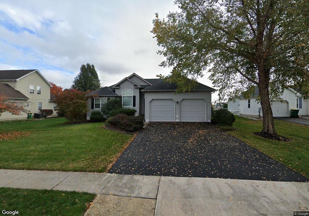
603 Dove Nest Ct Middletown, DE 19709
Estimated Value: $333,000 - $395,000
3
Beds
2
Baths
1,401
Sq Ft
$269/Sq Ft
Est. Value
About This Home
This home is located at 603 Dove Nest Ct, Middletown, DE 19709 and is currently estimated at $376,979, approximately $269 per square foot. 603 Dove Nest Ct is a home located in New Castle County with nearby schools including Bunker Hill Elementary School, Everett Meredith Middle School, and Appoquinimink High School.
Ownership History
Date
Name
Owned For
Owner Type
Purchase Details
Closed on
Jan 12, 2009
Sold by
Edwards Patricia A
Bought by
Edwards Patricia A and Edwards Walter A
Current Estimated Value
Purchase Details
Closed on
Aug 14, 2001
Sold by
Edwards Walter A and Owsiany Patricia A
Bought by
Edwards Patricia A
Create a Home Valuation Report for This Property
The Home Valuation Report is an in-depth analysis detailing your home's value as well as a comparison with similar homes in the area
Home Values in the Area
Average Home Value in this Area
Purchase History
| Date | Buyer | Sale Price | Title Company |
|---|---|---|---|
| Edwards Patricia A | -- | None Available | |
| Edwards Patricia A | -- | -- |
Source: Public Records
Tax History Compared to Growth
Tax History
| Year | Tax Paid | Tax Assessment Tax Assessment Total Assessment is a certain percentage of the fair market value that is determined by local assessors to be the total taxable value of land and additions on the property. | Land | Improvement |
|---|---|---|---|---|
| 2024 | $1,660 | $63,100 | $11,700 | $51,400 |
| 2023 | $1,289 | $63,100 | $11,700 | $51,400 |
| 2022 | $1,281 | $63,100 | $11,700 | $51,400 |
| 2021 | $1,349 | $63,100 | $11,700 | $51,400 |
| 2020 | $1,325 | $63,100 | $11,700 | $51,400 |
| 2019 | $1,169 | $63,100 | $11,700 | $51,400 |
| 2018 | $1,117 | $63,100 | $11,700 | $51,400 |
| 2017 | $1,064 | $63,100 | $11,700 | $51,400 |
| 2016 | $801 | $63,100 | $11,700 | $51,400 |
| 2015 | $752 | $63,100 | $11,700 | $51,400 |
| 2014 | $747 | $63,100 | $11,700 | $51,400 |
Source: Public Records
Map
Nearby Homes
- 306 E Harvest Ln
- 367 E Harvest Ln
- 330 E Harvest Ln
- 102 Springmill Dr
- 131 Rosie Dr
- 580 Whispering Trail
- 832 Woodline Dr
- 51 Springmill Dr
- 56 Springmill Dr
- 1023 Bunker Hill Rd
- 320 Marldale Dr
- 335 Marldale Dr
- 47 Franklin Dr
- 415 Morning Glory Ln
- 417 Morning Glory Ln
- 6 Kimberly Dr
- 107 Gazebo Ln
- 402 Topiary Ln
- 1167 Bunker Hill Rd
- 13 Brady Cir
- 605 Dove Nest Ct
- 601 Dove Nest Ct
- 302 E Harvest Ln
- 300 E Harvest Ln
- 607 Dove Nest Ct
- 602 Dove Nest Ct
- 604 Dove Nest Ct
- 600 Dove Nest Ct
- 606 Dove Nest Ct
- 609 Dove Nest Ct
- 501 N Ramunno Dr
- 372 E Harvest Ln
- 400 W Harvest Ln
- 303 E Harvest Ln
- 312 E Harvest Ln
- 316 E Harvest Ln
- 305 E Harvest Ln
- 608 Dove Nest Ct
- 370 E Harvest Ln
- 307 E Harvest Ln