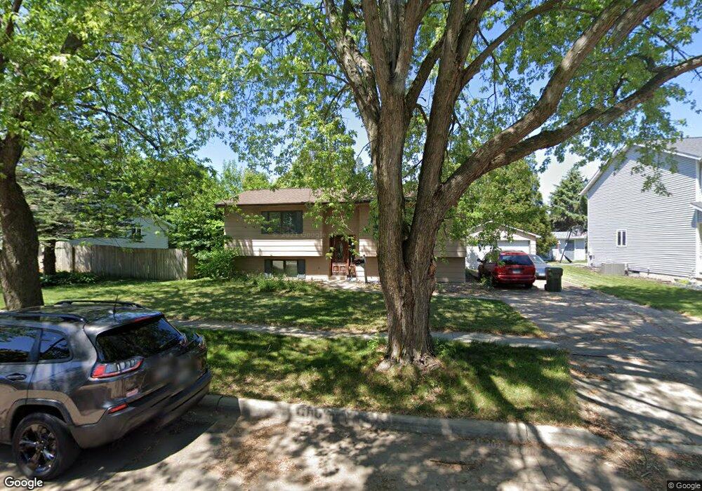
603 Fireside Dr Cedar Falls, IA 50613
Estimated Value: $213,734 - $280,000
2
Beds
2
Baths
954
Sq Ft
$256/Sq Ft
Est. Value
About This Home
This home is located at 603 Fireside Dr, Cedar Falls, IA 50613 and is currently estimated at $244,434, approximately $256 per square foot. 603 Fireside Dr is a home located in Black Hawk County with nearby schools including Helen A. Hansen Elementary School, Holmes Junior High School, and Cedar Falls High School.
Ownership History
Date
Name
Owned For
Owner Type
Purchase Details
Closed on
Jun 6, 2006
Sold by
Murray John M and Murray Debora M
Bought by
Nelson John R and Nelson Lise R
Current Estimated Value
Home Financials for this Owner
Home Financials are based on the most recent Mortgage that was taken out on this home.
Original Mortgage
$144,500
Outstanding Balance
$84,927
Interest Rate
6.66%
Mortgage Type
Credit Line Revolving
Estimated Equity
$159,507
Create a Home Valuation Report for This Property
The Home Valuation Report is an in-depth analysis detailing your home's value as well as a comparison with similar homes in the area
Home Values in the Area
Average Home Value in this Area
Purchase History
| Date | Buyer | Sale Price | Title Company |
|---|---|---|---|
| Nelson John R | $144,500 | Professional Closing And Set |
Source: Public Records
Mortgage History
| Date | Status | Borrower | Loan Amount |
|---|---|---|---|
| Open | Nelson John R | $144,500 |
Source: Public Records
Tax History
| Year | Tax Paid | Tax Assessment Tax Assessment Total Assessment is a certain percentage of the fair market value that is determined by local assessors to be the total taxable value of land and additions on the property. | Land | Improvement |
|---|---|---|---|---|
| 2025 | $2,732 | $211,920 | $44,090 | $167,830 |
| 2024 | $2,732 | $169,730 | $44,090 | $125,640 |
| 2023 | $3,018 | $169,730 | $44,090 | $125,640 |
| 2022 | $3,110 | $154,230 | $44,090 | $110,140 |
| 2021 | $2,598 | $154,230 | $44,090 | $110,140 |
| 2020 | $2,737 | $139,530 | $29,390 | $110,140 |
| 2019 | $5,092 | $139,530 | $29,390 | $110,140 |
| 2018 | $2,668 | $132,330 | $29,390 | $102,940 |
| 2017 | $2,446 | $132,330 | $29,390 | $102,940 |
| 2016 | $2,338 | $132,330 | $29,390 | $102,940 |
| 2015 | $2,338 | $132,330 | $29,390 | $102,940 |
| 2014 | $2,366 | $132,330 | $29,390 | $102,940 |
Source: Public Records
Map
Nearby Homes
- 929 Barnett Dr
- 2718 Ryan Dr
- 114 Parkgate Rd
- 2912 W 4th St Unit 2
- 1103 Carriage Ln
- 1033 Barrington Dr
- 1522 W 5th St
- 3702 Apollo St
- 0 W 1st St
- 1504 W 4th St
- 502 Oak Park Blvd
- 1916 Shelden Ave
- 3023 Wellington Dr
- 3413 Pheasant Dr
- 1115 Oak Park Blvd
- 1409 Parkway Ave
- 214 N Francis St
- 2706 Country Meadow Ln
- 1826 Breckenridge St
- 4035 Broomfield Dr
- 551 Fireside Dr
- 613 Fireside Dr
- 612 Barnett Dr
- 618 Barnett Dr
- 602 Fireside Dr
- 608 Fireside Dr
- 550 Fireside Dr
- 604 Barnett Dr
- 524 Barnett Dr Unit 526
- 626 Barnett Dr
- 539 Fireside Dr
- 614 Fireside Dr
- 544 Fireside Dr
- 621 Fireside Dr
- 516 Barnett Dr Unit 518
- 624 Fireside Dr
- 607 Birdsall Dr
- 515 Birdsall Dr
- 704 Barnett Dr
- 525 Birdsall Dr
Your Personal Tour Guide
Ask me questions while you tour the home.