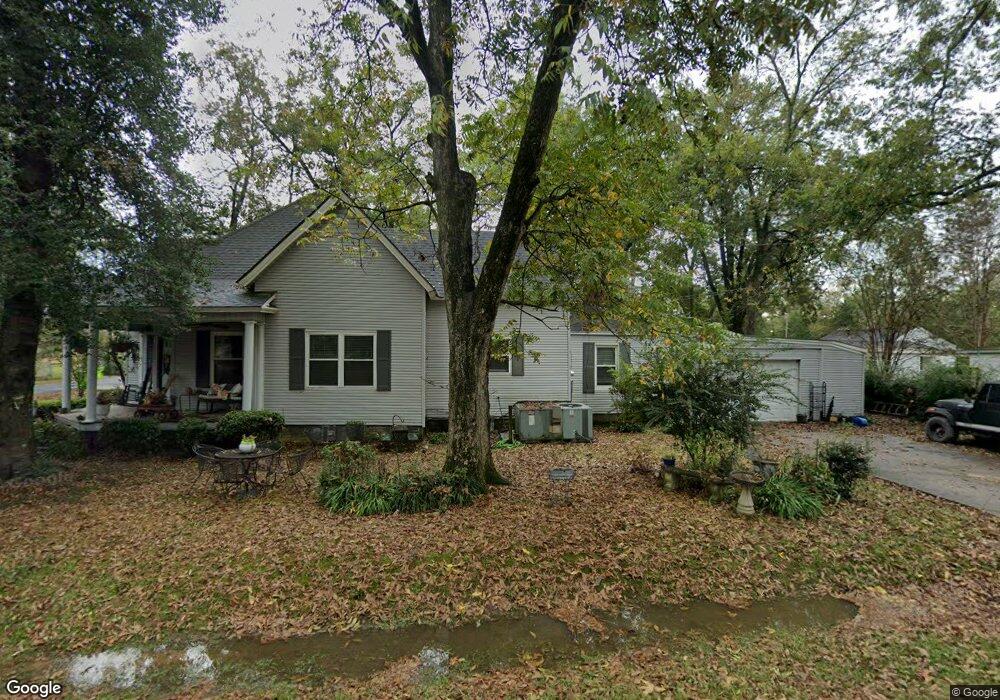
603 W Pine St Lonoke, AR 72086
Estimated Value: $139,495 - $167,000
3
Beds
2
Baths
1,660
Sq Ft
$92/Sq Ft
Est. Value
About This Home
This home is located at 603 W Pine St, Lonoke, AR 72086 and is currently estimated at $152,874, approximately $92 per square foot. 603 W Pine St is a home located in Lonoke County with nearby schools including Lonoke Primary School, Lonoke Elementary School, and Lonoke Middle School.
Ownership History
Date
Name
Owned For
Owner Type
Purchase Details
Closed on
May 22, 2014
Bought by
Bronson Robert David
Current Estimated Value
Purchase Details
Closed on
Oct 24, 2013
Sold by
Wells Fargo Bank Na
Bought by
The Secretary Of Housing And Urban Devel
Purchase Details
Closed on
Jan 21, 2003
Bought by
Smith and Smith Wf
Purchase Details
Closed on
Oct 29, 1998
Bought by
Scroggins
Purchase Details
Closed on
Jul 9, 1997
Bought by
Chivers
Create a Home Valuation Report for This Property
The Home Valuation Report is an in-depth analysis detailing your home's value as well as a comparison with similar homes in the area
Home Values in the Area
Average Home Value in this Area
Purchase History
| Date | Buyer | Sale Price | Title Company |
|---|---|---|---|
| Bronson Robert David | -- | -- | |
| The Secretary Of Housing And Urban Devel | -- | -- | |
| Smith | -- | -- | |
| Scroggins | $25,000 | -- | |
| Scroggins | $25,000 | -- | |
| Chivers | $20,000 | -- |
Source: Public Records
Tax History Compared to Growth
Tax History
| Year | Tax Paid | Tax Assessment Tax Assessment Total Assessment is a certain percentage of the fair market value that is determined by local assessors to be the total taxable value of land and additions on the property. | Land | Improvement |
|---|---|---|---|---|
| 2025 | $347 | $14,440 | $1,200 | $13,240 |
| 2024 | $347 | $14,440 | $1,200 | $13,240 |
| 2023 | $347 | $14,440 | $1,200 | $13,240 |
| 2022 | $363 | $14,440 | $1,200 | $13,240 |
| 2021 | $330 | $14,440 | $1,200 | $13,240 |
| 2020 | $296 | $11,760 | $1,200 | $10,560 |
| 2019 | $274 | $11,760 | $1,200 | $10,560 |
| 2018 | $299 | $11,760 | $1,200 | $10,560 |
| 2017 | $649 | $11,760 | $1,200 | $10,560 |
| 2016 | $299 | $11,760 | $1,200 | $10,560 |
| 2015 | $627 | $11,370 | $1,200 | $10,170 |
| 2014 | $627 | $11,370 | $1,200 | $10,170 |
Source: Public Records
Map
Nearby Homes