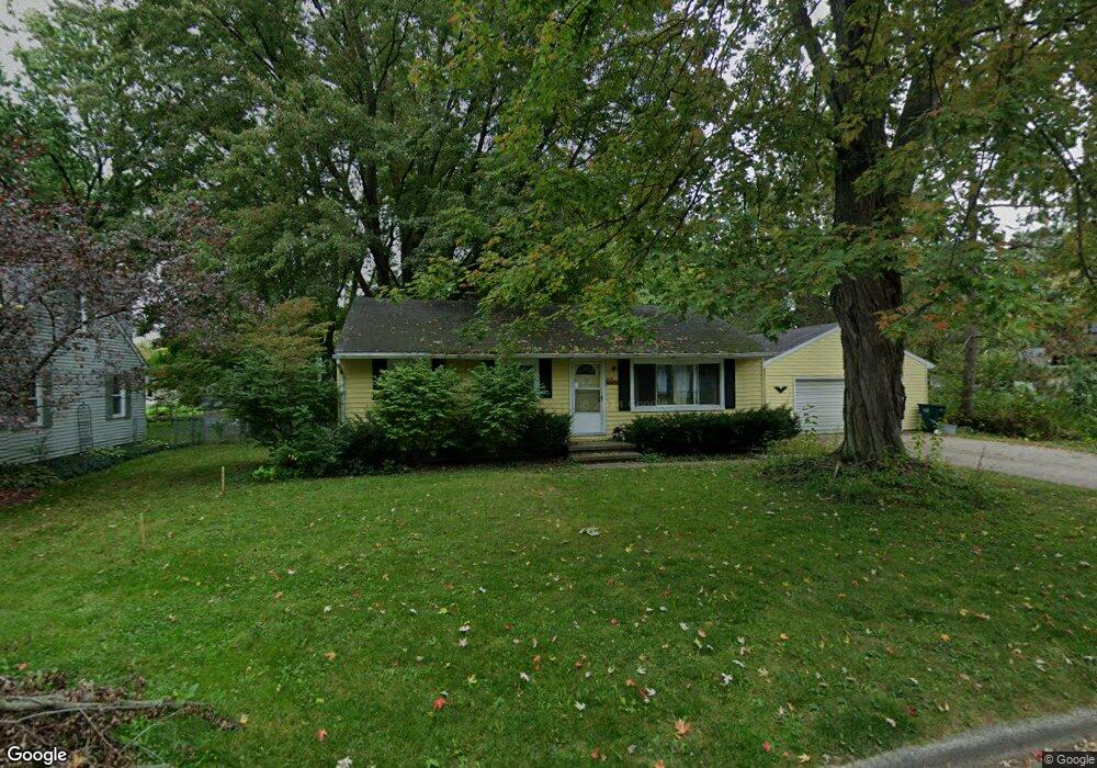
6041 Rolfe Rd Lansing, MI 48911
Southern Lansing NeighborhoodEstimated Value: $145,238 - $175,000
Studio
--
Bath
1,068
Sq Ft
$151/Sq Ft
Est. Value
About This Home
This home is located at 6041 Rolfe Rd, Lansing, MI 48911 and is currently estimated at $161,560, approximately $151 per square foot. 6041 Rolfe Rd is a home located in Ingham County with nearby schools including Kendon School, Attwood School, and Everett High School.
Ownership History
Date
Name
Owned For
Owner Type
Purchase Details
Closed on
Nov 6, 2014
Sold by
Welch Robert W and Spayd-Welch Sharon K
Bought by
The Welch Family Trust and Welch Robert W
Current Estimated Value
Purchase Details
Closed on
Sep 13, 1999
Sold by
Good Robert J and Good Ann
Bought by
Welch Robert W
Purchase Details
Closed on
May 23, 1996
Sold by
Sweeney Timothy P and Sweeney Shari L
Bought by
Good Robert J and Good Ann
Create a Home Valuation Report for This Property
The Home Valuation Report is an in-depth analysis detailing your home's value as well as a comparison with similar homes in the area
Home Values in the Area
Average Home Value in this Area
Purchase History
| Date | Buyer | Sale Price | Title Company |
|---|---|---|---|
| The Welch Family Trust | -- | None Available | |
| Welch Robert W | -- | None Available | |
| Welch Robert W | $80,000 | First American Title Ins Co | |
| Good Robert J | $68,000 | -- |
Source: Public Records
Tax History
| Year | Tax Paid | Tax Assessment Tax Assessment Total Assessment is a certain percentage of the fair market value that is determined by local assessors to be the total taxable value of land and additions on the property. | Land | Improvement |
|---|---|---|---|---|
| 2025 | $3,920 | $77,900 | $11,400 | $66,500 |
| 2024 | $33 | $65,800 | $11,400 | $54,400 |
| 2023 | $3,687 | $59,700 | $11,400 | $48,300 |
| 2022 | $3,364 | $56,300 | $13,700 | $42,600 |
| 2021 | $3,286 | $53,600 | $11,400 | $42,200 |
| 2020 | $3,263 | $49,700 | $11,400 | $38,300 |
| 2019 | $3,155 | $45,500 | $11,400 | $34,100 |
| 2018 | $2,990 | $41,300 | $11,400 | $29,900 |
| 2017 | $2,878 | $41,300 | $11,400 | $29,900 |
| 2016 | $2,124 | $38,700 | $11,400 | $27,300 |
| 2015 | $2,124 | $37,700 | $22,840 | $14,860 |
| 2014 | $2,124 | $37,700 | $27,408 | $10,292 |
Source: Public Records
Map
Nearby Homes
- 5902 Hilliard Rd
- 115 E Claremore Dr
- 6246 Gardenia Ave
- 6444 Sommerset Rd
- 6429 Rosedale Rd
- 6421 S Washington Ave
- 208 E Northrup St
- 510 Sawyer Rd
- 1020 R G Curtiss Ave
- 1015 Brad St
- 5267 Crocus Ave
- 6235 Yunker St
- 5641 Ashley Dr
- 5808 Orchard Ct
- 1406 Weymouth Ct
- 5902 Haag Rd
- 6037 Hughes Rd
- 419 W Jolly Rd
- 6935 Vernson Dr
- 5723 Taffy Pkwy
- 6031 Rolfe Rd
- 6055 Rolfe Rd
- 6055 Rolfe Rd
- 6027 Rolfe Rd
- 6040 Ellendale Dr
- 6044 Rolfe Rd
- 6034 Rolfe Rd
- 6034 Ellendale Dr
- 6048 Ellendale Dr
- 6063 Rolfe Rd
- 310 W Miller Rd
- 310 W Ller
- 6056 Ellendale Dr
- 6028 Ellendale Dr
- 6019 Rolfe Rd
- 400 W Miller Rd
- 300 W Miller Rd
- 6022 Rolfe Rd
- 6020 Ellendale Dr
- 320 W Miller Rd
Your Personal Tour Guide
Ask me questions while you tour the home.