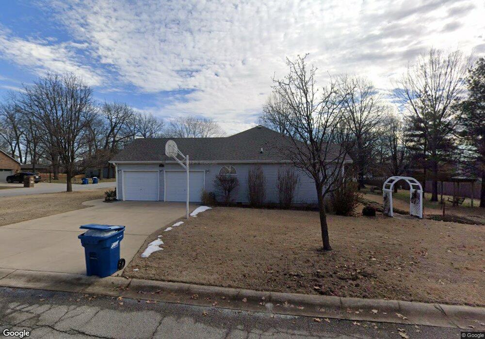
605 Bunker Ln Carl Junction, MO 64834
Briarbrook NeighborhoodEstimated Value: $249,000 - $300,000
4
Beds
2
Baths
1,853
Sq Ft
$147/Sq Ft
Est. Value
About This Home
This home is located at 605 Bunker Ln, Carl Junction, MO 64834 and is currently estimated at $272,771, approximately $147 per square foot. 605 Bunker Ln is a home located in Jasper County with nearby schools including Carl Junction Primary School (K-1), Carl Junction Intermediate School, and Carl Junction Primary School (2-3).
Ownership History
Date
Name
Owned For
Owner Type
Purchase Details
Closed on
Sep 1, 2010
Sold by
Schrage Michael A and Schrage Karolyn M
Bought by
Schrage Michael A and Schrage Karolyn M
Current Estimated Value
Purchase Details
Closed on
Aug 19, 2010
Sold by
Schrage Michael A and Schrage Karolyn M
Bought by
Schrage Michael A and Schrage Karolyn M
Purchase Details
Closed on
Jun 24, 2005
Sold by
Garoutte Michael and Garoutte Susan
Bought by
Kelly Richard D and Kelly Deborah R
Purchase Details
Closed on
Aug 11, 2004
Sold by
Heckert Construction Co Inc
Bought by
Garoutte Michael and Garoutte Susan
Create a Home Valuation Report for This Property
The Home Valuation Report is an in-depth analysis detailing your home's value as well as a comparison with similar homes in the area
Home Values in the Area
Average Home Value in this Area
Purchase History
| Date | Buyer | Sale Price | Title Company |
|---|---|---|---|
| Schrage Michael A | -- | Abbey | |
| Schrage Michael A | -- | Abbey | |
| Kelly Richard D | -- | -- | |
| Garoutte Michael | -- | -- |
Source: Public Records
Tax History
| Year | Tax Paid | Tax Assessment Tax Assessment Total Assessment is a certain percentage of the fair market value that is determined by local assessors to be the total taxable value of land and additions on the property. | Land | Improvement |
|---|---|---|---|---|
| 2025 | $1,691 | $29,340 | $3,350 | $25,990 |
| 2024 | $1,697 | $26,670 | $3,350 | $23,320 |
| 2023 | $1,697 | $26,670 | $3,350 | $23,320 |
| 2022 | $1,715 | $26,960 | $3,350 | $23,610 |
| 2021 | $1,485 | $26,960 | $3,350 | $23,610 |
| 2020 | $1,387 | $24,850 | $3,350 | $21,500 |
| 2019 | $1,319 | $24,850 | $3,350 | $21,500 |
| 2018 | $1,182 | $22,410 | $0 | $0 |
| 2016 | $1,239 | $23,630 | $0 | $0 |
Source: Public Records
Map
Nearby Homes
- 710 Briarbrook Dr
- 128 Par Ln
- 107 Foursome Ln
- 6548 Mo-171
- 306 Lakeview Ln
- XXX Lone Elm
- 121 Forest Dr
- 328 Briarbrook Dr
- 232 Hickory Place
- 106 Victoria Ln
- 706 W Briarbrook Ln
- 126 N Windwood
- 9130 Missouri 171
- 807 Copper Oaks Dr
- 913 W Briarbrook Ln
- 123 Rocky Ln
- 201 Tee Ln
- 909 Silver Oaks Dr
- LOT 4C Hwy 171 & Fir Rd Unit 4C
- 708 Danica Jo Ln
- 607 Bunker Ln
- 601 Bunker Ln
- 712 E Briarbrook Ln
- 606 E Briarbrook Ln
- 700 E Briarbrook Ln
- 700 Brassie Cir
- 603 Bunker Ln
- TBD Bunker Ln
- TBD Bunker Ln Unit 4
- 600 E Briarbrook Ln
- 703 E Briarbrook Ln
- 710 E Briarbrook Ln
- 507 Eagle Cir
- 715 E Briarbrook Ln
- 604 Bunker Cir
- 713 E Briarbrook Ln
- 506 Eagle Cir
- 706 Brassie Cir
- 702 Brassie Cir
- 701 Bunker Ln
Your Personal Tour Guide
Ask me questions while you tour the home.