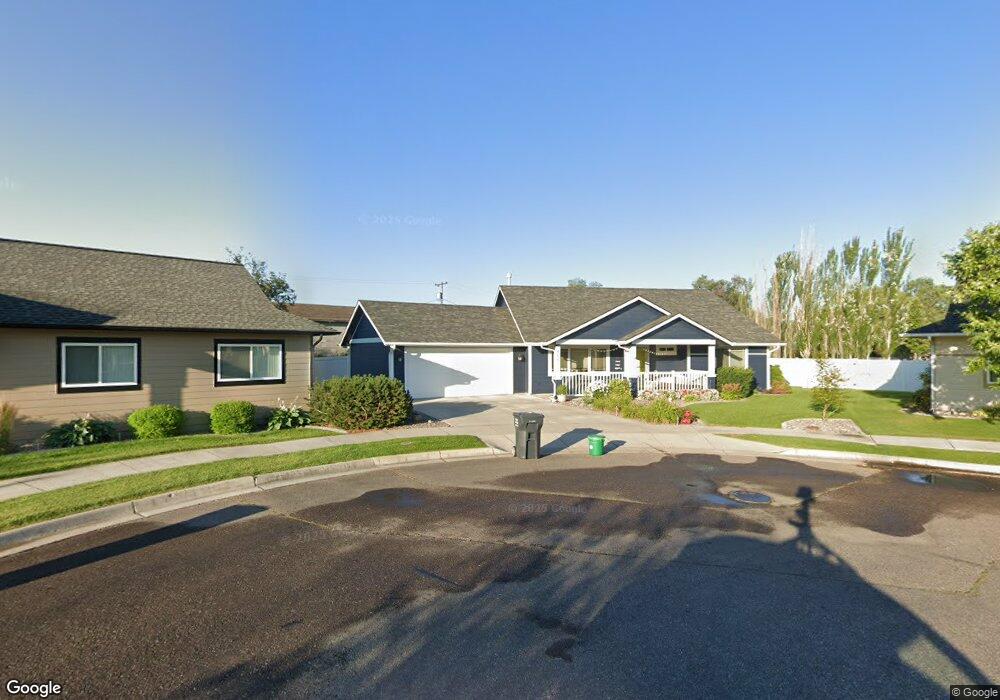
605 Carter Ct Missoula, MT 59801
River Road NeighborhoodEstimated Value: $465,000 - $518,241
3
Beds
2
Baths
1,376
Sq Ft
$356/Sq Ft
Est. Value
About This Home
This home is located at 605 Carter Ct, Missoula, MT 59801 and is currently estimated at $489,414, approximately $355 per square foot. 605 Carter Ct is a home located in Missoula County with nearby schools including Hawthorne Elementary School, Porter Middle School, and Big Sky High School.
Ownership History
Date
Name
Owned For
Owner Type
Purchase Details
Closed on
Feb 22, 2018
Sold by
Hill Jeanette L
Bought by
Beck Danie R and Beck Jo Anne
Current Estimated Value
Purchase Details
Closed on
Feb 18, 2011
Sold by
Charney Myrton R
Bought by
Hill Jeanette L
Purchase Details
Closed on
Jun 30, 2005
Sold by
Earls Construction Inc
Bought by
Charney Myrton R and Charney Jean N
Home Financials for this Owner
Home Financials are based on the most recent Mortgage that was taken out on this home.
Original Mortgage
$182,800
Interest Rate
4.75%
Mortgage Type
Fannie Mae Freddie Mac
Create a Home Valuation Report for This Property
The Home Valuation Report is an in-depth analysis detailing your home's value as well as a comparison with similar homes in the area
Home Values in the Area
Average Home Value in this Area
Purchase History
| Date | Buyer | Sale Price | Title Company |
|---|---|---|---|
| Beck Danie R | -- | Insured Titles Llc | |
| Hill Jeanette L | -- | Stm | |
| Charney Myrton R | -- | Insured Titles Llc |
Source: Public Records
Mortgage History
| Date | Status | Borrower | Loan Amount |
|---|---|---|---|
| Previous Owner | Charney Myrton R | $182,800 |
Source: Public Records
Tax History Compared to Growth
Tax History
| Year | Tax Paid | Tax Assessment Tax Assessment Total Assessment is a certain percentage of the fair market value that is determined by local assessors to be the total taxable value of land and additions on the property. | Land | Improvement |
|---|---|---|---|---|
| 2025 | $5,366 | $507,600 | $215,306 | $292,294 |
| 2024 | $5,145 | $422,800 | $163,428 | $259,372 |
| 2023 | $4,962 | $422,800 | $163,428 | $259,372 |
| 2022 | $4,215 | $311,500 | $0 | $0 |
| 2021 | $3,784 | $311,500 | $0 | $0 |
| 2020 | $3,416 | $260,700 | $0 | $0 |
| 2019 | $3,405 | $260,700 | $0 | $0 |
| 2018 | $2,936 | $218,500 | $0 | $0 |
| 2017 | $2,885 | $218,500 | $0 | $0 |
| 2016 | $2,703 | $213,800 | $0 | $0 |
| 2015 | $2,501 | $213,800 | $0 | $0 |
| 2014 | $2,362 | $113,791 | $0 | $0 |
Source: Public Records
Map
Nearby Homes
- 1923 Montana St Unit B
- 1915 Montana St Unit I
- 1822 Wyoming St Unit G
- 215 N Garfield St Unit C
- 714 Skyla Ct Unit B
- 612 N Curtis St
- Lot 17B Block 6 Montana St
- Lot 3 Block 6 Montana St
- Lot 2 Block 6 Montana St
- Lot 1A Block 6 Montana St
- Lot 5 Block 3 Montana St
- Lot 4 Block 3 Montana St
- Lot 3 Block 3 Montana St
- Lot 2 Block 3 Montana St
- Lot 1 Block 3 Montana St
- 200 N Garfield St
- 2355 River Rd
- 2348 River Rd
- 2360 River Rd Unit 2
- 145 S Russell St
- 609 Carter Ct
- 606 Carter Ct
- 615 Carter Ct
- 615 Carter Ct
- 612 Carter Ct
- 1935 Idaho St
- 1939 Idaho St
- 619 Carter Ct
- 616 Carter Ct
- 1905 Idaho St Unit B
- 1945 Idaho St Unit Lot 5, 6, 7
- 1945 Idaho St Unit Lot 5
- 1945 Idaho St Unit Lot 6
- 1945 Idaho St Unit Lot 7
- 1945 Idaho St
- 1909 Idaho St Unit D
- 1909 Idaho St
- 1909 Idaho St Unit E
- 1909 Idaho St Unit C
- 1909 Idaho St Unit C