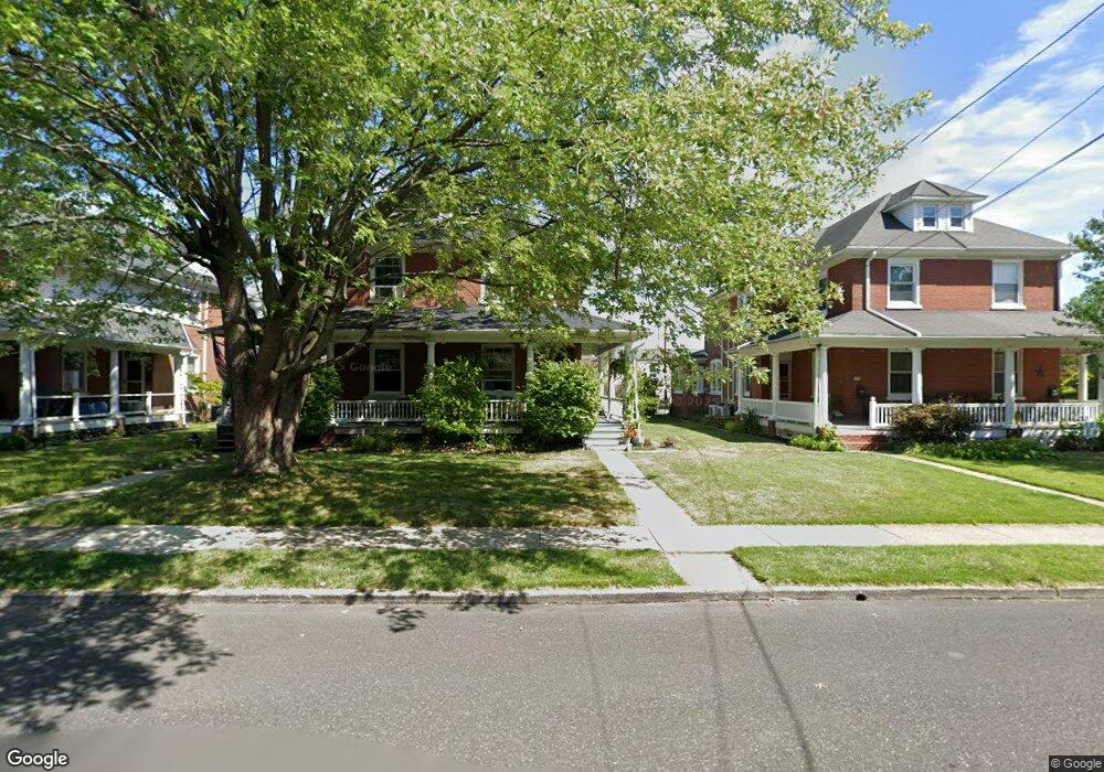
605 Derstine Ave Lansdale, PA 19446
Estimated Value: $352,000 - $432,000
4
Beds
3
Baths
2,025
Sq Ft
$190/Sq Ft
Est. Value
About This Home
This home is located at 605 Derstine Ave, Lansdale, PA 19446 and is currently estimated at $384,266, approximately $189 per square foot. 605 Derstine Ave is a home located in Montgomery County with nearby schools including York Avenue Elementary School, Penndale Middle School, and North Penn Senior High School.
Ownership History
Date
Name
Owned For
Owner Type
Purchase Details
Closed on
Jun 12, 2009
Sold by
Chebook Philip R and Chebook Erin L H
Bought by
Sitron Aaron J and Newkirk Allison P
Current Estimated Value
Home Financials for this Owner
Home Financials are based on the most recent Mortgage that was taken out on this home.
Original Mortgage
$188,000
Outstanding Balance
$119,739
Interest Rate
4.92%
Estimated Equity
$264,527
Purchase Details
Closed on
Mar 10, 2006
Sold by
Chebook Philip R and Chebook Erin L H
Bought by
Chebook Philip R and Chebook Erin L H
Purchase Details
Closed on
Feb 25, 1994
Sold by
Becker Russell E and Becker Monica
Bought by
Chebook Philip R and Chebook Erin L H
Create a Home Valuation Report for This Property
The Home Valuation Report is an in-depth analysis detailing your home's value as well as a comparison with similar homes in the area
Home Values in the Area
Average Home Value in this Area
Purchase History
| Date | Buyer | Sale Price | Title Company |
|---|---|---|---|
| Sitron Aaron J | $235,000 | None Available | |
| Chebook Philip R | -- | None Available | |
| Chebook Philip R | $124,500 | T A Title Insurance Company |
Source: Public Records
Mortgage History
| Date | Status | Borrower | Loan Amount |
|---|---|---|---|
| Open | Sitron Aaron J | $188,000 |
Source: Public Records
Tax History Compared to Growth
Tax History
| Year | Tax Paid | Tax Assessment Tax Assessment Total Assessment is a certain percentage of the fair market value that is determined by local assessors to be the total taxable value of land and additions on the property. | Land | Improvement |
|---|---|---|---|---|
| 2025 | $4,791 | $113,910 | $43,570 | $70,340 |
| 2024 | $4,791 | $113,910 | $43,570 | $70,340 |
| 2023 | $4,482 | $113,910 | $43,570 | $70,340 |
| 2022 | $4,340 | $113,910 | $43,570 | $70,340 |
| 2021 | $4,163 | $113,910 | $43,570 | $70,340 |
| 2020 | $4,038 | $113,910 | $43,570 | $70,340 |
| 2019 | $3,971 | $113,910 | $43,570 | $70,340 |
| 2018 | $1,065 | $113,910 | $43,570 | $70,340 |
| 2017 | $3,706 | $113,910 | $43,570 | $70,340 |
| 2016 | $3,662 | $113,910 | $43,570 | $70,340 |
| 2015 | $3,399 | $113,910 | $43,570 | $70,340 |
| 2014 | $3,399 | $113,910 | $43,570 | $70,340 |
Source: Public Records
Map
Nearby Homes
- 405 Derstine Ave
- 831 W Main St
- 21 S Valley Forge Rd Unit 213
- 920 Columbia Ave
- 108 Allison Ct Unit 8
- 204 N Valley Forge Rd Unit 7B
- 833 W 4th St
- 13 W End Dr
- 1061 York Ave
- 128 S Broad St
- 129 W Fifth St
- 1028 Poplar St Unit 75
- 532 Green St
- 534 Green St
- 302 W 8th St Unit 21
- 1035 Forest Ave
- 340 Central Dr
- 39 E 5th St
- 816 Kenilworth Ave
- 100 Penn St
- 603 Derstine Ave
- 607 Derstine Ave
- 601 Derstine Ave
- 609 Derstine Ave
- 611 Derstine Ave
- 613 Derstine Ave
- 541 Derstine Ave
- 615 Derstine Ave
- 539 Derstine Ave
- 617 Derstine Ave
- 537 Derstine Ave
- 619 Derstine Ave
- 535 Derstine Ave
- 604 Derstine Ave
- 608 Derstine Ave
- 600 Derstine Ave
- 610 Derstine Ave
- 621 Derstine Ave
- 533 Derstine Ave
- 612 Derstine Ave