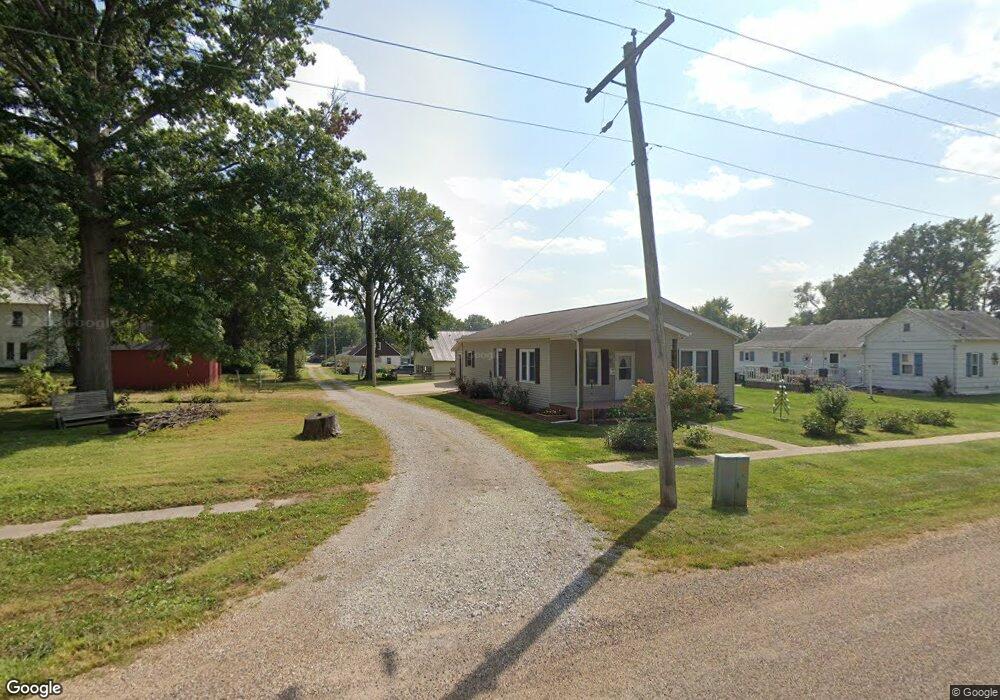
605 W Locust St Bloomfield, IA 52537
Estimated Value: $139,153 - $165,000
2
Beds
2
Baths
1,176
Sq Ft
$130/Sq Ft
Est. Value
About This Home
This home is located at 605 W Locust St, Bloomfield, IA 52537 and is currently estimated at $153,288, approximately $130 per square foot. 605 W Locust St is a home located in Davis County with nearby schools including Davis County Elementary School, Davis County Middle School, and Davis County Community High School.
Ownership History
Date
Name
Owned For
Owner Type
Purchase Details
Closed on
Oct 28, 2009
Sold by
Ware Amanda and Ware John
Bought by
Everly Evelyn E
Current Estimated Value
Purchase Details
Closed on
Mar 28, 2007
Sold by
Clark Colleen and Clark Justin R
Bought by
Ware Amanda
Home Financials for this Owner
Home Financials are based on the most recent Mortgage that was taken out on this home.
Original Mortgage
$50,733
Interest Rate
6.31%
Mortgage Type
Credit Line Revolving
Purchase Details
Closed on
Nov 22, 2006
Sold by
Bank Of The West
Bought by
Ware Amanda and Clark Colleen
Create a Home Valuation Report for This Property
The Home Valuation Report is an in-depth analysis detailing your home's value as well as a comparison with similar homes in the area
Home Values in the Area
Average Home Value in this Area
Purchase History
| Date | Buyer | Sale Price | Title Company |
|---|---|---|---|
| Everly Evelyn E | $79,500 | None Available | |
| Ware Amanda | -- | None Available | |
| Ware Amanda | $13,000 | None Available |
Source: Public Records
Mortgage History
| Date | Status | Borrower | Loan Amount |
|---|---|---|---|
| Previous Owner | Ware Amanda | $50,733 |
Source: Public Records
Tax History Compared to Growth
Tax History
| Year | Tax Paid | Tax Assessment Tax Assessment Total Assessment is a certain percentage of the fair market value that is determined by local assessors to be the total taxable value of land and additions on the property. | Land | Improvement |
|---|---|---|---|---|
| 2025 | $2,356 | $129,630 | $10,860 | $118,770 |
| 2024 | $2,356 | $120,000 | $10,860 | $109,140 |
| 2023 | $2,480 | $120,000 | $10,860 | $109,140 |
| 2022 | $1,944 | $110,460 | $10,860 | $99,600 |
| 2021 | $1,944 | $90,210 | $10,860 | $79,350 |
| 2020 | $1,762 | $81,340 | $7,970 | $73,370 |
| 2019 | $1,838 | $81,340 | $7,970 | $73,370 |
| 2018 | $1,668 | $78,450 | $7,970 | $70,480 |
| 2017 | $1,636 | $78,450 | $7,970 | $70,480 |
| 2016 | $1,576 | $74,940 | $0 | $0 |
| 2015 | $1,576 | $75,130 | $0 | $0 |
| 2014 | $1,542 | $75,130 | $0 | $0 |
Source: Public Records
Map
Nearby Homes
- 608 W Franklin St
- 603 W Walnut St
- 404 Elm St
- 408 W Chestnut St
- 601 W Chestnut St
- 906 W Chestnut St
- 293rd Street
- 502 S West St
- 402 Goode St
- 0000 Highway 63
- 416 N Madison St
- 507 N Washington St
- 702 S Washington St
- 201 Gregory Ln
- 406 E Chestnut St
- 293rd Street
- 707 E Franklin St
- 152 A Iowa 2
- 1106 E Franklin St
- 19743 212th St
- 110 N Buckeye St
- 106 N Buckeye St
- 109 N Pine St
- 111 N Pine St
- 201 N Pine St
- 107 N Pine St
- 606 W Locust St
- 111 N Buckeye St
- 200 N Buckeye St
- 107 N Buckeye St
- 702 W Locust St
- 203 N Pine St
- 105 N Buckeye St
- 103 N Pine St
- 606 W Jefferson St
- 112 N Pine St
- 110 N Pine St
- 608 W Jefferson St
- 204 N Buckeye St
- 110 N Cherry St