Estimated Value: $213,000 - $395,000
--
Bed
3
Baths
2,188
Sq Ft
$133/Sq Ft
Est. Value
About This Home
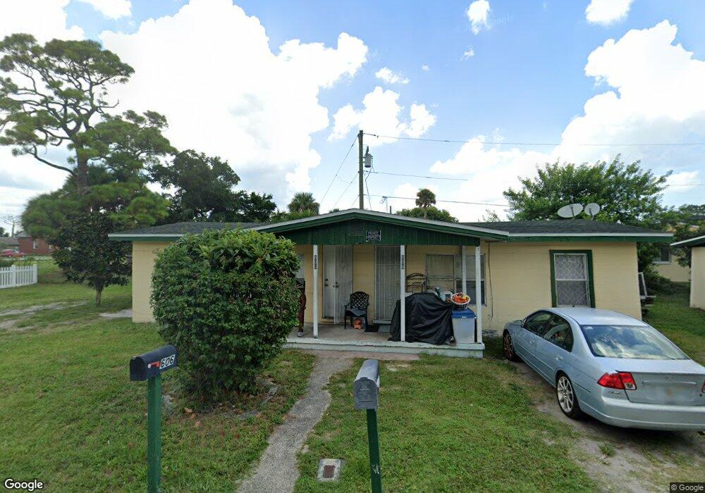
This home is located at 606 Bernard Ave Unit WSTUNT, Cocoa, FL 32922 and is currently estimated at $291,533, approximately $133 per square foot. 606 Bernard Ave Unit WSTUNT is a home located in Brevard County with nearby schools including Endeavour Elementary Magnet, Ronald McNair Magnet Middle School, and Rockledge Senior High School.
Ownership History
Date
Name
Owned For
Owner Type
Purchase Details
Closed on
Mar 16, 2017
Sold by
Lauw Kon Jen
Bought by
Bowni Djalma and Bowni Zella Maria De Oliveira
Current Estimated Value
Purchase Details
Closed on
May 30, 2007
Sold by
Frame John Timothy
Bought by
Jackson Caroline Wyns
Purchase Details
Closed on
Dec 10, 2006
Sold by
Hadley Katrinka Frame
Bought by
Jackson Caroline
Purchase Details
Closed on
Nov 25, 2006
Sold by
Frame Annie K
Bought by
Jackson Caroline
Purchase Details
Closed on
Jun 5, 2006
Sold by
Wynn Adams Julia M
Bought by
Jackson Caroline
Purchase Details
Closed on
Jan 5, 2006
Sold by
Wyns Robert W
Bought by
Jackson Caroline
Create a Home Valuation Report for This Property
The Home Valuation Report is an in-depth analysis detailing your home's value as well as a comparison with similar homes in the area
Home Values in the Area
Average Home Value in this Area
Purchase History
| Date | Buyer | Sale Price | Title Company |
|---|---|---|---|
| Bowni Djalma | $40,400 | Alliance Title Ins Agency In | |
| Jackson Caroline Wyns | -- | None Available | |
| Jackson Caroline | -- | None Available | |
| Jackson Caroline | -- | None Available | |
| Jackson Caroline | -- | None Available | |
| Jackson Caroline | -- | None Available |
Source: Public Records
Tax History Compared to Growth
Tax History
| Year | Tax Paid | Tax Assessment Tax Assessment Total Assessment is a certain percentage of the fair market value that is determined by local assessors to be the total taxable value of land and additions on the property. | Land | Improvement |
|---|---|---|---|---|
| 2025 | $4,163 | $268,800 | -- | -- |
| 2024 | $3,715 | $268,800 | -- | -- |
| 2023 | $3,715 | $215,040 | $0 | $0 |
| 2022 | $2,832 | $116,640 | $0 | $0 |
| 2021 | $2,506 | $71,180 | $4,200 | $66,980 |
| 2020 | $2,372 | $66,140 | $4,200 | $61,940 |
| 2019 | $2,306 | $62,980 | $4,200 | $58,780 |
| 2018 | $2,146 | $60,000 | $0 | $60,000 |
| 2017 | $2,118 | $58,000 | $0 | $58,000 |
| 2016 | $2,018 | $53,000 | $0 | $0 |
| 2015 | $1,966 | $50,000 | $4,000 | $46,000 |
| 2014 | $1,689 | $45,500 | $4,000 | $41,500 |
Source: Public Records
Map
Nearby Homes
- 535 Bernard St
- 610 Paw St
- 614 Paw St
- 817 Paw St
- 506 Stone St
- 824 Temple St
- 826 Ferndale Ave
- Xxxx S Fiske Blvd
- 535 S Kentucky Ave
- Xxxx Fiske
- 1237 Holmes St
- 0000 Lemon St
- 220 Lemon St
- 919 Fern Ave
- 0 Highway Us 1 Unit 1000884
- 1009 S Fiske Blvd
- 935 S Varr Ave
- 920 Bear Lake Dr
- 840 Florida Ave Unit 5
- 128 Aurora St