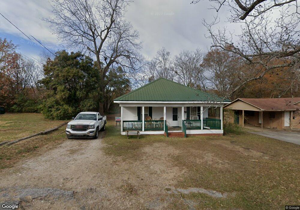
606 Rock St Lancaster, SC 29720
Estimated Value: $121,967 - $167,000
Studio
1
Bath
1,200
Sq Ft
$124/Sq Ft
Est. Value
About This Home
This home is located at 606 Rock St, Lancaster, SC 29720 and is currently estimated at $148,992, approximately $124 per square foot. 606 Rock St is a home located in Lancaster County with nearby schools including Clinton Elementary School, Buford Middle School, and Lancaster High School.
Ownership History
Date
Name
Owned For
Owner Type
Purchase Details
Closed on
Jul 31, 2008
Sold by
Knight Cindy C
Bought by
Mcmanus Brenda H and Mcmanus Thomas N
Current Estimated Value
Home Financials for this Owner
Home Financials are based on the most recent Mortgage that was taken out on this home.
Original Mortgage
$57,000
Outstanding Balance
$37,374
Interest Rate
6.31%
Mortgage Type
Unknown
Estimated Equity
$111,618
Purchase Details
Closed on
Aug 13, 2003
Sold by
The Chase Manhattan Bank
Bought by
Knight Cindy
Purchase Details
Closed on
Dec 12, 2002
Sold by
Jordan Tony E and Jordan Virginia
Bought by
The Chase Manhattan Bank and Imc Home Equity Loan Trust 1998-3
Create a Home Valuation Report for This Property
The Home Valuation Report is an in-depth analysis detailing your home's value as well as a comparison with similar homes in the area
Home Values in the Area
Average Home Value in this Area
Purchase History
| Date | Buyer | Sale Price | Title Company |
|---|---|---|---|
| Mcmanus Brenda H | $65,000 | -- | |
| Knight Cindy | $12,000 | -- | |
| The Chase Manhattan Bank | $2,500 | -- |
Source: Public Records
Mortgage History
| Date | Status | Borrower | Loan Amount |
|---|---|---|---|
| Open | Mcmanus Brenda H | $57,000 |
Source: Public Records
Tax History
| Year | Tax Paid | Tax Assessment Tax Assessment Total Assessment is a certain percentage of the fair market value that is determined by local assessors to be the total taxable value of land and additions on the property. | Land | Improvement |
|---|---|---|---|---|
| 2024 | $87 | $2,440 | $204 | $2,236 |
| 2023 | $98 | $2,440 | $204 | $2,236 |
| 2022 | $105 | $2,440 | $204 | $2,236 |
| 2021 | $103 | $2,440 | $204 | $2,236 |
| 2020 | $532 | $2,268 | $204 | $2,064 |
| 2019 | $1,160 | $2,268 | $204 | $2,064 |
| 2018 | $739 | $2,268 | $204 | $2,064 |
| 2017 | $490 | $0 | $0 | $0 |
| 2016 | $505 | $0 | $0 | $0 |
| 2015 | $511 | $0 | $0 | $0 |
| 2014 | $511 | $0 | $0 | $0 |
| 2013 | $511 | $0 | $0 | $0 |
Source: Public Records
Map
Nearby Homes
- 608 Rock St
- 802 Chesterfield Ave
- 711 Chesterfield Ave
- 900 Chesterfield Ave
- 403 Glenwood Ave
- 801 Calhoun St
- 1003 Chesterfield Ave
- 000 E Arch St
- 1001 Miller St
- 319 Connor St
- 1132 Threatt St
- 508 Miller St
- 1103 E Arch St
- 306 E Arch St
- 307 E Arch St
- 332 E Dunlap St
- 00 Hwy 200 Bypass
- 406 S Catawba St
- 00 Pageland Hwy
- 000 Pageland Hwy
- 610 Rock St
- 800 Chesterfield Ave
- 607 Rock St
- 605 Rock St
- 706 Chesterfield Ave
- 601 Rock St
- 108 Marion St
- 100 Marion St
- 804 Chesterfield Ave
- 907 Marion St
- 509 Rock St
- 508 Rock St
- 803 Chesterfield Ave
- 511 Glenwood Ave
- 509 Glenwood Ave
- 104 Marion St
- 707 Chesterfield Ave
- 211 Datura Way
- 806 Chesterfield Ave
- 902 Marion St
Your Personal Tour Guide
Ask me questions while you tour the home.