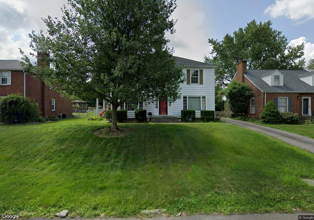
607 Barnard Ave Mansfield, OH 44903
Estimated Value: $173,000 - $234,000
4
Beds
3
Baths
2,436
Sq Ft
$87/Sq Ft
Est. Value
About This Home
This home is located at 607 Barnard Ave, Mansfield, OH 44903 and is currently estimated at $211,530, approximately $86 per square foot. 607 Barnard Ave is a home located in Richland County with nearby schools including Goal Digital Academy, Discovery School, and St. Peter's Elementary/Montessori School.
Ownership History
Date
Name
Owned For
Owner Type
Purchase Details
Closed on
Mar 12, 2021
Sold by
Kelley Samantha I and Fugitt Samantha I
Bought by
Fugitt Wesley B
Current Estimated Value
Home Financials for this Owner
Home Financials are based on the most recent Mortgage that was taken out on this home.
Original Mortgage
$148,500
Outstanding Balance
$133,187
Interest Rate
2.73%
Mortgage Type
VA
Estimated Equity
$78,343
Purchase Details
Closed on
Apr 29, 2016
Sold by
Fugitt Wesley B
Bought by
Fugitt Wesley B and Fugitt Samantha I
Purchase Details
Closed on
Jun 29, 2005
Sold by
Brandt Walter E and Brandt Carol Ann
Bought by
Fugitt Wesley B
Home Financials for this Owner
Home Financials are based on the most recent Mortgage that was taken out on this home.
Original Mortgage
$133,000
Interest Rate
5.75%
Mortgage Type
VA
Create a Home Valuation Report for This Property
The Home Valuation Report is an in-depth analysis detailing your home's value as well as a comparison with similar homes in the area
Home Values in the Area
Average Home Value in this Area
Purchase History
| Date | Buyer | Sale Price | Title Company |
|---|---|---|---|
| Fugitt Wesley B | -- | Great American Ttl Agcy Llc | |
| Fugitt Wesley B | -- | Southern Title | |
| Fugitt Wesley B | $133,000 | Lawyers Title |
Source: Public Records
Mortgage History
| Date | Status | Borrower | Loan Amount |
|---|---|---|---|
| Open | Fugitt Wesley B | $148,500 | |
| Closed | Fugitt Wesley B | $133,000 |
Source: Public Records
Tax History
| Year | Tax Paid | Tax Assessment Tax Assessment Total Assessment is a certain percentage of the fair market value that is determined by local assessors to be the total taxable value of land and additions on the property. | Land | Improvement |
|---|---|---|---|---|
| 2024 | $2,231 | $48,740 | $4,920 | $43,820 |
| 2023 | $2,282 | $48,740 | $4,920 | $43,820 |
| 2022 | $1,973 | $35,320 | $4,220 | $31,100 |
| 2021 | $1,987 | $35,320 | $4,220 | $31,100 |
| 2020 | $2,032 | $35,320 | $4,220 | $31,100 |
| 2019 | $2,252 | $35,320 | $4,220 | $31,100 |
| 2018 | $2,221 | $35,320 | $4,220 | $31,100 |
| 2017 | $2,103 | $35,320 | $4,220 | $31,100 |
| 2016 | $2,044 | $32,390 | $5,360 | $27,030 |
| 2015 | $1,953 | $32,390 | $5,360 | $27,030 |
| 2014 | $1,927 | $32,390 | $5,360 | $27,030 |
| 2012 | $734 | $32,380 | $5,640 | $26,740 |
Source: Public Records
Map
Nearby Homes
- 616 Cline Ave
- 679 Coleman Rd
- 455 Marion Ave
- 487 Davey Ave
- 189 Westwood Ave
- 133 Stewart Ave S
- 116 Stewart Ave S
- 282 Vennum Ave
- 108 Stewart Ave S
- 143 Fairlawn Ave
- 135 Fairlawn Ave
- 129 Fairlawn Ave
- 356 S Linden Rd
- 158 Vennum Ave
- 341 Townview Cir N
- 24 Stewart Ave S
- 655 Woodhill Rd
- 310 Townview Cir N
- 960 W Linden Cir
- 31 Bartley Ave
- 611 Barnard Ave
- 599 Barnard Ave
- 597 Barnard Ave
- 619 Barnard Ave
- 600 Manchester Rd
- 608 Manchester Rd
- 591 Barnard Ave Unit 593
- 594 Manchester Rd
- 614 Manchester Rd
- 606 Barnard Ave
- 625 Barnard Ave
- 612 Barnard Ave
- 598 Barnard Ave
- 585 Barnard Ave
- 620 Manchester Rd
- 620 Barnard Ave
- 624 Barnard Ave
- 592 Barnard Ave
- 560 Marion Ave
- 631 Barnard Ave
Your Personal Tour Guide
Ask me questions while you tour the home.