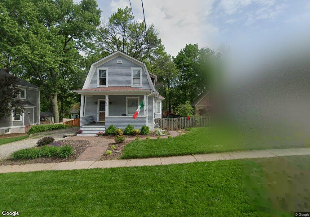
607 Clark Ave Saint Louis, MO 63119
Estimated Value: $465,000 - $584,000
3
Beds
2
Baths
1,404
Sq Ft
$375/Sq Ft
Est. Value
About This Home
This home is located at 607 Clark Ave, Saint Louis, MO 63119 and is currently estimated at $526,390, approximately $374 per square foot. 607 Clark Ave is a home located in St. Louis County with nearby schools including Avery Elementary School, Hixson Middle School, and Webster Groves High School.
Ownership History
Date
Name
Owned For
Owner Type
Purchase Details
Closed on
Aug 26, 2013
Sold by
Walters Jason L and Walters Toni T
Bought by
Johnson Robert W and Johnson Jessica M
Current Estimated Value
Home Financials for this Owner
Home Financials are based on the most recent Mortgage that was taken out on this home.
Original Mortgage
$143,920
Outstanding Balance
$107,156
Interest Rate
4.42%
Mortgage Type
New Conventional
Estimated Equity
$419,234
Purchase Details
Closed on
May 24, 2013
Sold by
Walters Jason L and Walters Toni T
Bought by
Walters Jason L and Walters Toni T
Home Financials for this Owner
Home Financials are based on the most recent Mortgage that was taken out on this home.
Original Mortgage
$155,000
Interest Rate
3.41%
Mortgage Type
Future Advance Clause Open End Mortgage
Purchase Details
Closed on
May 22, 2013
Sold by
Deutsche Bank National Trust Company
Bought by
Walters Jason L
Home Financials for this Owner
Home Financials are based on the most recent Mortgage that was taken out on this home.
Original Mortgage
$155,000
Interest Rate
3.41%
Mortgage Type
Future Advance Clause Open End Mortgage
Purchase Details
Closed on
Mar 29, 2013
Sold by
Brantingham Charles Travis and Brantingham Hannah
Bought by
Duetsche Bank National Trust Company
Home Financials for this Owner
Home Financials are based on the most recent Mortgage that was taken out on this home.
Original Mortgage
$155,000
Interest Rate
3.41%
Mortgage Type
Future Advance Clause Open End Mortgage
Purchase Details
Closed on
May 7, 2004
Sold by
Hotaling Sarah J and Hotaling David M
Bought by
Brantingham Charles Travis and Brantingham Hannah K M
Home Financials for this Owner
Home Financials are based on the most recent Mortgage that was taken out on this home.
Original Mortgage
$183,920
Interest Rate
5.81%
Mortgage Type
Purchase Money Mortgage
Purchase Details
Closed on
Aug 27, 1997
Sold by
Baker Thomas P and Baker Sandra K
Bought by
Hotaling David M and Hotaling Sarah J
Home Financials for this Owner
Home Financials are based on the most recent Mortgage that was taken out on this home.
Original Mortgage
$149,150
Interest Rate
7.5%
Create a Home Valuation Report for This Property
The Home Valuation Report is an in-depth analysis detailing your home's value as well as a comparison with similar homes in the area
Home Values in the Area
Average Home Value in this Area
Purchase History
| Date | Buyer | Sale Price | Title Company |
|---|---|---|---|
| Johnson Robert W | $179,900 | Investors Title Co Clayton | |
| Walters Jason L | -- | Investors Title Co Clayton | |
| Walters Jason L | -- | Investors Title Co Clayton | |
| Duetsche Bank National Trust Company | $165,000 | None Available | |
| Brantingham Charles Travis | $229,900 | -- | |
| Hotaling David M | -- | -- |
Source: Public Records
Mortgage History
| Date | Status | Borrower | Loan Amount |
|---|---|---|---|
| Open | Johnson Robert W | $143,920 | |
| Previous Owner | Walters Jason L | $155,000 | |
| Previous Owner | Brantingham Charles Travis | $183,920 | |
| Previous Owner | Hotaling David M | $149,150 | |
| Closed | Brantingham Charles Travis | $45,980 |
Source: Public Records
Tax History Compared to Growth
Tax History
| Year | Tax Paid | Tax Assessment Tax Assessment Total Assessment is a certain percentage of the fair market value that is determined by local assessors to be the total taxable value of land and additions on the property. | Land | Improvement |
|---|---|---|---|---|
| 2025 | $5,583 | $93,440 | $49,320 | $44,120 |
| 2024 | $5,583 | $80,270 | $35,870 | $44,400 |
| 2023 | $4,264 | $61,440 | $35,870 | $25,570 |
| 2022 | $4,067 | $54,400 | $35,870 | $18,530 |
| 2021 | $4,054 | $54,400 | $35,870 | $18,530 |
| 2020 | $4,386 | $54,890 | $35,870 | $19,020 |
| 2019 | $4,355 | $54,890 | $35,870 | $19,020 |
| 2018 | $3,489 | $38,950 | $25,120 | $13,830 |
| 2017 | $3,466 | $38,950 | $25,120 | $13,830 |
| 2016 | $3,616 | $38,950 | $21,530 | $17,420 |
| 2015 | $3,629 | $38,950 | $21,530 | $17,420 |
| 2014 | $3,859 | $40,320 | $16,440 | $23,880 |
Source: Public Records
Map
Nearby Homes
- 610 Cornelia Ave
- 619 N Bompart Ave
- 716 Clark Ave
- 441 Park Rd
- 544 Summit Ave
- 808 Greeley Ave
- 400 Marion Ave
- 840 Marshall Ave
- 835 N Forest Ave
- 814 Holland Ave
- 2911 Brazeau Ave
- 2905 Brazeau Ave
- 546 Holland Ave
- 2829 Brazeau Ave
- 946 Marshall Ave Unit D
- 827 Cornell Ave
- 112 Oakwood Ave
- 2904 Collier Ave
- 940 Brookside Ave
- 8908 W Pendleton Ave