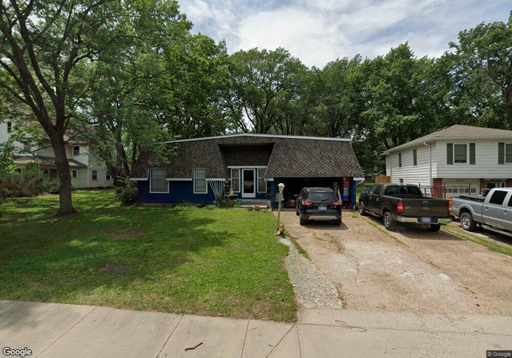
607 S Grant St Olathe, KS 66061
Estimated Value: $287,000 - $305,000
2
Beds
2
Baths
1,920
Sq Ft
$156/Sq Ft
Est. Value
About This Home
This home is located at 607 S Grant St, Olathe, KS 66061 and is currently estimated at $298,850, approximately $155 per square foot. 607 S Grant St is a home located in Johnson County with nearby schools including Westview Elementary School, Oregon Trail Middle School, and Olathe West High School.
Ownership History
Date
Name
Owned For
Owner Type
Purchase Details
Closed on
Dec 26, 2002
Sold by
Laptad Jack A and Laptad Sarah
Bought by
Webb Wendy L
Current Estimated Value
Home Financials for this Owner
Home Financials are based on the most recent Mortgage that was taken out on this home.
Original Mortgage
$77,000
Interest Rate
5.5%
Purchase Details
Closed on
Jun 25, 2001
Sold by
Laptad Jack A and Laptad Sarah
Bought by
Borger Kevin G and Borger Beth
Home Financials for this Owner
Home Financials are based on the most recent Mortgage that was taken out on this home.
Original Mortgage
$114,500
Interest Rate
5.97%
Mortgage Type
Purchase Money Mortgage
Create a Home Valuation Report for This Property
The Home Valuation Report is an in-depth analysis detailing your home's value as well as a comparison with similar homes in the area
Home Values in the Area
Average Home Value in this Area
Purchase History
| Date | Buyer | Sale Price | Title Company |
|---|---|---|---|
| Webb Wendy L | -- | Realty Title Company | |
| Borger Kevin G | -- | Midwest Title Company Inc |
Source: Public Records
Mortgage History
| Date | Status | Borrower | Loan Amount |
|---|---|---|---|
| Previous Owner | Webb Wendy L | $77,000 | |
| Previous Owner | Borger Kevin G | $114,500 |
Source: Public Records
Tax History Compared to Growth
Tax History
| Year | Tax Paid | Tax Assessment Tax Assessment Total Assessment is a certain percentage of the fair market value that is determined by local assessors to be the total taxable value of land and additions on the property. | Land | Improvement |
|---|---|---|---|---|
| 2024 | $3,252 | $29,405 | $5,054 | $24,351 |
| 2023 | $3,020 | $26,634 | $5,054 | $21,580 |
| 2022 | $2,826 | $24,253 | $4,593 | $19,660 |
| 2021 | $2,855 | $23,207 | $4,172 | $19,035 |
| 2020 | $2,628 | $21,194 | $3,790 | $17,404 |
| 2019 | $2,578 | $20,654 | $3,297 | $17,357 |
| 2018 | $2,349 | $18,722 | $2,996 | $15,726 |
| 2017 | $2,005 | $15,859 | $2,996 | $12,863 |
| 2016 | $1,779 | $14,467 | $2,996 | $11,471 |
| 2015 | $1,646 | $13,421 | $2,996 | $10,425 |
| 2013 | -- | $10,798 | $2,723 | $8,075 |
Source: Public Records
Map
Nearby Homes
- 617 S Grant St
- 600 W Elm St
- 812 S Troost St
- 573 W Loula St
- 706 S Kansas Ave
- 507 W Park St
- 109 E Cedar St
- 1106 W Sheridan St
- 721 S Chestnut St
- 335 S Water St
- 1200 W Sheridan St
- 401 S Harrison St
- 515 E Sheridan St
- 321 S Wabash Cir
- 336 E Park St
- 531 S Oscar St
- 1604 W Cedar St
- 1545 W Park St
- 612 N Logan St
- 1425 W Poplar St
- 605 S Grant St
- 609 S Grant St
- 603 S Grant St
- 603 W Little St
- 601 S Grant St
- 605 W Little St
- 604 S Sherman St
- 604 S Grant St
- 609 W Little St
- 606 S Grant St
- 613 W Little St
- 611 S Grant St
- 602 S Grant St
- 606 S Sherman Ave
- 600 S Grant St
- 602 S Sherman Ave
- 602 S Sherman Ave
- 612 S Sherman St
- 608 S Sherman Ave