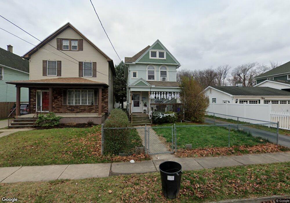
608 Race St Scranton, PA 18509
Providence NeighborhoodEstimated Value: $142,608 - $242,000
--
Bed
--
Bath
--
Sq Ft
5,706
Sq Ft Lot
About This Home
This home is located at 608 Race St, Scranton, PA 18509 and is currently estimated at $181,652. 608 Race St is a home with nearby schools including Maybeury Elementary School, Pinchbeck Elementary School, and Robert Morris #27.
Ownership History
Date
Name
Owned For
Owner Type
Purchase Details
Closed on
Jun 10, 2011
Sold by
Reichle Robert J and Reichle Joseph G
Bought by
City Of Scranton
Current Estimated Value
Purchase Details
Closed on
Jun 17, 2010
Sold by
Theis George William and Theis Barbara A
Bought by
City Of Scranton
Purchase Details
Closed on
Dec 28, 2006
Sold by
The City Of Scranton
Bought by
Martin Patricia A
Purchase Details
Closed on
Feb 10, 2006
Sold by
Walsh Scott and Walsh Andrea
Bought by
City Of Scranton
Create a Home Valuation Report for This Property
The Home Valuation Report is an in-depth analysis detailing your home's value as well as a comparison with similar homes in the area
Home Values in the Area
Average Home Value in this Area
Purchase History
| Date | Buyer | Sale Price | Title Company |
|---|---|---|---|
| City Of Scranton | $169,000 | None Available | |
| City Of Scranton | $88,000 | None Available | |
| Martin Patricia A | $30,925 | None Available | |
| City Of Scranton | -- | None Available |
Source: Public Records
Tax History Compared to Growth
Tax History
| Year | Tax Paid | Tax Assessment Tax Assessment Total Assessment is a certain percentage of the fair market value that is determined by local assessors to be the total taxable value of land and additions on the property. | Land | Improvement |
|---|---|---|---|---|
| 2025 | $2,934 | $8,750 | $2,000 | $6,750 |
| 2024 | $2,690 | $8,750 | $2,000 | $6,750 |
| 2023 | $2,690 | $8,750 | $2,000 | $6,750 |
| 2022 | $2,631 | $8,750 | $2,000 | $6,750 |
| 2021 | $2,631 | $8,750 | $2,000 | $6,750 |
| 2020 | $2,584 | $8,750 | $2,000 | $6,750 |
| 2019 | $2,433 | $8,750 | $2,000 | $6,750 |
| 2018 | $2,433 | $8,750 | $2,000 | $6,750 |
| 2017 | $2,392 | $8,750 | $2,000 | $6,750 |
| 2016 | $806 | $8,750 | $2,000 | $6,750 |
| 2015 | $1,816 | $8,750 | $2,000 | $6,750 |
| 2014 | -- | $8,750 | $2,000 | $6,750 |
Source: Public Records
Map
Nearby Homes
- 2129 Comegys Ave Unit L11
- 2106 Boulevard Ave
- 601 Dean St
- 2237 Boulevard Ave
- 2136 N Main Ave
- 35 Dean St
- 512 Electric St Unit 510-516
- 1762-1764 Sanderson Ave
- 416 Electric St
- 1747 Monsey Ave
- 1021 Richmont St
- 802 Sunset St
- 2089 N Main Ave
- 119 Spring St
- 1008 Fisk St
- 121 Throop St
- 1732 Capouse Ave
- 2040 Edna Ave
- 2105 Belmont Terrace
- 831 Raines St