Estimated Value: $637,853 - $709,000
3
Beds
2
Baths
3,148
Sq Ft
$214/Sq Ft
Est. Value
About This Home
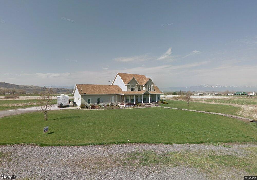
This home is located at 60874 Sharpe Rd, Cove, OR 97824 and is currently estimated at $673,427, approximately $213 per square foot. 60874 Sharpe Rd is a home located in Union County with nearby schools including Cove Charter School and Grande Ronde Mennonite.
Ownership History
Date
Name
Owned For
Owner Type
Purchase Details
Closed on
Aug 31, 2017
Sold by
Louden Timothy S and Louden Donna M
Bought by
Miller Travis A and Miller Cristy L
Current Estimated Value
Home Financials for this Owner
Home Financials are based on the most recent Mortgage that was taken out on this home.
Original Mortgage
$269,000
Outstanding Balance
$223,922
Interest Rate
3.96%
Mortgage Type
New Conventional
Estimated Equity
$449,505
Create a Home Valuation Report for This Property
The Home Valuation Report is an in-depth analysis detailing your home's value as well as a comparison with similar homes in the area
Home Values in the Area
Average Home Value in this Area
Purchase History
| Date | Buyer | Sale Price | Title Company |
|---|---|---|---|
| Miller Travis A | $369,000 | Amerititle |
Source: Public Records
Mortgage History
| Date | Status | Borrower | Loan Amount |
|---|---|---|---|
| Open | Miller Travis A | $269,000 |
Source: Public Records
Tax History Compared to Growth
Tax History
| Year | Tax Paid | Tax Assessment Tax Assessment Total Assessment is a certain percentage of the fair market value that is determined by local assessors to be the total taxable value of land and additions on the property. | Land | Improvement |
|---|---|---|---|---|
| 2025 | $4,217 | $427,500 | $74,460 | $353,040 |
| 2024 | $4,097 | $415,050 | $72,290 | $342,760 |
| 2023 | $3,980 | $402,970 | $70,190 | $332,780 |
| 2022 | $3,767 | $391,242 | $68,146 | $323,096 |
| 2021 | $3,758 | $379,847 | $81,277 | $298,570 |
| 2020 | $3,551 | $368,784 | $79,351 | $289,433 |
| 2019 | $3,448 | $358,043 | $77,040 | $281,003 |
| 2018 | $3,347 | $347,615 | $75,356 | $272,259 |
| 2017 | $3,250 | $337,491 | $74,715 | $262,776 |
| 2016 | $3,194 | $327,662 | $72,234 | $255,428 |
| 2015 | $2,897 | $318,119 | $64,649 | $253,470 |
| 2014 | $2,897 | $308,854 | $60,758 | $248,096 |
| 2013 | $3,164 | $299,859 | $58,434 | $241,425 |
Source: Public Records
Map
Nearby Homes
- 0 Conklin Ln Unit 232609065
- 69431 Antles Ln
- 69431 Antles Ln Unit 1
- 0 Antles Ln Unit 436244681
- 301 High Valley Rd
- 0 Rose Ridge Rd Unit 3
- 0 Rose Ridge Rd Unit 1
- 0 Rose Ridge Rd Unit 22290306
- 0 Rose Ridge Rd Unit 2
- 69717 Antles Ln
- 59926 Comstock Rd
- 61938 High Valley Rd
- 141 E Bryan Ave
- 1137 N Bellwood St
- 650 E Chestnut St
- 527 S Dewey St
- 845 W Arch St
- 306 S Main St
- 746 W Arch St
- 558 E Fulton St
- 60874 Sharp Rd
- 0 Sharp Rd Unit 8044591
- 0 Sharp Rd Unit 9001425
- 0 Sharp Rd Unit 12039676
- 0 Sharp Rd Unit 19629334
- 60871 Sharp Rd
- 60910 Sharpe Rd
- 60910 Sharp Rd
- 502 Ash St
- 60926 Sharp Rd
- 60915 Sharp Rd
- 1703 Orchard St
- 60938 Sharp Rd
- 503 Ash St
- 501 Ash St
- 507 Ash St
- 603 Ash St
- 1605 Orchard St
- 607 Ash St
- 60956 Sharp Rd