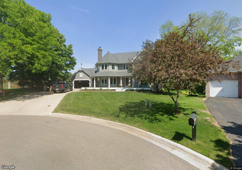
609 High Ridge Cir Saint Paul, MN 55118
Estimated Value: $917,026 - $1,031,000
5
Beds
3
Baths
3,068
Sq Ft
$321/Sq Ft
Est. Value
About This Home
This home is located at 609 High Ridge Cir, Saint Paul, MN 55118 and is currently estimated at $983,675, approximately $320 per square foot. 609 High Ridge Cir is a home located in Dakota County with nearby schools including Somerset Elementary School, Heritage E-STEM Magnet School, and Two Rivers High School.
Ownership History
Date
Name
Owned For
Owner Type
Purchase Details
Closed on
Aug 8, 2014
Sold by
Waldvogel James A and Waldvogel Mary E
Bought by
Pico Katharine Scott Armstrong and Pico Peter L
Current Estimated Value
Home Financials for this Owner
Home Financials are based on the most recent Mortgage that was taken out on this home.
Original Mortgage
$618,300
Outstanding Balance
$471,276
Interest Rate
4.1%
Mortgage Type
New Conventional
Estimated Equity
$512,399
Purchase Details
Closed on
Jul 1, 1997
Sold by
Chlebeck Lawrence S and Chlebeck Jo Ellyn
Bought by
Waldvogel James A and Waldvogel Mary E
Create a Home Valuation Report for This Property
The Home Valuation Report is an in-depth analysis detailing your home's value as well as a comparison with similar homes in the area
Home Values in the Area
Average Home Value in this Area
Purchase History
| Date | Buyer | Sale Price | Title Company |
|---|---|---|---|
| Pico Katharine Scott Armstrong | $687,000 | Titlesmart Inc | |
| Waldvogel James A | $295,000 | -- |
Source: Public Records
Mortgage History
| Date | Status | Borrower | Loan Amount |
|---|---|---|---|
| Open | Pico Katharine Scott Armstrong | $618,300 |
Source: Public Records
Tax History Compared to Growth
Tax History
| Year | Tax Paid | Tax Assessment Tax Assessment Total Assessment is a certain percentage of the fair market value that is determined by local assessors to be the total taxable value of land and additions on the property. | Land | Improvement |
|---|---|---|---|---|
| 2024 | $8,582 | $854,000 | $215,900 | $638,100 |
| 2023 | $8,582 | $851,300 | $181,300 | $670,000 |
| 2022 | $7,680 | $855,200 | $180,900 | $674,300 |
| 2021 | $7,108 | $721,200 | $157,300 | $563,900 |
| 2020 | $6,744 | $666,200 | $149,800 | $516,400 |
| 2019 | $6,903 | $616,800 | $142,700 | $474,100 |
| 2018 | $6,659 | $601,900 | $133,300 | $468,600 |
| 2017 | $6,699 | $602,400 | $127,000 | $475,400 |
| 2016 | $6,779 | $587,900 | $120,900 | $467,000 |
| 2015 | $6,261 | $598,500 | $120,900 | $477,600 |
| 2014 | -- | $542,100 | $114,100 | $428,000 |
| 2013 | -- | $485,100 | $110,700 | $374,400 |
Source: Public Records
Map
Nearby Homes
- 1912 South Ln
- 485 Preserve Path
- 614 Hidden Creek Trail
- 679 Marie Ave W
- 1774 Dodd Rd
- 685 Hidden Creek Trail
- 1941 Dodd Rd
- 2122 Delaware Ave
- 600 Wentworth Ave
- 792 Hilltop Rd
- 2148 Delaware Ave
- 2194 Charlton Rd
- 795 Creek Ave
- 2222 Apache St
- 2012 Pine Ridge Dr
- 884 Marie Ave W
- 1620 Charlton St Unit 109
- 1513 Smith Ave S
- 912 Crown Ct
- 1860 Eagle Ridge Dr Unit W303
- 613 High Ridge Cir
- 605 High Ridge Cir
- 585 High Ridge Cir
- 612 612 Highridge Cir
- 612 High Ridge Cir
- 608 High Ridge Cir
- 604 604 High Ridge Cir
- 604 High Ridge Cir
- 600 High Ridge Cir
- 582 High Ridge Cir
- 576 High Ridge Cir
- 588 High Ridge Cir
- 1883 1883 Warrior Dr
- 1883 Warrior Dr
- 596 High Ridge Cir
- 1920 Knob Rd
- 1910 Knob Rd
- 592 High Ridge Cir
- 1934 Knob Rd
- 1875 Warrior Dr