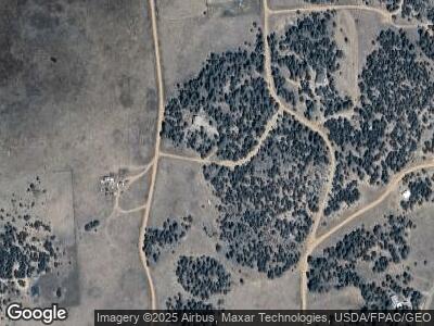
61 Columbine Ln Cotopaxi, CO 81223
Estimated Value: $187,035 - $281,000
1
Bed
1
Bath
1,028
Sq Ft
$239/Sq Ft
Est. Value
About This Home
This home is located at 61 Columbine Ln, Cotopaxi, CO 81223 and is currently estimated at $246,009, approximately $239 per square foot. 61 Columbine Ln is a home located in Fremont County with nearby schools including Cotopaxi Elementary School and Cotopaxi Junior/Senior High School.
Ownership History
Date
Name
Owned For
Owner Type
Purchase Details
Closed on
Aug 30, 2012
Sold by
Quadri Diana M
Bought by
Campbell Colin
Current Estimated Value
Home Financials for this Owner
Home Financials are based on the most recent Mortgage that was taken out on this home.
Original Mortgage
$45,000
Interest Rate
3.56%
Mortgage Type
Seller Take Back
Purchase Details
Closed on
Jul 26, 2004
Sold by
Lutz Raymond H
Bought by
Quadri Eugene B and Quadri Diana M
Purchase Details
Closed on
Mar 24, 2004
Sold by
Oliver Dionne K
Bought by
Lutz Raymond H
Purchase Details
Closed on
Dec 15, 1995
Sold by
Dunn
Bought by
Oliver
Create a Home Valuation Report for This Property
The Home Valuation Report is an in-depth analysis detailing your home's value as well as a comparison with similar homes in the area
Home Values in the Area
Average Home Value in this Area
Purchase History
| Date | Buyer | Sale Price | Title Company |
|---|---|---|---|
| Campbell Colin | $85,000 | None Available | |
| Quadri Eugene B | $60,500 | -- | |
| Lutz Raymond H | -- | -- | |
| Oliver | $40,000 | -- |
Source: Public Records
Mortgage History
| Date | Status | Borrower | Loan Amount |
|---|---|---|---|
| Closed | Campbell Colin | $45,000 | |
| Previous Owner | Quadri Eugene B | $15,867 |
Source: Public Records
Tax History Compared to Growth
Tax History
| Year | Tax Paid | Tax Assessment Tax Assessment Total Assessment is a certain percentage of the fair market value that is determined by local assessors to be the total taxable value of land and additions on the property. | Land | Improvement |
|---|---|---|---|---|
| 2024 | $80 | $5,659 | $0 | $0 |
| 2023 | $80 | $1,974 | $0 | $0 |
| 2022 | $162 | $4,225 | $0 | $0 |
| 2021 | $163 | $4,347 | $0 | $0 |
| 2020 | $146 | $3,985 | $0 | $0 |
| 2019 | $146 | $3,985 | $0 | $0 |
| 2018 | $128 | $3,513 | $0 | $0 |
| 2017 | $129 | $3,513 | $0 | $0 |
| 2016 | $156 | $4,250 | $0 | $0 |
| 2015 | $155 | $4,250 | $0 | $0 |
| 2012 | $165 | $4,457 | $3,229 | $1,228 |
Source: Public Records
Map
Nearby Homes
- 838 Ridge Way Dr
- 160 Nuthatch Dr
- 0 Trail Dr Unit 17 REC3689536
- 0 Basin Dr Unit 1 REC3358120
- 390 North Ln
- 1136 Bird Point Dr
- 8617 County Road 12
- 000 Bird Point Dr
- TBD Big Bow Dr
- 3635 Bird Point Dr
- 1810 Bird Point Dr
- 10240 U S 50
- 14527 U S 50
- 10817 U S 50
- 530 & 592 Red Feather Rd
- 9825 Us Highway 50
- 35 Shillelagh Place
- 1111 Red Feather Rd
- 9564 Us Highway 50
- 110 Triple j Ct
