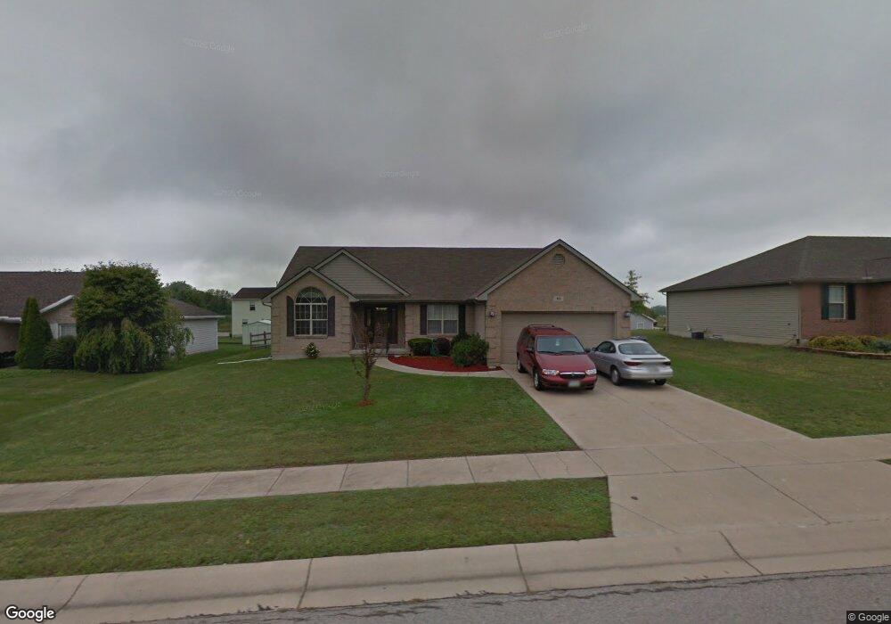
61 Field Crest Dr Franklin, OH 45005
Estimated Value: $333,000 - $355,000
4
Beds
2
Baths
1,734
Sq Ft
$197/Sq Ft
Est. Value
About This Home
This home is located at 61 Field Crest Dr, Franklin, OH 45005 and is currently estimated at $341,942, approximately $197 per square foot. 61 Field Crest Dr is a home located in Warren County with nearby schools including Franklin High School.
Ownership History
Date
Name
Owned For
Owner Type
Purchase Details
Closed on
Apr 19, 2022
Sold by
Pitts Sandra F and Pitts James C
Bought by
Pitts James C and Pitts Sandra
Current Estimated Value
Home Financials for this Owner
Home Financials are based on the most recent Mortgage that was taken out on this home.
Original Mortgage
$135,000
Outstanding Balance
$126,688
Interest Rate
4.16%
Mortgage Type
New Conventional
Estimated Equity
$215,254
Purchase Details
Closed on
Apr 5, 2002
Sold by
O Martin Group Inc
Bought by
Pitts James C and Pitts Sandra F
Home Financials for this Owner
Home Financials are based on the most recent Mortgage that was taken out on this home.
Original Mortgage
$107,000
Interest Rate
6.87%
Mortgage Type
New Conventional
Purchase Details
Closed on
Sep 6, 2001
Sold by
Hill Robert
Bought by
O Martin Group Inc
Purchase Details
Closed on
May 27, 1998
Sold by
Huntley Homes Inc
Bought by
Hill Robert C and Hill Cherie L
Home Financials for this Owner
Home Financials are based on the most recent Mortgage that was taken out on this home.
Original Mortgage
$163,300
Interest Rate
7.27%
Mortgage Type
New Conventional
Purchase Details
Closed on
Sep 29, 1997
Sold by
Rolling Meadows Dev
Bought by
Huntley Homes Inc
Create a Home Valuation Report for This Property
The Home Valuation Report is an in-depth analysis detailing your home's value as well as a comparison with similar homes in the area
Home Values in the Area
Average Home Value in this Area
Purchase History
| Date | Buyer | Sale Price | Title Company |
|---|---|---|---|
| Pitts James C | -- | None Listed On Document | |
| Pitts James C | $163,000 | -- | |
| O Martin Group Inc | $160,000 | -- | |
| Hill Robert C | $171,900 | -- | |
| Huntley Homes Inc | $25,900 | -- |
Source: Public Records
Mortgage History
| Date | Status | Borrower | Loan Amount |
|---|---|---|---|
| Open | Pitts James C | $135,000 | |
| Previous Owner | Pitts James C | $107,000 | |
| Previous Owner | Hill Robert C | $163,300 |
Source: Public Records
Tax History Compared to Growth
Tax History
| Year | Tax Paid | Tax Assessment Tax Assessment Total Assessment is a certain percentage of the fair market value that is determined by local assessors to be the total taxable value of land and additions on the property. | Land | Improvement |
|---|---|---|---|---|
| 2024 | $4,231 | $99,620 | $22,750 | $76,870 |
| 2023 | $3,625 | $77,763 | $12,390 | $65,373 |
| 2022 | $3,556 | $77,763 | $12,390 | $65,373 |
| 2021 | $3,372 | $77,763 | $12,390 | $65,373 |
| 2020 | $3,167 | $65,902 | $10,500 | $55,402 |
| 2019 | $2,881 | $65,902 | $10,500 | $55,402 |
| 2018 | $2,886 | $65,902 | $10,500 | $55,402 |
| 2017 | $2,667 | $57,071 | $9,247 | $47,824 |
| 2016 | $2,938 | $57,071 | $9,247 | $47,824 |
| 2015 | $2,925 | $57,071 | $9,247 | $47,824 |
| 2014 | $2,908 | $55,410 | $8,980 | $46,430 |
| 2013 | $2,278 | $64,810 | $10,500 | $54,310 |
Source: Public Records
Map
Nearby Homes
- 155 Green Knoll Dr
- 22 Green Meadow Ct
- 6801 Gorsuch Rd
- 191 Lakeview Dr
- 6 Beal Rd
- 995 E 4th St
- 16 Harding Ct
- 718 Millard Dr
- 0 Kathy Ln Unit 1834240
- 0 Kathy Ln Unit 930066
- 7657 Sharts Rd
- 590 Kristine Ln
- 445 Beam Dr
- 388 Thomas Dr
- 25 Copperhead Trail
- 4491 Michaels Dr
- 5554 State Route 123
- 760 David Blvd
- 5554 Ohio 123
- 747 David Blvd
- 51 Field Crest Dr
- 71 Field Crest Dr
- 36 Green Knoll Dr
- 26 Green Knoll Dr
- 46 Green Knoll Dr
- 41 Field Crest Dr
- 62 Field Crest Dr
- 52 Field Crest Dr
- 72 Field Crest Dr
- 16 Green Knoll Dr
- 65 Green Knoll Dr
- 42 Field Crest Dr
- 75 Green Knoll Dr
- 31 Field Crest Dr
- 6 Green Knoll Dr
- 85 Green Knoll Dr
- 45 Green Knoll Dr
- 61 Long Meadow Dr
- 32 Field Crest Dr
- 71 Long Meadow Dr