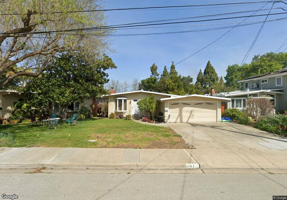
61 Lorelei Ln Menlo Park, CA 94025
Flood Park NeighborhoodEstimated Value: $1,820,610 - $2,094,000
3
Beds
2
Baths
1,100
Sq Ft
$1,772/Sq Ft
Est. Value
About This Home
This home is located at 61 Lorelei Ln, Menlo Park, CA 94025 and is currently estimated at $1,949,653, approximately $1,772 per square foot. 61 Lorelei Ln is a home located in San Mateo County with nearby schools including Encinal Elementary School, Hillview Middle School, and Menlo-Atherton High School.
Ownership History
Date
Name
Owned For
Owner Type
Purchase Details
Closed on
May 1, 2014
Sold by
Morantes Socorro E
Bought by
Morantes Socorro E
Current Estimated Value
Purchase Details
Closed on
Jul 25, 1997
Sold by
Morantes S E
Bought by
Morantes Socorro E
Home Financials for this Owner
Home Financials are based on the most recent Mortgage that was taken out on this home.
Original Mortgage
$165,000
Interest Rate
7.58%
Purchase Details
Closed on
Apr 28, 1997
Sold by
Morantes Guillermo P
Bought by
Morantes Socorro E
Create a Home Valuation Report for This Property
The Home Valuation Report is an in-depth analysis detailing your home's value as well as a comparison with similar homes in the area
Home Values in the Area
Average Home Value in this Area
Purchase History
| Date | Buyer | Sale Price | Title Company |
|---|---|---|---|
| Morantes Socorro E | -- | None Available | |
| Morantes Socorro E | -- | Santa Clara Land Title Co | |
| Morantes Socorro E | -- | -- |
Source: Public Records
Mortgage History
| Date | Status | Borrower | Loan Amount |
|---|---|---|---|
| Closed | Morantes Socorro E | $165,000 |
Source: Public Records
Tax History Compared to Growth
Tax History
| Year | Tax Paid | Tax Assessment Tax Assessment Total Assessment is a certain percentage of the fair market value that is determined by local assessors to be the total taxable value of land and additions on the property. | Land | Improvement |
|---|---|---|---|---|
| 2025 | $4,599 | $292,093 | $145,007 | $147,086 |
| 2023 | $4,599 | $280,752 | $139,377 | $141,375 |
| 2022 | $4,371 | $275,248 | $136,645 | $138,603 |
| 2021 | $4,303 | $269,852 | $133,966 | $135,886 |
| 2020 | $4,261 | $267,086 | $132,593 | $134,493 |
| 2019 | $4,175 | $261,850 | $129,994 | $131,856 |
| 2018 | $4,051 | $256,717 | $127,446 | $129,271 |
| 2017 | $3,956 | $251,685 | $124,948 | $126,737 |
| 2016 | $3,847 | $246,751 | $122,499 | $124,252 |
| 2015 | $3,769 | $243,045 | $120,659 | $122,386 |
| 2014 | $3,651 | $238,285 | $118,296 | $119,989 |
Source: Public Records
Map
Nearby Homes
- 60 Callie Ln
- 911 Peggy Ln
- 1031 Timothy Ln
- 22 Wayne Ct
- 3760 Hoover St
- 183 Hedge Rd
- 856 15th Ave
- 1155 17th Ave
- 824 Fourteenth Ave
- 55 Irving Ave
- 4 Athlone Way
- 3464 Michael Dr
- 3519 Hoover St
- 3820 Fair Oaks Ave
- 811 10th Ave
- 548 Placitas Ave
- 820 Eighth Ave
- 3499 E Bayshore Rd Unit 13
- 3499 E Bayshore Rd Unit 22
- 3499 E Bayshore Rd Unit 86