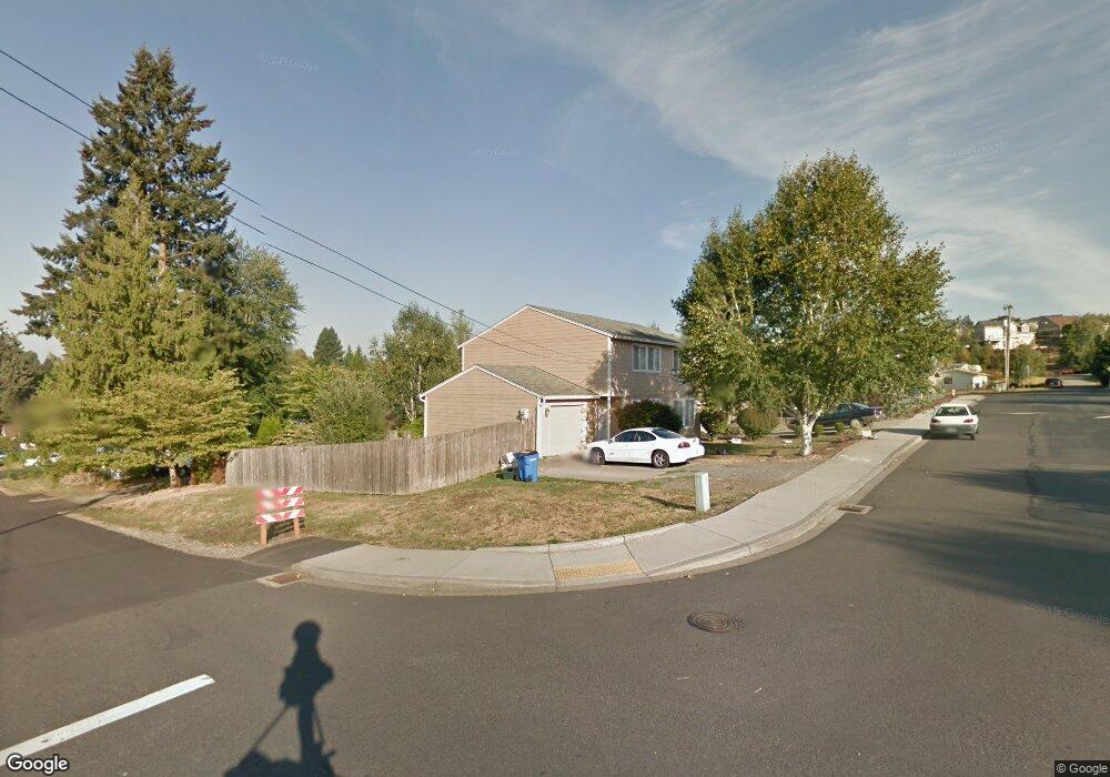
610 E Elm Ave La Center, WA 98629
Estimated Value: $483,000 - $534,688
4
Beds
2
Baths
2,088
Sq Ft
$242/Sq Ft
Est. Value
About This Home
This home is located at 610 E Elm Ave, La Center, WA 98629 and is currently estimated at $504,922, approximately $241 per square foot. 610 E Elm Ave is a home located in Clark County with nearby schools including La Center Elementary School, La Center Middle School, and La Center High School.
Ownership History
Date
Name
Owned For
Owner Type
Purchase Details
Closed on
Jun 16, 2015
Sold by
Mckay Properties Llc
Bought by
Hougan Linda
Current Estimated Value
Home Financials for this Owner
Home Financials are based on the most recent Mortgage that was taken out on this home.
Original Mortgage
$92,000
Interest Rate
3.77%
Mortgage Type
New Conventional
Purchase Details
Closed on
Aug 3, 2009
Sold by
Hougan Mark and Hougan Linda
Bought by
Mckay Properties Llc
Purchase Details
Closed on
Dec 4, 2006
Sold by
Cole Forrest G
Bought by
Hougan Mark M and Hougan Linda L
Home Financials for this Owner
Home Financials are based on the most recent Mortgage that was taken out on this home.
Original Mortgage
$35,901
Interest Rate
6.32%
Mortgage Type
Stand Alone Second
Purchase Details
Closed on
Feb 25, 1999
Sold by
Cole Lynn
Bought by
Cole Forrest G
Home Financials for this Owner
Home Financials are based on the most recent Mortgage that was taken out on this home.
Original Mortgage
$114,000
Interest Rate
6.76%
Create a Home Valuation Report for This Property
The Home Valuation Report is an in-depth analysis detailing your home's value as well as a comparison with similar homes in the area
Home Values in the Area
Average Home Value in this Area
Purchase History
| Date | Buyer | Sale Price | Title Company |
|---|---|---|---|
| Hougan Linda | -- | Stewart Title Vancouver Main | |
| Mckay Properties Llc | -- | None Available | |
| Hougan Mark M | $240,800 | Stewart Title | |
| Cole Forrest G | -- | Transnation Title Insurance |
Source: Public Records
Mortgage History
| Date | Status | Borrower | Loan Amount |
|---|---|---|---|
| Previous Owner | Hougan Linda | $92,000 | |
| Previous Owner | Hougan Mark M | $35,901 | |
| Previous Owner | Hougan Mark M | $179,625 | |
| Previous Owner | Cole Forrest G | $114,000 |
Source: Public Records
Tax History Compared to Growth
Tax History
| Year | Tax Paid | Tax Assessment Tax Assessment Total Assessment is a certain percentage of the fair market value that is determined by local assessors to be the total taxable value of land and additions on the property. | Land | Improvement |
|---|---|---|---|---|
| 2025 | $4,127 | $454,269 | $145,132 | $309,137 |
| 2024 | $3,823 | $447,140 | $145,132 | $302,008 |
| 2023 | $3,682 | $431,380 | $140,905 | $290,475 |
| 2022 | $3,422 | $401,364 | $121,384 | $279,980 |
| 2021 | $3,238 | $330,962 | $97,107 | $233,855 |
| 2020 | $3,067 | $295,061 | $90,171 | $204,890 |
| 2019 | $2,915 | $273,247 | $81,154 | $192,093 |
| 2018 | $2,792 | $264,332 | $0 | $0 |
| 2017 | $2,419 | $250,450 | $0 | $0 |
| 2016 | $2,307 | $230,311 | $0 | $0 |
| 2015 | -- | $204,545 | $0 | $0 |
| 2014 | -- | $193,480 | $0 | $0 |
| 2013 | -- | $170,138 | $0 | $0 |
Source: Public Records
Map
Nearby Homes
- 325 E 7th St
- 135 E Airedale Ave
- 2401 SE Foxtrot St
- 2405 E Foxtrot St
- 545 E Stonecreek Dr
- 642 E Pioneer Loop
- 124 W 12th Way
- 771 E Heritage Loop
- 1267 E Spencer Ct
- 126 W 15th St
- 564 E 15th Cir
- 1224 E Pioneer Loop
- 1350 E 14th Cir
- 1506 E Heritage Loop
- 1503 W Alder Place
- 1025 NW Pacific Hwy
- 1509 W Alder Place
- 503 E 18th St
- Silverton Plan at Stephens Hillside Farm
- Baker Plan at Stephens Hillside Farm
- 615 E Dogwood Ave
- 409 E 6th St
- 615 E Elm Ave
- 625 E Dogwood Ave
- 530 E Elm Ave
- 625 E Elm Ave
- 0 E 6th St Unit 15345946
- 0 E 6th St
- 525 E Dogwood Ave
- 519 E 6th St
- 515 E Dogwood Ave
- 514 E 7th St
- 319 E 6th St
- 425 E 7th St
- 439 E 5th St
- 514 E 6th St
- 0 SW 6th Dogwood Unit 14613893
- 509 E 7th St
- 340 E 6th St
- 415 E 7th St