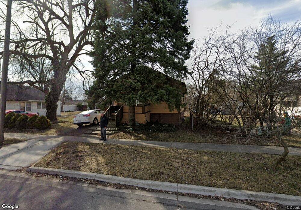
610 E Troy St Ferndale, MI 48220
Estimated Value: $214,181 - $258,000
4
Beds
1
Bath
1,072
Sq Ft
$227/Sq Ft
Est. Value
About This Home
This home is located at 610 E Troy St, Ferndale, MI 48220 and is currently estimated at $243,045, approximately $226 per square foot. 610 E Troy St is a home located in Oakland County with nearby schools including Ferndale Lower Elementary Campus, Ferndale Upper Elementary Campus, and Ferndale Middle School.
Ownership History
Date
Name
Owned For
Owner Type
Purchase Details
Closed on
Nov 27, 2024
Sold by
Francis X Norris Revocable Living Trust
Bought by
Combs Shaunna Marie and Gavnsey Antonio Brandon
Current Estimated Value
Purchase Details
Closed on
Jun 12, 2008
Sold by
Norris Francis X and Norris Helen M
Bought by
Norris Francis X and The Francis X Norris Revocable Living Tr
Purchase Details
Closed on
Oct 17, 2001
Sold by
Norris Helen M
Bought by
Norris Francis X
Create a Home Valuation Report for This Property
The Home Valuation Report is an in-depth analysis detailing your home's value as well as a comparison with similar homes in the area
Home Values in the Area
Average Home Value in this Area
Purchase History
| Date | Buyer | Sale Price | Title Company |
|---|---|---|---|
| Combs Shaunna Marie | -- | None Listed On Document | |
| Combs Shaunna Marie | -- | None Listed On Document | |
| Norris Francis X | -- | None Available | |
| Norris Francis X | -- | -- |
Source: Public Records
Tax History
| Year | Tax Paid | Tax Assessment Tax Assessment Total Assessment is a certain percentage of the fair market value that is determined by local assessors to be the total taxable value of land and additions on the property. | Land | Improvement |
|---|---|---|---|---|
| 2025 | $2,532 | $94,460 | $0 | $0 |
| 2024 | $2,460 | $93,380 | $0 | $0 |
| 2023 | $2,373 | $86,330 | $0 | $0 |
| 2022 | $2,349 | $88,750 | $0 | $0 |
| 2021 | $2,341 | $77,730 | $0 | $0 |
| 2020 | $2,243 | $73,860 | $0 | $0 |
| 2019 | $2,259 | $62,710 | $0 | $0 |
| 2018 | $2,253 | $51,960 | $0 | $0 |
| 2017 | $2,220 | $48,230 | $0 | $0 |
| 2016 | $2,190 | $40,330 | $0 | $0 |
| 2015 | -- | $35,020 | $0 | $0 |
| 2014 | -- | $30,450 | $0 | $0 |
| 2011 | -- | $35,990 | $0 | $0 |
Source: Public Records
Map
Nearby Homes
- 408 College St
- 1032 E Breckenridge St
- 1054 E Troy St
- 1130 E Breckenridge St
- 366 E Marshall St
- 525 E Lewiston Ave
- 3 W Nine Mile Rd
- 2411 Harris St
- 211 Silman St
- 2157 Symes St
- 918 Saint Louis St
- 274 Silman St
- 306 Silman St
- 1971 Leitch Rd
- 398 W Hazelhurst St
- 420 Silman St
- 600 E Oakridge St
- 2128 Romeo St
- 1986 Leitch Rd
- 1600 Woodward Heights
- 610 E Troy St Unit 201
- 592 E Troy St
- 624 E Troy St
- 588 E Troy St
- 609 E Saratoga St
- 603 E Saratoga St
- 615 E Saratoga St
- 634 E Troy St
- 580 E Troy St
- 625 E Saratoga St
- 595 E Troy St
- 635 E Saratoga St
- 587 E Saratoga St
- 587 E Saratoga St
- 579 E Saratoga St
- 585 E Troy St
- 571 E Saratoga St
- 571 E Saratoga St
- 643 E Saratoga St
- 561 E Saratoga St
Your Personal Tour Guide
Ask me questions while you tour the home.