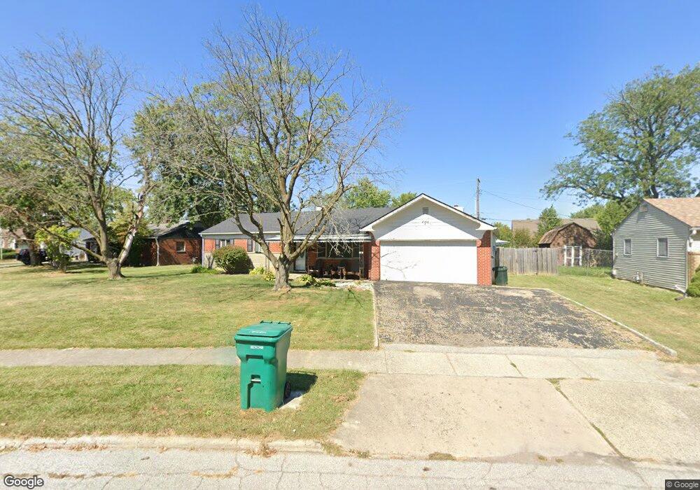
610 Maple Ct Brownsburg, IN 46112
Estimated Value: $239,000 - $274,000
Studio
1
Bath
1,510
Sq Ft
$167/Sq Ft
Est. Value
About This Home
This home is located at 610 Maple Ct, Brownsburg, IN 46112 and is currently estimated at $252,375, approximately $167 per square foot. 610 Maple Ct is a home located in Hendricks County with nearby schools including Brown Elementary School, Brownsburg West Middle School, and Brownsburg High School.
Ownership History
Date
Name
Owned For
Owner Type
Purchase Details
Closed on
Apr 12, 2005
Sold by
Wittman John and Wittman Marilyn
Bought by
Icenogle Diane M
Current Estimated Value
Home Financials for this Owner
Home Financials are based on the most recent Mortgage that was taken out on this home.
Original Mortgage
$89,000
Outstanding Balance
$45,240
Interest Rate
6.06%
Mortgage Type
New Conventional
Estimated Equity
$207,135
Create a Home Valuation Report for This Property
The Home Valuation Report is an in-depth analysis detailing your home's value as well as a comparison with similar homes in the area
Home Values in the Area
Average Home Value in this Area
Purchase History
| Date | Buyer | Sale Price | Title Company |
|---|---|---|---|
| Icenogle Diane M | -- | None Available |
Source: Public Records
Mortgage History
| Date | Status | Borrower | Loan Amount |
|---|---|---|---|
| Open | Icenogle Diane M | $89,000 |
Source: Public Records
Tax History
| Year | Tax Paid | Tax Assessment Tax Assessment Total Assessment is a certain percentage of the fair market value that is determined by local assessors to be the total taxable value of land and additions on the property. | Land | Improvement |
|---|---|---|---|---|
| 2025 | $1,834 | $192,100 | $37,600 | $154,500 |
| 2024 | $1,834 | $183,400 | $37,600 | $145,800 |
| 2023 | $1,666 | $166,600 | $34,100 | $132,500 |
| 2022 | $1,521 | $152,100 | $30,000 | $122,100 |
| 2021 | $1,414 | $141,400 | $30,000 | $111,400 |
| 2020 | $1,388 | $138,800 | $30,000 | $108,800 |
| 2019 | $1,288 | $128,800 | $27,800 | $101,000 |
| 2018 | $1,357 | $126,900 | $27,600 | $99,300 |
| 2017 | $1,268 | $121,000 | $26,600 | $94,400 |
| 2016 | $1,211 | $117,700 | $26,600 | $91,100 |
| 2014 | $1,067 | $110,700 | $26,600 | $84,100 |
Source: Public Records
Map
Nearby Homes
- 529 Maple Ln
- 638 Maple Ct
- 645 E Main St
- 9937 Us Highway 136
- 509 E Main St
- 106 S Grant St
- 252 N Odell St
- 448 Murphy Ln
- 635 Jackson St
- 390 Vinewood Dr N
- 867 Ironwood West Dr
- 212 Hamilton St
- 6843 Sable Point Dr
- 8691 Laurelton Place
- 8626 Jeff Cir
- 8610 Hudson Way
- 0 Tbd Unit MBR22086564
- 1108 Redwood Dr
- 17 Roselawn Ave
- 506 S Green St
Your Personal Tour Guide
Ask me questions while you tour the home.