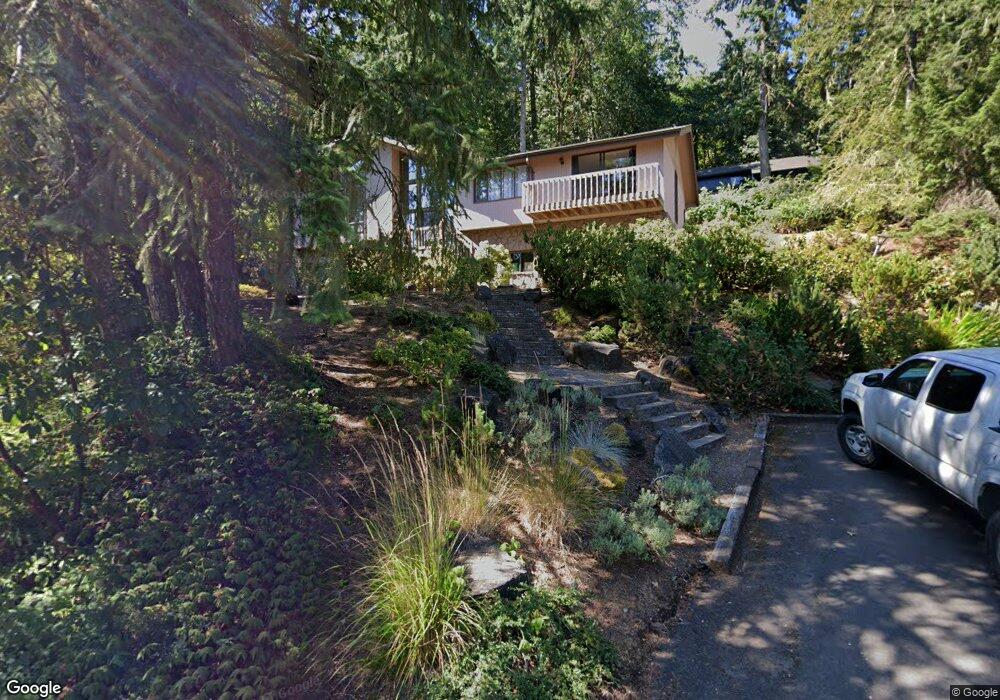
610 Startouch Dr Eugene, OR 97405
Crest Drive NeighborhoodEstimated Value: $631,000 - $704,000
3
Beds
3
Baths
2,522
Sq Ft
$262/Sq Ft
Est. Value
About This Home
This home is located at 610 Startouch Dr, Eugene, OR 97405 and is currently estimated at $660,529, approximately $261 per square foot. 610 Startouch Dr is a home located in Lane County with nearby schools including Edgewood Community Elementary School, Spencer Butte Middle School, and South Eugene High School.
Ownership History
Date
Name
Owned For
Owner Type
Purchase Details
Closed on
Dec 17, 2008
Sold by
Nairns Jerry
Bought by
Nairns Sun
Current Estimated Value
Purchase Details
Closed on
Nov 9, 2005
Sold by
Henney Michele C and Henney Douglas D
Bought by
Nairns Jerry
Home Financials for this Owner
Home Financials are based on the most recent Mortgage that was taken out on this home.
Original Mortgage
$268,000
Outstanding Balance
$143,831
Interest Rate
5.9%
Mortgage Type
Fannie Mae Freddie Mac
Estimated Equity
$516,698
Purchase Details
Closed on
May 28, 2004
Sold by
Robak Gary L and Robak Nancy J
Bought by
Henney Douglas D and Henney Michele C
Home Financials for this Owner
Home Financials are based on the most recent Mortgage that was taken out on this home.
Original Mortgage
$236,000
Interest Rate
5.92%
Mortgage Type
Purchase Money Mortgage
Purchase Details
Closed on
Sep 28, 1998
Sold by
Reddersen Brad R
Bought by
Robak Gary L and Robak Nancy J
Home Financials for this Owner
Home Financials are based on the most recent Mortgage that was taken out on this home.
Original Mortgage
$198,000
Interest Rate
6.88%
Create a Home Valuation Report for This Property
The Home Valuation Report is an in-depth analysis detailing your home's value as well as a comparison with similar homes in the area
Home Values in the Area
Average Home Value in this Area
Purchase History
| Date | Buyer | Sale Price | Title Company |
|---|---|---|---|
| Nairns Sun | -- | Fidelity National Title Insu | |
| Nairns Jerry | $335,000 | Cascade Title Co | |
| Henney Douglas D | $295,000 | Fidelity National Title Insu | |
| Robak Gary L | $220,000 | Cascade Title Co |
Source: Public Records
Mortgage History
| Date | Status | Borrower | Loan Amount |
|---|---|---|---|
| Open | Nairns Jerry | $268,000 | |
| Closed | Nairns Jerry | $67,000 | |
| Previous Owner | Henney Douglas D | $236,000 | |
| Previous Owner | Robak Gary L | $198,000 |
Source: Public Records
Tax History
| Year | Tax Paid | Tax Assessment Tax Assessment Total Assessment is a certain percentage of the fair market value that is determined by local assessors to be the total taxable value of land and additions on the property. | Land | Improvement |
|---|---|---|---|---|
| 2025 | $8,672 | $445,067 | -- | -- |
| 2024 | $8,564 | $432,104 | -- | -- |
| 2023 | $8,564 | $419,519 | $0 | $0 |
| 2022 | $8,023 | $407,300 | $0 | $0 |
| 2021 | $7,335 | $395,437 | $0 | $0 |
| 2020 | $7,154 | $383,920 | $0 | $0 |
| 2019 | $6,961 | $372,738 | $0 | $0 |
| 2018 | $6,494 | $351,342 | $0 | $0 |
| 2017 | $6,074 | $351,342 | $0 | $0 |
| 2016 | $5,848 | $341,109 | $0 | $0 |
| 2015 | $5,677 | $331,174 | $0 | $0 |
| 2014 | $5,618 | $321,528 | $0 | $0 |
Source: Public Records
Map
Nearby Homes
- 418 Stonewood Dr Unit 418
- 422 Stonewood Dr Unit 422
- 223 Trailside Loop Unit 223
- 151 Treehill Loop Unit 151
- 152 Treehill Loop Unit 152
- 5159 Solar Heights Dr
- 143 Treehill Loop Unit 143
- 0 Pine View Ct Unit 758820410
- 278 Rockridge Ct
- 126 Treehill Loop Unit 126
- 365 Brae Burn Dr
- 36 Westbrook Way
- 4103 Brae Burn Dr
- 21 Westbrook Way
- 17 Westbrook Way
- 4344 Blanton Rd
- 4040 Southpointe Dr
- 806 Sundance St
- 0 W 40th Ave Unit 3 545854116
- 0 W 40th Ave Unit 3 639571582
- 628 Startouch Dr
- 608 Startouch Dr
- 620 Startouch Dr
- 611 Startouch Dr
- 619 Startouch Dr
- 630 Startouch Dr
- 625 Startouch Dr
- 629 Startouch Dr
- 632 Startouch Dr
- 615 Montara Way
- 581 Brookside Dr
- 611 Montara Way
- 609 Brookside Dr
- 609 Montara Way
- 635 Startouch Dr
- 614 Montara Way
- 585 Brookside Dr
- 612 Montara Way
- 651 Brookside Dr
- 610 Montara Way
Your Personal Tour Guide
Ask me questions while you tour the home.