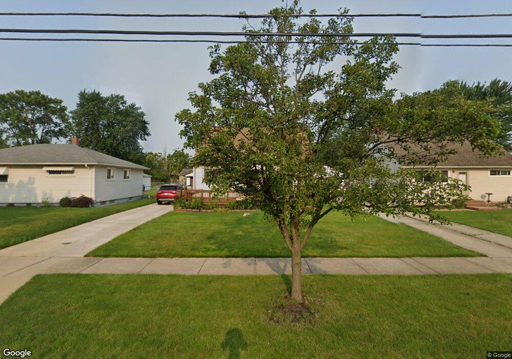
6100 Michael Dr Brookpark, OH 44142
Estimated Value: $196,537 - $223,000
4
Beds
2
Baths
1,131
Sq Ft
$189/Sq Ft
Est. Value
About This Home
This home is located at 6100 Michael Dr, Brookpark, OH 44142 and is currently estimated at $213,634, approximately $188 per square foot. 6100 Michael Dr is a home located in Cuyahoga County with nearby schools including Berea-Midpark Middle School, Berea-Midpark High School, and Huber Heights Preparatory Academy Parma Academy.
Ownership History
Date
Name
Owned For
Owner Type
Purchase Details
Closed on
Nov 3, 2014
Sold by
Estate Of James O Fawks
Bought by
Fawks James M and Fawks Jason A
Current Estimated Value
Purchase Details
Closed on
Mar 24, 2008
Sold by
Fawks James M and Fawks Jason A
Bought by
Fawks James O
Purchase Details
Closed on
Dec 18, 2001
Sold by
Fawks Pamela J
Bought by
Fawks James O
Purchase Details
Closed on
Sep 30, 1985
Sold by
Yurchenko Dale A
Bought by
Fawks James O
Purchase Details
Closed on
Jun 9, 1977
Sold by
Jameson Ernest L and Jameson Janet E
Bought by
Yurchenko Dale A
Purchase Details
Closed on
Jan 1, 1975
Bought by
Jameson Ernest L and Jameson Janet E
Create a Home Valuation Report for This Property
The Home Valuation Report is an in-depth analysis detailing your home's value as well as a comparison with similar homes in the area
Home Values in the Area
Average Home Value in this Area
Purchase History
| Date | Buyer | Sale Price | Title Company |
|---|---|---|---|
| Fawks James M | -- | Attorney | |
| Fawks James O | -- | Attorney | |
| Fawks James O | -- | -- | |
| Fawks James O | $53,900 | -- | |
| Yurchenko Dale A | $35,000 | -- | |
| Jameson Ernest L | -- | -- |
Source: Public Records
Tax History
| Year | Tax Paid | Tax Assessment Tax Assessment Total Assessment is a certain percentage of the fair market value that is determined by local assessors to be the total taxable value of land and additions on the property. | Land | Improvement |
|---|---|---|---|---|
| 2025 | $2,813 | $54,880 | $11,935 | $42,945 |
| 2024 | $2,830 | $54,880 | $11,935 | $42,945 |
| 2023 | $2,855 | $45,850 | $9,170 | $36,680 |
| 2022 | $2,835 | $45,850 | $9,170 | $36,680 |
| 2021 | $2,820 | $45,850 | $9,170 | $36,680 |
| 2020 | $2,544 | $36,400 | $7,280 | $29,120 |
| 2019 | $2,470 | $104,000 | $20,800 | $83,200 |
| 2018 | $2,460 | $36,400 | $7,280 | $29,120 |
| 2017 | $2,378 | $32,490 | $6,830 | $25,660 |
| 2016 | $2,358 | $32,490 | $6,830 | $25,660 |
| 2015 | $3,334 | $32,490 | $6,830 | $25,660 |
| 2014 | $3,334 | $32,490 | $6,830 | $25,660 |
Source: Public Records
Map
Nearby Homes
- 6095 Stark Dr
- 6103 Westbrook Dr
- 6024 Brook Ct
- 6065 Mercer Dr
- 6014 Westbrook Dr
- 14761 Larkfield Dr
- 14801 Larkfield Dr
- 14242 Holland Rd
- 14024 Donald Dr
- 14396 Park Dr
- 13442 Havendale Dr
- 13602 Holland Rd
- 13670 Middlebrook Blvd
- 5952 Delores Blvd
- 15995 Paulding Blvd
- 6330 Sandfield Dr
- 6386 Sandfield Dr
- 6330 Ledgebrook Dr
- 6377 Ledgebrook Dr
- 6330 Stonecrest Dr
- 6106 Michael Dr
- 6094 Michael Dr
- 6088 Michael Dr
- 6112 Michael Dr
- 6101 Morrow Dr
- 6082 Michael Dr
- 6095 Morrow Dr
- 6107 Morrow Dr
- 6114 Michael Dr
- 6089 Morrow Dr
- 6113 Morrow Dr
- 6101 Michael Dr
- 6076 Michael Dr
- 6107 Michael Dr
- 6083 Morrow Dr
- 6113 Michael Dr
- 6095 Michael Dr
- 6116 Michael Dr
- 6087 Michael Dr
- 6119 Michael Dr
Your Personal Tour Guide
Ask me questions while you tour the home.