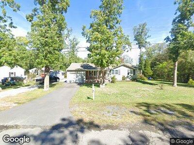
6105 11th St Mays Landing, NJ 08330
Estimated Value: $210,000 - $334,000
3
Beds
1
Bath
1,192
Sq Ft
$244/Sq Ft
Est. Value
About This Home
This home is located at 6105 11th St, Mays Landing, NJ 08330 and is currently estimated at $290,743, approximately $243 per square foot. 6105 11th St is a home located in Atlantic County with nearby schools including Joseph Shaner School, George L. Hess Educational Complex, and William Davies Middle School.
Ownership History
Date
Name
Owned For
Owner Type
Purchase Details
Closed on
Aug 25, 2017
Sold by
Departmetn Of Veterans Affaris
Bought by
Merrill Judy and Frildey Wiliam C
Current Estimated Value
Purchase Details
Closed on
May 23, 2017
Sold by
Scarlett John H
Bought by
Secretary Of Veterans Affairs
Purchase Details
Closed on
Nov 29, 2007
Sold by
Boone Berton M and Boone Waltraud
Bought by
Scarlett John H
Home Financials for this Owner
Home Financials are based on the most recent Mortgage that was taken out on this home.
Original Mortgage
$219,600
Interest Rate
6.3%
Mortgage Type
VA
Create a Home Valuation Report for This Property
The Home Valuation Report is an in-depth analysis detailing your home's value as well as a comparison with similar homes in the area
Home Values in the Area
Average Home Value in this Area
Purchase History
| Date | Buyer | Sale Price | Title Company |
|---|---|---|---|
| Merrill Judy | $85,000 | Surety Title Co Llc | |
| Secretary Of Veterans Affairs | $1,000 | None Available | |
| Scarlett John H | -- | Accommodation | |
| Scarlett John H | $215,000 | Foundation Title |
Source: Public Records
Mortgage History
| Date | Status | Borrower | Loan Amount |
|---|---|---|---|
| Previous Owner | Scarlett John H | $219,600 |
Source: Public Records
Tax History Compared to Growth
Tax History
| Year | Tax Paid | Tax Assessment Tax Assessment Total Assessment is a certain percentage of the fair market value that is determined by local assessors to be the total taxable value of land and additions on the property. | Land | Improvement |
|---|---|---|---|---|
| 2024 | $5,304 | $154,600 | $44,200 | $110,400 |
| 2023 | $4,987 | $154,600 | $44,200 | $110,400 |
| 2022 | $4,987 | $154,600 | $44,200 | $110,400 |
| 2021 | $4,977 | $154,600 | $44,200 | $110,400 |
| 2020 | $4,977 | $154,600 | $44,200 | $110,400 |
| 2019 | $4,989 | $154,600 | $44,200 | $110,400 |
| 2018 | $4,814 | $154,600 | $44,200 | $110,400 |
| 2017 | $4,738 | $154,600 | $44,200 | $110,400 |
| 2016 | $4,356 | $154,600 | $44,200 | $110,400 |
| 2015 | $4,199 | $154,600 | $44,200 | $110,400 |
| 2014 | $4,219 | $170,100 | $52,800 | $117,300 |
Source: Public Records
Map
Nearby Homes
- 6105 11th St
- 6109 11th St
- 1116 Calhoun Ave
- 6104 11th St
- 6009 11th St
- 6108 11th St
- 246 11th St
- 1132 Calhoun Ave
- 964 Decatur Ave
- 949 Decatur Ave
- 948 Calhoun Ave
- 1101 Calhoun Ave
- 948 Decatur Ave
- 1143 Route 50
- 1148 Calhoun Ave
- 1133 Calhoun Ave
- 933 Decatur Ave
- 0 Decatur Ave Unit 1005915687
- 0 Decatur Ave Unit 7210714
- 0 Decatur Ave Unit 459655