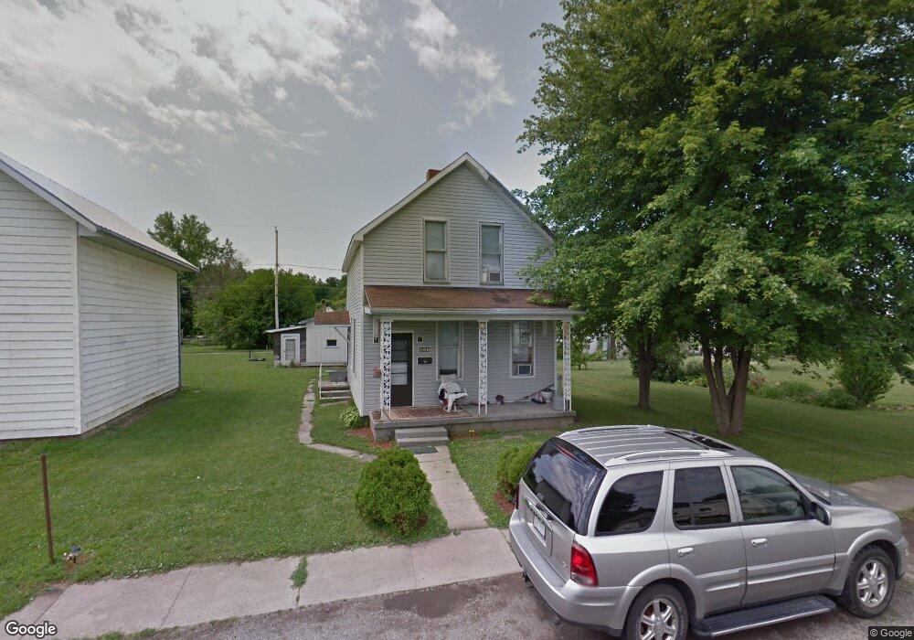
611 Smith Ave Kenton, OH 43326
Estimated Value: $68,000 - $137,000
3
Beds
1
Bath
1,254
Sq Ft
$88/Sq Ft
Est. Value
About This Home
This home is located at 611 Smith Ave, Kenton, OH 43326 and is currently estimated at $110,797, approximately $88 per square foot. 611 Smith Ave is a home located in Hardin County with nearby schools including Kenton Elementary School, Kenton Middle School, and Kenton High School.
Ownership History
Date
Name
Owned For
Owner Type
Purchase Details
Closed on
Dec 23, 2015
Sold by
Wingfield Thomas A and Wingfield Marjorie S
Bought by
Jacques Misty Ann
Current Estimated Value
Home Financials for this Owner
Home Financials are based on the most recent Mortgage that was taken out on this home.
Original Mortgage
$32,756
Interest Rate
3.96%
Mortgage Type
Land Contract Argmt. Of Sale
Purchase Details
Closed on
Jan 15, 2007
Sold by
Awrence Bobby R
Bought by
Wingfield Thomas A and Wingfield Marjorie
Purchase Details
Closed on
Mar 9, 2004
Bought by
Wingfield Marjorie S and Wingfield B
Purchase Details
Closed on
May 5, 2003
Bought by
Wells Fargo Bank Minneso
Purchase Details
Closed on
Nov 6, 1996
Bought by
Scott William H and Scott Cora L
Purchase Details
Closed on
Aug 17, 1989
Create a Home Valuation Report for This Property
The Home Valuation Report is an in-depth analysis detailing your home's value as well as a comparison with similar homes in the area
Home Values in the Area
Average Home Value in this Area
Purchase History
| Date | Buyer | Sale Price | Title Company |
|---|---|---|---|
| Jacques Misty Ann | $37,500 | None Available | |
| Wingfield Thomas A | -- | None Available | |
| Wingfield Marjorie S | $18,400 | -- | |
| Wells Fargo Bank Minneso | $21,000 | -- | |
| Scott William H | $15,000 | -- | |
| -- | $3,700 | -- |
Source: Public Records
Mortgage History
| Date | Status | Borrower | Loan Amount |
|---|---|---|---|
| Closed | Jacques Misty Ann | $32,756 |
Source: Public Records
Tax History
| Year | Tax Paid | Tax Assessment Tax Assessment Total Assessment is a certain percentage of the fair market value that is determined by local assessors to be the total taxable value of land and additions on the property. | Land | Improvement |
|---|---|---|---|---|
| 2024 | $721 | $16,000 | $1,870 | $14,130 |
| 2023 | $725 | $16,000 | $1,870 | $14,130 |
| 2022 | $640 | $13,260 | $1,310 | $11,950 |
| 2021 | $643 | $13,260 | $1,310 | $11,950 |
| 2020 | $662 | $13,260 | $1,310 | $11,950 |
| 2019 | $577 | $10,680 | $1,240 | $9,440 |
| 2018 | $553 | $10,680 | $1,240 | $9,440 |
| 2017 | $553 | $10,680 | $1,240 | $9,440 |
| 2016 | $560 | $11,550 | $1,370 | $10,180 |
| 2015 | $428 | $11,550 | $1,370 | $10,180 |
| 2014 | $448 | $11,550 | $1,370 | $10,180 |
| 2013 | $509 | $12,680 | $1,370 | $11,310 |
Source: Public Records
Map
Nearby Homes
- 804 W Franklin St
- 703 S Detroit St
- 226 S Wayne St
- 639 S Main St
- 219 W Carrol St
- 95 Hillcrest Ln
- 310 N Market St
- 121 S High St
- 233 N Main St
- 404 N Glendale St
- 508 Decatur St
- 510 Decatur St
- 354 S Barron St
- 416 Center St
- 405 E Carroll St
- 405 E Carrol St Unit 405 1/2
- 530 E Franklin St
- 39 Grape St
- 509 E North St
- 619 E North St
Your Personal Tour Guide
Ask me questions while you tour the home.