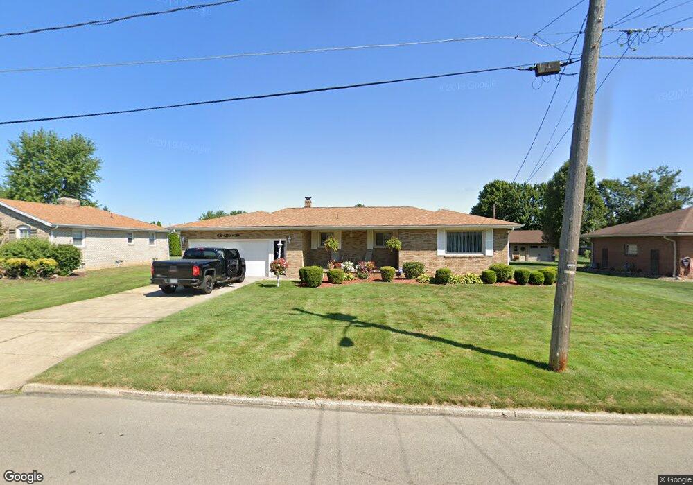
611 W Omar St Struthers, OH 44471
Estimated Value: $174,000 - $257,000
3
Beds
2
Baths
1,336
Sq Ft
$154/Sq Ft
Est. Value
About This Home
This home is located at 611 W Omar St, Struthers, OH 44471 and is currently estimated at $205,840, approximately $154 per square foot. 611 W Omar St is a home located in Mahoning County with nearby schools including Mckamy Elementary School, Carrollton Elementary School, and Lovett Elementary School.
Ownership History
Date
Name
Owned For
Owner Type
Purchase Details
Closed on
Jun 5, 2013
Sold by
Gregory Veronica Susan and Palovich Paul Vincent
Bought by
Smith William
Current Estimated Value
Home Financials for this Owner
Home Financials are based on the most recent Mortgage that was taken out on this home.
Original Mortgage
$82,650
Outstanding Balance
$58,503
Interest Rate
3.38%
Mortgage Type
New Conventional
Estimated Equity
$147,337
Purchase Details
Closed on
Apr 16, 1964
Bought by
Palovich Paul and Palovich I
Create a Home Valuation Report for This Property
The Home Valuation Report is an in-depth analysis detailing your home's value as well as a comparison with similar homes in the area
Home Values in the Area
Average Home Value in this Area
Purchase History
| Date | Buyer | Sale Price | Title Company |
|---|---|---|---|
| Smith William | $87,000 | Escrow | |
| Palovich Paul | -- | -- |
Source: Public Records
Mortgage History
| Date | Status | Borrower | Loan Amount |
|---|---|---|---|
| Open | Smith William | $82,650 |
Source: Public Records
Tax History Compared to Growth
Tax History
| Year | Tax Paid | Tax Assessment Tax Assessment Total Assessment is a certain percentage of the fair market value that is determined by local assessors to be the total taxable value of land and additions on the property. | Land | Improvement |
|---|---|---|---|---|
| 2024 | $1,956 | $47,000 | $2,900 | $44,100 |
| 2023 | $1,923 | $47,000 | $2,900 | $44,100 |
| 2022 | $1,939 | $35,890 | $2,730 | $33,160 |
| 2021 | $1,922 | $35,890 | $2,730 | $33,160 |
| 2020 | $1,930 | $35,890 | $2,730 | $33,160 |
| 2019 | $1,847 | $31,200 | $2,370 | $28,830 |
| 2018 | $1,762 | $31,200 | $2,370 | $28,830 |
| 2017 | $1,793 | $31,200 | $2,370 | $28,830 |
| 2016 | $1,827 | $33,160 | $2,770 | $30,390 |
| 2015 | $1,784 | $33,160 | $2,770 | $30,390 |
| 2014 | $1,790 | $33,160 | $2,770 | $30,390 |
| 2013 | $1,911 | $33,160 | $2,770 | $30,390 |
Source: Public Records
Map
Nearby Homes
- 576 W Harvey St
- 550 Brandon Ave
- 525 W Omar St
- 2089 Shetland Ln
- 478 W Harvey St
- 1933 Brandon Ave
- 5710 Youngstown Poland Rd
- 2296 Knollwood Ave
- 1919 Wingate Rd
- 2021 Country Club Ave
- 2128 Lyon Blvd
- 2153 Lyon Blvd
- 418 W Wilson St
- 1913 Country Club Ave
- 0 Oles Ave
- 0 Woodlawn Ave
- 2411 Lyon Blvd
- 1828 Basil Ave
- 1830 Halbert Dr
- 1890 Mathews Rd
- 599 W Omar St
- 613 W Omar St
- 593 W Omar St
- 602 W Harvey St
- 608 W Harvey St
- 594 W Harvey St
- 604 W Omar St
- 623 W Omar St Unit 625
- 610 W Omar St
- 587 W Omar St
- 614 W Harvey St
- 598 W Omar St
- 588 W Harvey St
- 616 W Omar St
- 592 W Omar St
- 620 W Harvey St
- 585 W Omar St
- 582 W Harvey St
- 620 W Omar St
- 586 W Omar St