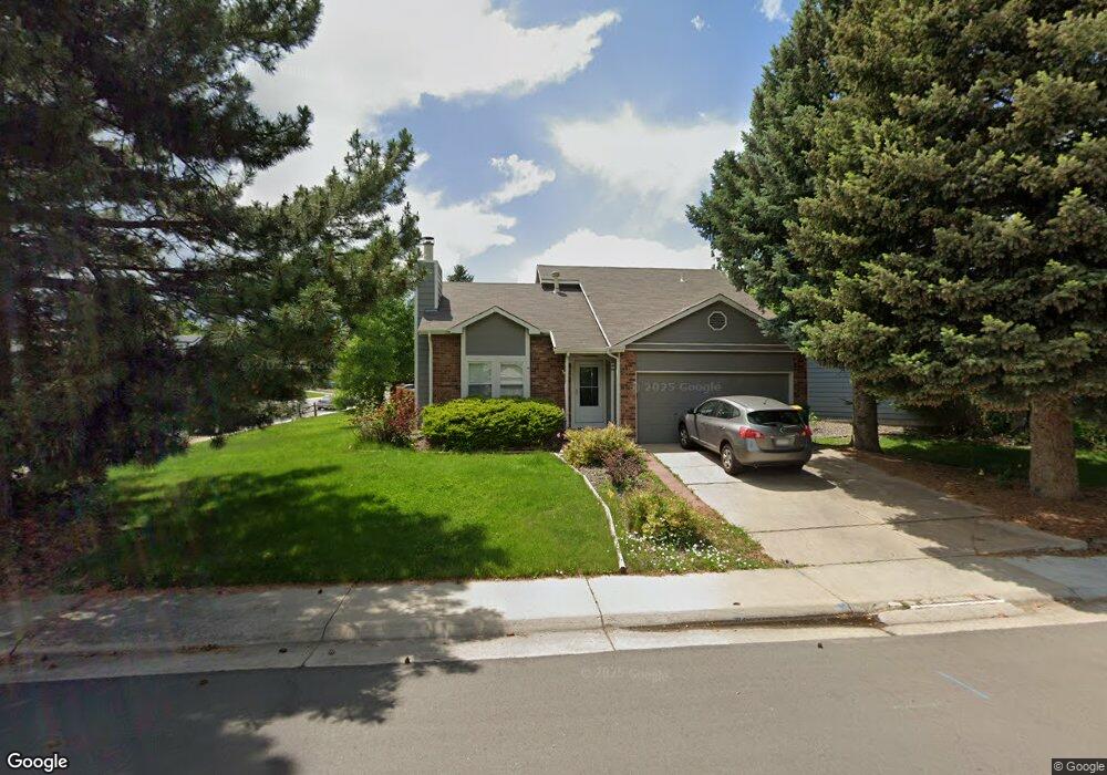
6111 S Tabor St Littleton, CO 80127
Foothill Green NeighborhoodEstimated Value: $556,508 - $601,000
3
Beds
3
Baths
1,570
Sq Ft
$369/Sq Ft
Est. Value
About This Home
This home is located at 6111 S Tabor St, Littleton, CO 80127 and is currently estimated at $579,627, approximately $369 per square foot. 6111 S Tabor St is a home located in Jefferson County with nearby schools including Powderhorn Elementary School, Summit Ridge Middle School, and Dakota Ridge Senior High School.
Ownership History
Date
Name
Owned For
Owner Type
Purchase Details
Closed on
Aug 6, 2021
Sold by
Chambers Matt
Bought by
Dwf Vi Atlas Sfr Co Llc
Current Estimated Value
Purchase Details
Closed on
Nov 15, 2005
Sold by
Williams Deandra Lee and Achammer Deandra
Bought by
Chambers Matt
Home Financials for this Owner
Home Financials are based on the most recent Mortgage that was taken out on this home.
Original Mortgage
$188,000
Interest Rate
6.04%
Mortgage Type
Fannie Mae Freddie Mac
Create a Home Valuation Report for This Property
The Home Valuation Report is an in-depth analysis detailing your home's value as well as a comparison with similar homes in the area
Home Values in the Area
Average Home Value in this Area
Purchase History
| Date | Buyer | Sale Price | Title Company |
|---|---|---|---|
| Dwf Vi Atlas Sfr Co Llc | $535,000 | First Integrity Title | |
| Chambers Matt | $235,000 | Land Title Guarantee Company |
Source: Public Records
Mortgage History
| Date | Status | Borrower | Loan Amount |
|---|---|---|---|
| Previous Owner | Chambers Matt | $188,000 |
Source: Public Records
Tax History Compared to Growth
Tax History
| Year | Tax Paid | Tax Assessment Tax Assessment Total Assessment is a certain percentage of the fair market value that is determined by local assessors to be the total taxable value of land and additions on the property. | Land | Improvement |
|---|---|---|---|---|
| 2024 | $2,983 | $30,455 | $11,229 | $19,226 |
| 2023 | $2,983 | $30,455 | $11,229 | $19,226 |
| 2022 | $2,749 | $27,557 | $8,131 | $19,426 |
| 2021 | $2,784 | $28,350 | $8,365 | $19,985 |
| 2020 | $2,495 | $25,461 | $7,040 | $18,421 |
| 2019 | $2,464 | $25,461 | $7,040 | $18,421 |
| 2018 | $2,235 | $22,303 | $6,844 | $15,459 |
| 2017 | $2,040 | $22,303 | $6,844 | $15,459 |
| 2016 | $1,959 | $20,670 | $6,151 | $14,519 |
| 2015 | $1,704 | $20,670 | $6,151 | $14,519 |
| 2014 | $2,009 | $16,862 | $5,320 | $11,542 |
Source: Public Records
Map
Nearby Homes
- 5995 S Taft Way
- 11445 W Maplewood Ave
- 11877 W Bowles Cir
- 5981 S Vivian St
- 11371 W Parkhill Dr
- 12299 W Burgundy Ave
- 12319 W Burgundy Ave
- 6424 S Routt St
- 5903 S Ward St
- 5941 S Quail Way
- 6459 S Queen Way
- 6097 S Pierson St
- 6077 S Pierson St
- 6057 S Pierson St
- 11993 W Long Cir Unit 204
- 6017 S Pierson St
- 6506 S Robb Way
- 6126 S Pierson St
- 11992 W Long Cir Unit 204
- 11972 W Long Cir Unit 104
- 6091 S Tabor St
- 11875 W Maplewood Ave
- 6081 S Tabor St
- 11836 W Maplewood Ave
- 6110 S Tabor St
- 11876 W Maplewood Ave
- 11895 W Maplewood Ave
- 6100 S Tabor St
- 11816 W Maplewood Ave
- 6090 S Tabor St
- 11896 W Maplewood Ave
- 11786 W Maplewood Ave
- 11905 W Maplewood Ave
- 6119 S Swadley Way
- 6080 S Tabor St
- 11906 W Maplewood Ave
- 6109 S Swadley Way
- 11766 W Maplewood Ave
- 6099 S Swadley Way
- 11926 W Maplewood Ave