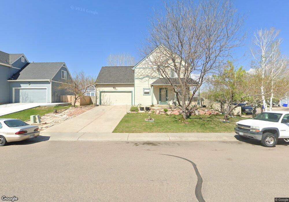
6115 Polaris Dr Fort Collins, CO 80525
Estimated Value: $491,000 - $493,000
3
Beds
2
Baths
1,290
Sq Ft
$381/Sq Ft
Est. Value
About This Home
This home is located at 6115 Polaris Dr, Fort Collins, CO 80525 and is currently estimated at $491,766, approximately $381 per square foot. 6115 Polaris Dr is a home located in Larimer County with nearby schools including Lopez Elementary School, Webber Middle School, and Rocky Mountain High School.
Ownership History
Date
Name
Owned For
Owner Type
Purchase Details
Closed on
Oct 31, 2002
Sold by
Wade Tara Anne Moreau
Bought by
Lopez Evir A and Lopez Hercilda J
Current Estimated Value
Home Financials for this Owner
Home Financials are based on the most recent Mortgage that was taken out on this home.
Original Mortgage
$188,028
Outstanding Balance
$78,699
Interest Rate
6.01%
Mortgage Type
FHA
Estimated Equity
$413,067
Purchase Details
Closed on
Feb 3, 2000
Sold by
Palladian Construction Co
Bought by
Wade Tara Anne Moreau
Home Financials for this Owner
Home Financials are based on the most recent Mortgage that was taken out on this home.
Original Mortgage
$152,000
Interest Rate
9%
Purchase Details
Closed on
May 14, 1999
Sold by
North House Llc
Bought by
Palladian Construction Company Inc
Create a Home Valuation Report for This Property
The Home Valuation Report is an in-depth analysis detailing your home's value as well as a comparison with similar homes in the area
Home Values in the Area
Average Home Value in this Area
Purchase History
| Date | Buyer | Sale Price | Title Company |
|---|---|---|---|
| Lopez Evir A | $192,000 | North American Title Co | |
| Wade Tara Anne Moreau | $150,428 | -- | |
| Palladian Construction Company Inc | $35,000 | Security Title |
Source: Public Records
Mortgage History
| Date | Status | Borrower | Loan Amount |
|---|---|---|---|
| Open | Lopez Evir A | $188,028 | |
| Previous Owner | Wade Tara Anne Moreau | $152,000 |
Source: Public Records
Tax History Compared to Growth
Tax History
| Year | Tax Paid | Tax Assessment Tax Assessment Total Assessment is a certain percentage of the fair market value that is determined by local assessors to be the total taxable value of land and additions on the property. | Land | Improvement |
|---|---|---|---|---|
| 2025 | $2,445 | $33,085 | $2,144 | $30,941 |
| 2024 | $2,341 | $33,085 | $2,144 | $30,941 |
| 2022 | $2,521 | $23,686 | $2,224 | $21,462 |
| 2021 | $2,553 | $24,367 | $2,288 | $22,079 |
| 2020 | $2,560 | $24,253 | $2,288 | $21,965 |
| 2019 | $2,569 | $24,253 | $2,288 | $21,965 |
| 2018 | $1,936 | $18,770 | $2,304 | $16,466 |
| 2017 | $1,978 | $19,238 | $2,304 | $16,934 |
| 2016 | $1,768 | $17,114 | $2,547 | $14,567 |
| 2015 | $1,756 | $17,120 | $2,550 | $14,570 |
| 2014 | $1,614 | $15,640 | $2,550 | $13,090 |
Source: Public Records
Map
Nearby Homes
- 312 Milky Way Dr
- 301 Uranus St
- 5942 Colby St
- 306 Saturn Dr
- 501 Yuma Ct
- 6600 Debra Dr
- 102 Fossil Ct W
- 6701 Holyoke Ct
- 5925 Auburn Dr
- 402 Hudson Ct
- 433 Huntington Hills Dr
- 5509 Fossil Ridge Dr E
- 530 Holyoke Ct
- 508 Shadbury Ct
- 320 Strasburg Dr Unit B10
- 408 Strasburg Dr Unit B8
- 5436 Hilldale Ct
- 7008 Woodrow Dr
- 715 Yarnell Ct
- 5902 Huntington Hills Dr
- 6119 Polaris Dr
- 6102 Constellation Dr
- 6104 Constellation Dr
- 6125 Polaris Dr
- 6106 Constellation Dr
- 6127 Polaris Dr
- 404 Skyway Dr
- 6120 Polaris Dr
- 324 Skyway Dr
- 408 Skyway Dr
- 6108 Constellation Dr
- 6101 Constellation Dr
- 6126 Polaris Dr
- 6131 Polaris Dr
- 6016 Polaris Dr
- 6105 Constellation Dr
- 412 Skyway Dr
- 6132 Polaris Dr
- 6137 Polaris Dr
- 6025 Venus Ave