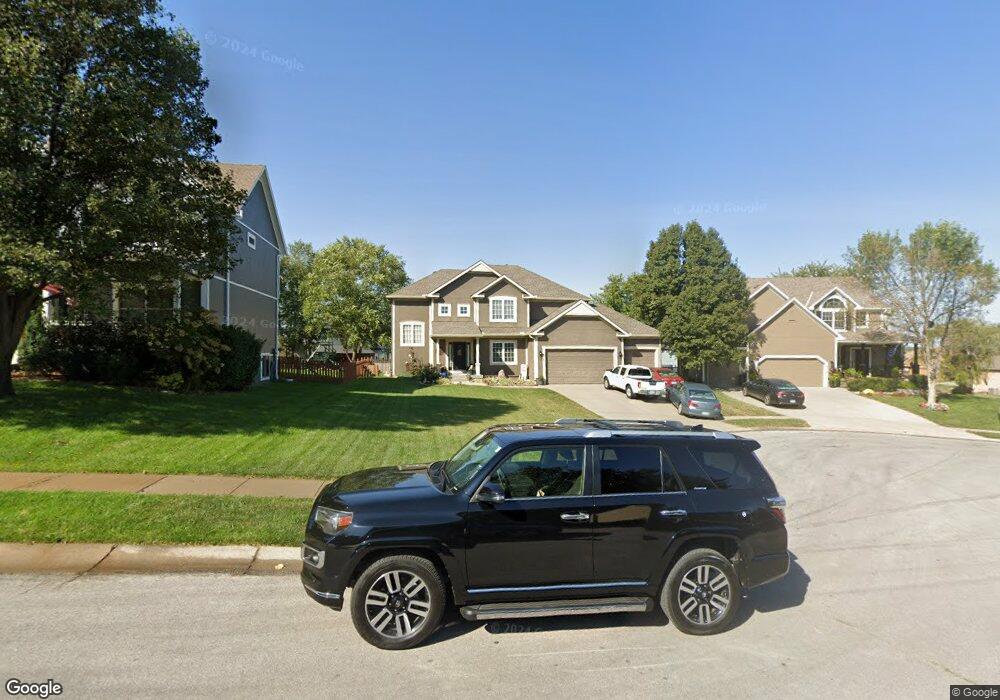
612 Duncan Cir Raymore, MO 64083
Estimated Value: $416,000 - $481,000
4
Beds
3
Baths
2,246
Sq Ft
$203/Sq Ft
Est. Value
About This Home
This home is located at 612 Duncan Cir, Raymore, MO 64083 and is currently estimated at $456,899, approximately $203 per square foot. 612 Duncan Cir is a home located in Cass County with nearby schools including Creekmoor Elementary School, Raymore-Peculiar East Middle School, and Raymore-Peculiar Senior High School.
Ownership History
Date
Name
Owned For
Owner Type
Purchase Details
Closed on
Mar 27, 2009
Sold by
Northern Tarquinius P and Northern Kristine M
Bought by
Valentour James A and Valentour Deena L
Current Estimated Value
Home Financials for this Owner
Home Financials are based on the most recent Mortgage that was taken out on this home.
Original Mortgage
$183,150
Outstanding Balance
$116,637
Interest Rate
5.24%
Mortgage Type
FHA
Estimated Equity
$340,262
Purchase Details
Closed on
Jun 15, 2005
Sold by
C And M Builder Inc
Bought by
Northern Tarquinius P and Northern Kristine M
Home Financials for this Owner
Home Financials are based on the most recent Mortgage that was taken out on this home.
Original Mortgage
$199,010
Interest Rate
5.12%
Mortgage Type
Adjustable Rate Mortgage/ARM
Create a Home Valuation Report for This Property
The Home Valuation Report is an in-depth analysis detailing your home's value as well as a comparison with similar homes in the area
Home Values in the Area
Average Home Value in this Area
Purchase History
| Date | Buyer | Sale Price | Title Company |
|---|---|---|---|
| Valentour James A | -- | None Available | |
| Northern Tarquinius P | -- | -- |
Source: Public Records
Mortgage History
| Date | Status | Borrower | Loan Amount |
|---|---|---|---|
| Open | Valentour James A | $183,150 | |
| Previous Owner | Northern Tarquinius P | $199,010 |
Source: Public Records
Tax History
| Year | Tax Paid | Tax Assessment Tax Assessment Total Assessment is a certain percentage of the fair market value that is determined by local assessors to be the total taxable value of land and additions on the property. | Land | Improvement |
|---|---|---|---|---|
| 2025 | $4,757 | $66,300 | $11,180 | $55,120 |
| 2024 | $4,757 | $58,450 | $10,160 | $48,290 |
| 2023 | $4,750 | $58,450 | $10,160 | $48,290 |
| 2022 | $4,315 | $52,740 | $10,160 | $42,580 |
| 2021 | $4,315 | $52,740 | $10,160 | $42,580 |
| 2020 | $4,219 | $50,650 | $10,160 | $40,490 |
| 2019 | $4,073 | $50,650 | $10,160 | $40,490 |
| 2018 | $4,052 | $48,660 | $10,160 | $38,500 |
| 2017 | $3,744 | $48,660 | $10,160 | $38,500 |
| 2016 | $3,744 | $46,670 | $10,160 | $36,510 |
| 2015 | $3,747 | $46,670 | $10,160 | $36,510 |
| 2014 | $3,748 | $46,670 | $10,160 | $36,510 |
| 2013 | -- | $46,670 | $10,160 | $36,510 |
Source: Public Records
Map
Nearby Homes
- 1010 Wiltshire Blvd
- 1323 W Johns Blvd
- 503 N Jenkins Blvd
- 701 Hampstead Dr
- 614 Foxglove Ln
- 1412 W Stone Blvd
- 602 Foxglove Ln
- 604 Foxglove Ln
- 502 Foxglove Ln
- 835 Reed Dr
- 610 Foxglove Ln
- 612 Foxglove Ln
- 606 Foxglove Ln
- 608 Foxglove Ln
- 710 Blazing Star Dr
- 708 Blazing Star Dr
- 705 Red Clover Ct
- 701 Wood Sage Ct
- 707 Red Clover Ct
- 901 Reed Dr
- 610 Duncan Cir
- 614 Duncan Cir
- 1226 Wiltshire Blvd
- 1228 Wiltshire Blvd
- 1224 Wiltshire Blvd
- 608 Duncan Cir
- 1233 Edwards Cir
- 616 Duncan Cir
- 613 Duncan Cir
- 1230 Wiltshire Blvd
- 1222 Wiltshire Blvd
- 615 Duncan Cir
- 617 Duncan Cir
- 611 Duncan Cir
- 1232 Wiltshire Blvd
- 609 Duncan Cir
- 1235 Edwards Cir
- 1220 Wiltshire Blvd
- 1227 Wiltshire Blvd
- 0 Wiltshire Blvd
Your Personal Tour Guide
Ask me questions while you tour the home.