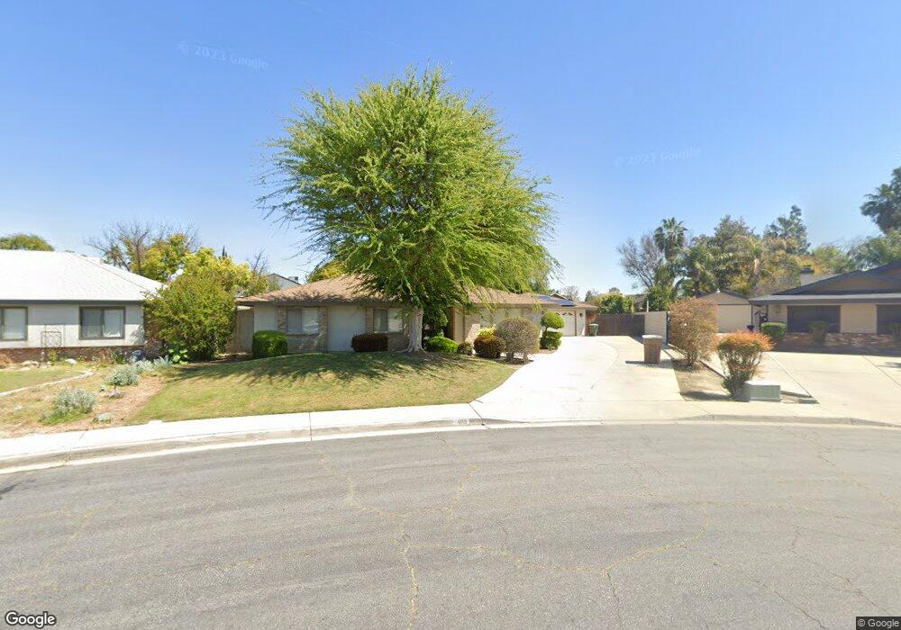
612 Marylhurst St Bakersfield, CA 93314
Estimated Value: $448,000 - $464,540
4
Beds
2
Baths
1,962
Sq Ft
$233/Sq Ft
Est. Value
About This Home
This home is located at 612 Marylhurst St, Bakersfield, CA 93314 and is currently estimated at $456,885, approximately $232 per square foot. 612 Marylhurst St is a home located in Kern County with nearby schools including Del Rio Elementary School, Rosedale Middle School, and Liberty High School.
Ownership History
Date
Name
Owned For
Owner Type
Purchase Details
Closed on
May 21, 2019
Sold by
Visser Rebecca L
Bought by
Rebecca L Visser Trust
Current Estimated Value
Purchase Details
Closed on
Oct 19, 1998
Sold by
Kersten Richard S and Kersten Karen L
Bought by
Viser Rebecca L
Home Financials for this Owner
Home Financials are based on the most recent Mortgage that was taken out on this home.
Original Mortgage
$136,250
Interest Rate
6.69%
Purchase Details
Closed on
Feb 15, 1994
Sold by
Harbour Darrell G and Harbour Janet L
Bought by
Kersten Richard S and Kersten Karen Laneice
Create a Home Valuation Report for This Property
The Home Valuation Report is an in-depth analysis detailing your home's value as well as a comparison with similar homes in the area
Home Values in the Area
Average Home Value in this Area
Purchase History
| Date | Buyer | Sale Price | Title Company |
|---|---|---|---|
| Rebecca L Visser Trust | -- | None Available | |
| Viser Rebecca L | $143,500 | First American Title Co | |
| Kersten Richard S | -- | Stewart Title Co |
Source: Public Records
Mortgage History
| Date | Status | Borrower | Loan Amount |
|---|---|---|---|
| Previous Owner | Viser Rebecca L | $136,250 |
Source: Public Records
Tax History
| Year | Tax Paid | Tax Assessment Tax Assessment Total Assessment is a certain percentage of the fair market value that is determined by local assessors to be the total taxable value of land and additions on the property. | Land | Improvement |
|---|---|---|---|---|
| 2025 | $3,094 | $224,151 | $53,286 | $170,865 |
| 2024 | $3,020 | $219,757 | $52,242 | $167,515 |
| 2023 | $3,020 | $215,449 | $51,218 | $164,231 |
| 2022 | $2,956 | $211,225 | $50,214 | $161,011 |
| 2021 | $2,833 | $207,084 | $49,230 | $157,854 |
| 2020 | $2,776 | $204,962 | $48,726 | $156,236 |
| 2019 | $2,725 | $204,962 | $48,726 | $156,236 |
| 2018 | $2,661 | $197,005 | $46,835 | $150,170 |
| 2017 | $2,618 | $193,143 | $45,917 | $147,226 |
| 2016 | $2,468 | $189,357 | $45,017 | $144,340 |
| 2015 | $2,425 | $186,513 | $44,341 | $142,172 |
| 2014 | $2,369 | $182,861 | $43,473 | $139,388 |
Source: Public Records
Map
Nearby Homes
- 13305 Frenchglen Ave
- 13116 Amanda Ct
- 13301 Birkenfeld Ave
- 13400 Frenchglen Ave
- 501 Reed St
- 15829 Cole Brook Ct
- 705 Harrisburg St
- 804 De Oro Ct
- 13813 Toluca Dr
- 601 Las Arenas Ct
- 14004 San Lazaro Ave
- 101 Cortez Ct
- 13904 Veracruz Dr
- 700 Los Mochis Dr
- 12811 Woodson Bridge Dr
- 12411 Riverfront Park Dr
- 13904 Las Entradas
- 14008 Las Entradas
- 1701 Audley End Place
- 14016 Las Entradas
- 608 Marylhurst St
- 616 Marylhurst St
- 617 Reed St
- 613 Reed St
- 701 Reed St
- 609 Reed St
- 604 Marylhurst St
- 13301 Frenchglen Ave
- 705 Reed St
- 613 Marylhurst St
- 605 Reed St
- 609 Marylhurst St
- 13300 Birkenfeld Ave
- 600 Marylhurst St
- 13304 Birkenfeld Ave
- 13120 Amanda Ct
- 605 Marylhurst St
- 13308 Birkenfeld Ave
- 601 Reed St
- 13121 Amanda Ct
Your Personal Tour Guide
Ask me questions while you tour the home.