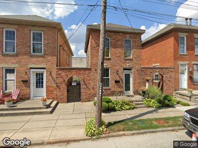
612 W State St Columbus, OH 43215
East Franklinton NeighborhoodEstimated Value: $172,000 - $234,000
2
Beds
1
Bath
1,050
Sq Ft
$190/Sq Ft
Est. Value
About This Home
This home is located at 612 W State St, Columbus, OH 43215 and is currently estimated at $199,326, approximately $189 per square foot. 612 W State St is a home located in Franklin County with nearby schools including Starling PK-8, Sullivant Elementary School, and West High School.
Ownership History
Date
Name
Owned For
Owner Type
Purchase Details
Closed on
Jun 29, 1999
Sold by
Gualtieri Rocco N
Bought by
Gualtieri Christopher M
Current Estimated Value
Purchase Details
Closed on
Jun 21, 1988
Bought by
Gualtieri Rocco N
Purchase Details
Closed on
Oct 1, 1981
Create a Home Valuation Report for This Property
The Home Valuation Report is an in-depth analysis detailing your home's value as well as a comparison with similar homes in the area
Home Values in the Area
Average Home Value in this Area
Purchase History
| Date | Buyer | Sale Price | Title Company |
|---|---|---|---|
| Gualtieri Christopher M | $16,100 | -- | |
| Gualtieri Rocco N | $24,000 | -- | |
| -- | $12,500 | -- |
Source: Public Records
Mortgage History
| Date | Status | Borrower | Loan Amount |
|---|---|---|---|
| Closed | Gualtieri Christopher M | $50,000 | |
| Closed | Gualtieri Christopher M | $50,000 | |
| Closed | Gualtieri Christopher M | $20,500 | |
| Closed | Gualtieri Christopher M | $10,000 | |
| Closed | Gualtieri Christopher M | $32,500 |
Source: Public Records
Tax History Compared to Growth
Tax History
| Year | Tax Paid | Tax Assessment Tax Assessment Total Assessment is a certain percentage of the fair market value that is determined by local assessors to be the total taxable value of land and additions on the property. | Land | Improvement |
|---|---|---|---|---|
| 2024 | $2,209 | $44,590 | $22,680 | $21,910 |
| 2023 | $2,026 | $44,590 | $22,680 | $21,910 |
| 2022 | $609 | $10,780 | $770 | $10,010 |
| 2021 | $610 | $10,780 | $770 | $10,010 |
| 2020 | $603 | $10,780 | $770 | $10,010 |
| 2019 | $546 | $9,000 | $630 | $8,370 |
| 2018 | $543 | $9,000 | $630 | $8,370 |
| 2017 | $546 | $9,000 | $630 | $8,370 |
| 2016 | $596 | $9,000 | $1,020 | $7,980 |
| 2015 | $541 | $9,000 | $1,020 | $7,980 |
| 2014 | $543 | $9,000 | $1,020 | $7,980 |
| 2013 | $297 | $9,975 | $1,120 | $8,855 |
Source: Public Records
Map
Nearby Homes
- 83 S Grubb St
- 502 W Town St
- 49 S Hartford Ave
- 45 S Hartford Ave
- 41 S Hartford Ave
- 775 Bellows Ave Unit 777
- 818 Bellows Ave
- 870-872 Sullivant Ave
- 743 Campbell Ave
- 0 Bellows Ave
- 84 Meek Ave
- 863 Campbell Ave
- 42 Rodgers Ave
- 34 Dakota Ave
- 286 Avondale Ave
- 273 Avondale Ave
- 61 Dakota Ave
- 901 Campbell Ave
- 69 Rodgers Ave
- 124 S Cypress Ave
- 612 W State St
- 616 W State St
- 606 W State St Unit 608
- 622 W State St
- 626 W State St
- 83 S Skidmore St
- 628 W State St Unit 630
- 633 Culbertson St
- 642 W State St
- 584 W State St
- 644 W State St
- 61 S Skidmore St
- 646 W State St
- 75 S Grubb St
- 648 W State St
- 105 S Grubb St
- 111 S Grubb St
- 654 W State St
- 115 S Grubb St
- 642 W Chapel St