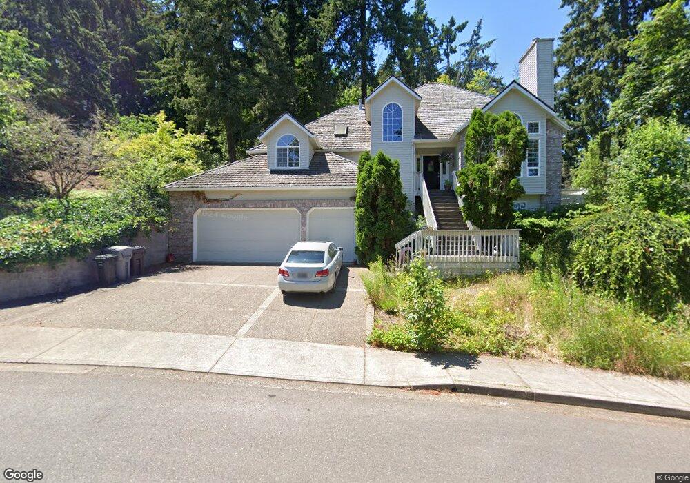
6120 Caufield St West Linn, OR 97068
Bolton NeighborhoodEstimated Value: $1,292,156 - $2,140,000
4
Beds
4
Baths
5,022
Sq Ft
$338/Sq Ft
Est. Value
About This Home
This home is located at 6120 Caufield St, West Linn, OR 97068 and is currently estimated at $1,698,039, approximately $338 per square foot. 6120 Caufield St is a home located in Clackamas County with nearby schools including Bolton Primary School, West Linn High School, and Clackamas Academy of Industrial Sciences (CAIS).
Ownership History
Date
Name
Owned For
Owner Type
Purchase Details
Closed on
Nov 2, 2016
Sold by
Hayashi Howard H and Hayashi Karen M
Bought by
Hayashi Evan
Current Estimated Value
Home Financials for this Owner
Home Financials are based on the most recent Mortgage that was taken out on this home.
Original Mortgage
$720,000
Interest Rate
3.48%
Mortgage Type
New Conventional
Purchase Details
Closed on
Feb 4, 2005
Sold by
Hayashi Howard H and Hayashi Karen M
Bought by
Hayashi Howard H and Hayashi Karen M
Create a Home Valuation Report for This Property
The Home Valuation Report is an in-depth analysis detailing your home's value as well as a comparison with similar homes in the area
Home Values in the Area
Average Home Value in this Area
Purchase History
| Date | Buyer | Sale Price | Title Company |
|---|---|---|---|
| Hayashi Evan | $900,000 | Old Republic Title Company | |
| Hayashi Howard H | -- | -- |
Source: Public Records
Mortgage History
| Date | Status | Borrower | Loan Amount |
|---|---|---|---|
| Closed | Hayashi Evan | $720,000 |
Source: Public Records
Tax History Compared to Growth
Tax History
| Year | Tax Paid | Tax Assessment Tax Assessment Total Assessment is a certain percentage of the fair market value that is determined by local assessors to be the total taxable value of land and additions on the property. | Land | Improvement |
|---|---|---|---|---|
| 2025 | $22,522 | $1,168,671 | -- | -- |
| 2024 | $21,679 | $1,134,633 | -- | -- |
| 2023 | $21,679 | $1,101,586 | $0 | $0 |
| 2022 | $20,462 | $1,069,501 | $0 | $0 |
| 2021 | $18,636 | $1,038,351 | $0 | $0 |
| 2020 | $18,481 | $1,008,108 | $0 | $0 |
| 2019 | $17,711 | $978,746 | $0 | $0 |
| 2018 | $16,831 | $950,239 | $0 | $0 |
| 2017 | $16,142 | $922,562 | $0 | $0 |
| 2016 | $15,505 | $895,691 | $0 | $0 |
| 2015 | $14,852 | $869,603 | $0 | $0 |
| 2014 | $14,059 | $844,275 | $0 | $0 |
Source: Public Records
Map
Nearby Homes
- 5128 Firwood Dr
- 1954 Buck St
- 6345 Caufield St
- 5219 Summit St
- 5910 W A St
- 6403 Tompkins Ct
- 20930 Fawn Ct Unit 26
- 5062 Prospect St
- 4973 Summit St
- 2764 Ridge Ln
- 2488 Tulane St
- 4050 Serango Ct
- 1470 Rosemont Rd
- 4794 Coho Ln
- 4020 Ridge Ln
- 22691 Oregon City Loop
- 2700 Underhill Ln Unit 1
- 2530 Cambridge St
- 3933 Parker Rd
- 22881 Oregon City Loop
- 5183 Firwood Place
- 5171 Firwood Dr
- 6100 Caufield St
- 6110 Caufield St
- 5191 Firwood Place
- 5163 Firwood Dr
- 5191 Firwood Dr
- 5151 Firwood Ct
- 2150 Hammerle St Unit H
- 6140 Caufield St
- 2140 Hammerle St
- 5190 Firwood Place
- 5190 Firwood Dr
- 2200 Hammerle St
- 5147 Firwood Ct
- 5176 Firwood Place
- 6101 Caufield St
- 2100 Hammerle St Unit H
- 2240 Hammerle St
- 2194 Hammerle St Unit H