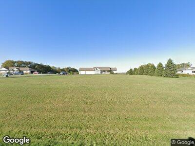
61210 325th St Malvern, IA 51551
Estimated Value: $465,000 - $550,000
4
Beds
3
Baths
2,491
Sq Ft
$198/Sq Ft
Est. Value
About This Home
This home is located at 61210 325th St, Malvern, IA 51551 and is currently estimated at $493,947, approximately $198 per square foot. 61210 325th St is a home located in Mills County with nearby schools including East Mills Elementary School and East Mills Jr. Sr. High School.
Ownership History
Date
Name
Owned For
Owner Type
Purchase Details
Closed on
Jun 24, 2014
Sold by
The Secretary Of Veterans Affairs
Bought by
Blasingame John and Blasingame Carolyn
Current Estimated Value
Purchase Details
Closed on
May 13, 2005
Sold by
Hughes James R and Hughes Monica A
Bought by
Mayfield Robert E and Mayfield Desiree A
Home Financials for this Owner
Home Financials are based on the most recent Mortgage that was taken out on this home.
Original Mortgage
$235,000
Interest Rate
5.91%
Mortgage Type
VA
Create a Home Valuation Report for This Property
The Home Valuation Report is an in-depth analysis detailing your home's value as well as a comparison with similar homes in the area
Home Values in the Area
Average Home Value in this Area
Purchase History
| Date | Buyer | Sale Price | Title Company |
|---|---|---|---|
| Blasingame John | $179,000 | None Available | |
| Mayfield Robert E | $227,500 | None Available |
Source: Public Records
Mortgage History
| Date | Status | Borrower | Loan Amount |
|---|---|---|---|
| Previous Owner | Mayfield Robert E | $235,000 |
Source: Public Records
Tax History Compared to Growth
Tax History
| Year | Tax Paid | Tax Assessment Tax Assessment Total Assessment is a certain percentage of the fair market value that is determined by local assessors to be the total taxable value of land and additions on the property. | Land | Improvement |
|---|---|---|---|---|
| 2024 | $4,630 | $454,485 | $116,790 | $337,695 |
| 2023 | $4,802 | $416,871 | $57,600 | $359,271 |
| 2022 | $4,580 | $341,923 | $57,600 | $284,323 |
| 2021 | $3,708 | $341,923 | $57,600 | $284,323 |
| 2020 | $3,708 | $297,238 | $50,000 | $247,238 |
| 2019 | $3,414 | $272,514 | $0 | $0 |
| 2018 | $3,526 | $272,514 | $0 | $0 |
| 2017 | $3,346 | $263,156 | $0 | $0 |
| 2016 | $2,928 | $249,636 | $0 | $0 |
| 2015 | $3,146 | $249,636 | $0 | $0 |
| 2014 | $3,328 | $249,636 | $0 | $0 |
Source: Public Records
Map
Nearby Homes
- 32164 Lambert Ave
- 933 E Ridge Dr
- 307 E 6th St
- 203 1/2 Prospect Ave
- 501 E 10th St
- 216 St Andrews Loop
- 802 Marion Ave
- 509 Main St
- 910 Prospect Ave
- 216 Saint Andrews Loop
- 59659 315th St
- 710 2nd Ave
- 60321 Jabber Rd
- 63944 310th St
- 421 Indian Ave
- 25+/- AC 305th St
- 12+/- AC 305th St
- 17+/- AC Hutchings Ave
- 5+/- ACRES Hutchings Ave
- 40+/- AC 305th St
- 61210 325th St
- 61212 325th St
- 61130 325th St
- 61163 325th St
- 61211 325th St
- 61128 325th St
- 61050 325th St
- 61306 325th St
- 32373 Lambert Ave
- 61048 325th St
- 32371 Lambert Ave
- 32295 Lambert Ave
- 32416 Lambert Ave
- 32293 Lambert Ave
- 60925 325th St
- 32322 Lambert Ave
- 32757 Lambert Ave
- 32033 Lambert Ave
- 56.54 AC Lambert Ave
- 32936 Lambert Ave