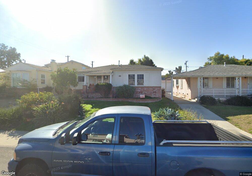
6122 W 82nd St Los Angeles, CA 90045
Westchester NeighborhoodEstimated Value: $1,455,000 - $1,659,000
3
Beds
2
Baths
1,382
Sq Ft
$1,138/Sq Ft
Est. Value
About This Home
This home is located at 6122 W 82nd St, Los Angeles, CA 90045 and is currently estimated at $1,572,543, approximately $1,137 per square foot. 6122 W 82nd St is a home located in Los Angeles County with nearby schools including Westport Heights Elementary, Wright Middle School STEAM Magnet, and Westchester Enriched Sciences Magnets.
Ownership History
Date
Name
Owned For
Owner Type
Purchase Details
Closed on
Apr 30, 2009
Sold by
Clark Douglas Robin
Bought by
Clark Ii Douglas Robin
Current Estimated Value
Home Financials for this Owner
Home Financials are based on the most recent Mortgage that was taken out on this home.
Original Mortgage
$584,870
Outstanding Balance
$368,538
Interest Rate
4.8%
Mortgage Type
New Conventional
Estimated Equity
$1,204,005
Purchase Details
Closed on
Apr 14, 2006
Sold by
Potoksky Norman and Pearson Gwendolyn M
Bought by
Clark Ii Douglas Robin
Home Financials for this Owner
Home Financials are based on the most recent Mortgage that was taken out on this home.
Original Mortgage
$627,200
Interest Rate
6.25%
Mortgage Type
Purchase Money Mortgage
Purchase Details
Closed on
Mar 16, 2002
Sold by
Potoksky Norman and Pearson Gwendolyn M
Bought by
Potoksky Norman
Create a Home Valuation Report for This Property
The Home Valuation Report is an in-depth analysis detailing your home's value as well as a comparison with similar homes in the area
Home Values in the Area
Average Home Value in this Area
Purchase History
| Date | Buyer | Sale Price | Title Company |
|---|---|---|---|
| Clark Ii Douglas Robin | -- | Fidelity Natl Title Ins Co | |
| Clark Ii Douglas Robin | $784,000 | Fidelity National Title Co | |
| Potoksky Norman | -- | -- |
Source: Public Records
Mortgage History
| Date | Status | Borrower | Loan Amount |
|---|---|---|---|
| Open | Clark Ii Douglas Robin | $584,870 | |
| Closed | Clark Ii Douglas Robin | $627,200 |
Source: Public Records
Tax History Compared to Growth
Tax History
| Year | Tax Paid | Tax Assessment Tax Assessment Total Assessment is a certain percentage of the fair market value that is determined by local assessors to be the total taxable value of land and additions on the property. | Land | Improvement |
|---|---|---|---|---|
| 2025 | $12,930 | $1,071,382 | $857,112 | $214,270 |
| 2024 | $12,930 | $1,050,375 | $840,306 | $210,069 |
| 2023 | $12,684 | $1,029,780 | $823,830 | $205,950 |
| 2022 | $12,099 | $1,009,589 | $807,677 | $201,912 |
| 2021 | $11,950 | $989,794 | $791,841 | $197,953 |
| 2019 | $11,595 | $960,438 | $768,355 | $192,083 |
| 2018 | $11,505 | $941,607 | $753,290 | $188,317 |
| 2016 | $9,948 | $816,000 | $653,000 | $163,000 |
| 2015 | $9,246 | $757,000 | $606,000 | $151,000 |
| 2014 | $9,462 | $757,000 | $606,000 | $151,000 |
Source: Public Records
Map
Nearby Homes
- 8101 Naylor Ave
- 7842 Croydon Ave
- 7832 Bleriot Ave
- 8210 Alverstone Ave
- 8313 Kittyhawk Ave
- 7817 Truxton Ave
- 7840 Boeing Ave
- 8507 Naylor Ave
- 6356 W 83rd St
- 6007 W 86th Place
- 8312 Barnsley Ave
- 8332 Barnsley Ave
- 6322 W 78th Place
- 6410 W 84th Place
- 8812 De Haviland Ave
- 6411 W 85th St
- 6040 W 76th St
- 8512 Belford Ave
- 6154 W 75th Place
- 5966 Abernathy Dr
- 6118 W 82nd St
- 6128 W 82nd St
- 6086 W 82nd St
- 6138 W 82nd St
- 8130 Croydon Ave
- 6080 W 82nd St
- 6142 W 82nd St
- 8131 Bleriot Ave
- 8126 Croydon Ave
- 6123 W 83rd Place
- 6119 W 83rd Place
- 8131 Croydon Ave
- 6074 W 82nd St
- 6107 W 83rd Place
- 6133 W 83rd Place
- 8127 Bleriot Ave
- 6148 W 82nd St
- 8120 Croydon Ave
- 8127 Croydon Ave
- 6101 W 83rd Place