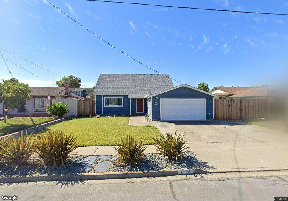
6126 Bennington Dr Newark, CA 94560
Estimated Value: $1,165,000 - $1,403,000
4
Beds
2
Baths
1,464
Sq Ft
$896/Sq Ft
Est. Value
About This Home
This home is located at 6126 Bennington Dr, Newark, CA 94560 and is currently estimated at $1,311,868, approximately $896 per square foot. 6126 Bennington Dr is a home located in Alameda County with nearby schools including Coyote Hills Elementary School, Newark Junior High School, and Newark Memorial High School.
Ownership History
Date
Name
Owned For
Owner Type
Purchase Details
Closed on
Oct 7, 1994
Sold by
Filson Mark E and Mahoney Mary E
Bought by
Lunsford Kelvin E and Lunsford Cynthia R
Current Estimated Value
Home Financials for this Owner
Home Financials are based on the most recent Mortgage that was taken out on this home.
Original Mortgage
$199,500
Interest Rate
8.7%
Create a Home Valuation Report for This Property
The Home Valuation Report is an in-depth analysis detailing your home's value as well as a comparison with similar homes in the area
Home Values in the Area
Average Home Value in this Area
Purchase History
| Date | Buyer | Sale Price | Title Company |
|---|---|---|---|
| Lunsford Kelvin E | $210,000 | Old Republic Title Company |
Source: Public Records
Mortgage History
| Date | Status | Borrower | Loan Amount |
|---|---|---|---|
| Closed | Lunsford Kelvin E | $199,500 |
Source: Public Records
Tax History
| Year | Tax Paid | Tax Assessment Tax Assessment Total Assessment is a certain percentage of the fair market value that is determined by local assessors to be the total taxable value of land and additions on the property. | Land | Improvement |
|---|---|---|---|---|
| 2025 | $4,664 | $345,717 | $105,815 | $246,902 |
| 2024 | $4,664 | $338,801 | $103,740 | $242,061 |
| 2023 | $4,525 | $339,023 | $101,707 | $237,316 |
| 2022 | $4,450 | $325,377 | $99,713 | $232,664 |
| 2021 | $4,342 | $318,860 | $97,758 | $228,102 |
| 2020 | $4,236 | $322,520 | $96,756 | $225,764 |
| 2019 | $4,178 | $316,196 | $94,859 | $221,337 |
| 2018 | $4,111 | $309,997 | $92,999 | $216,998 |
| 2017 | $4,005 | $303,920 | $91,176 | $212,744 |
| 2016 | $3,953 | $297,961 | $89,388 | $208,573 |
| 2015 | $3,938 | $293,487 | $88,046 | $205,441 |
| 2014 | $3,827 | $287,738 | $86,321 | $201,417 |
Source: Public Records
Map
Nearby Homes
- 6048 Bellhaven Ave
- 6252 Bennington Dr
- 36465 Hafner St
- 5874 Caleb Ct
- 5879 Caleb Ct
- 36057 Dalewood Dr
- 6328 Zulmida Ave
- 5585 Fernwood Dr
- 5912 Mayhews Landing Rd
- 35952 Rosewood Dr
- 6364 Noel Ave
- 36255 Casey Ct
- 6245 Thornton Ave
- 6449 Cedar Blvd
- 5311 Port Sailwood Dr
- 36184 Toulouse St
- 36563 Beutke Dr
- 5298 Sussex Place
- 5228 Falmouth Place
- 35050 Lido Blvd Unit B
- 6138 Bennington Dr
- 6118 Bennington Dr
- 6159 Bellhaven Ave
- 6173 Bellhaven Ave
- 6106 Bennington Dr
- 6146 Bennington Dr
- 6147 Bellhaven Ave
- 6201 Bellhaven Ave
- 6125 Bennington Dr
- 6133 Bellhaven Ave
- 6117 Bennington Dr
- 6137 Bennington Dr
- 6094 Bennington Dr
- 6154 Bennington Dr
- 6145 Bennington Dr
- 6257 Bellhaven Ave
- 6121 Bellhaven Ave
- 6093 Bennington Dr
- 6086 Bennington Dr
- 6153 Bennington Dr
Your Personal Tour Guide
Ask me questions while you tour the home.