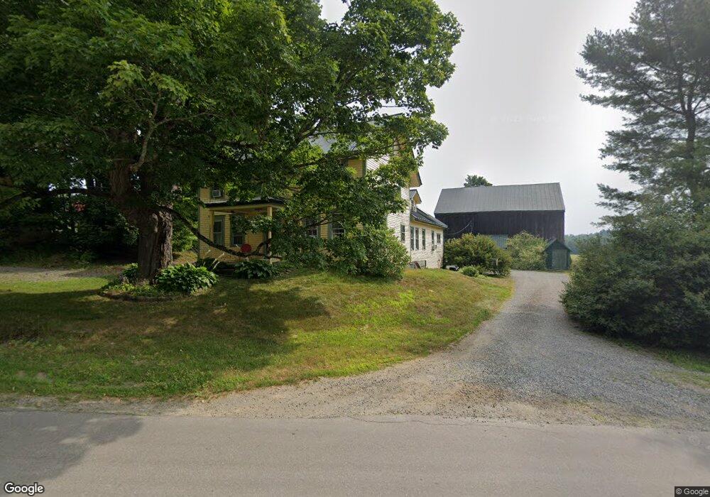
613 Durham Bridge Newport, ME 04953
Estimated Value: $413,000
4
Beds
2
Baths
3,400
Sq Ft
$121/Sq Ft
Est. Value
About This Home
This home is located at 613 Durham Bridge, Newport, ME 04953 and is currently priced at $413,000, approximately $121 per square foot. 613 Durham Bridge is a home located in Penobscot County with nearby schools including Sebasticook Valley Elementary School and Nokomis Regional Middle School/High School.
Ownership History
Date
Name
Owned For
Owner Type
Purchase Details
Closed on
Jul 10, 2023
Sold by
Demos George C and Demos Patricia A
Bought by
Demos George C and Demos Patricia A
Current Estimated Value
Purchase Details
Closed on
Aug 15, 2017
Sold by
Demos George and Demos Patricia A
Bought by
Demos Charles H and Demos Celia M
Home Financials for this Owner
Home Financials are based on the most recent Mortgage that was taken out on this home.
Original Mortgage
$280,000
Interest Rate
4.25%
Mortgage Type
New Conventional
Create a Home Valuation Report for This Property
The Home Valuation Report is an in-depth analysis detailing your home's value as well as a comparison with similar homes in the area
Home Values in the Area
Average Home Value in this Area
Purchase History
| Date | Buyer | Sale Price | Title Company |
|---|---|---|---|
| Demos George C | -- | None Available | |
| Demos Charles H | -- | -- |
Source: Public Records
Mortgage History
| Date | Status | Borrower | Loan Amount |
|---|---|---|---|
| Previous Owner | Demos Charles H | $280,000 |
Source: Public Records
Tax History Compared to Growth
Tax History
| Year | Tax Paid | Tax Assessment Tax Assessment Total Assessment is a certain percentage of the fair market value that is determined by local assessors to be the total taxable value of land and additions on the property. | Land | Improvement |
|---|---|---|---|---|
| 2024 | $6,832 | $390,400 | $79,300 | $311,100 |
| 2023 | $5,946 | $364,800 | $74,100 | $290,700 |
| 2022 | $5,649 | $288,200 | $58,500 | $229,700 |
| 2021 | $5,675 | $275,500 | $56,000 | $219,500 |
| 2019 | $643 | $30,200 | $30,200 | $0 |
| 2018 | $643 | $30,200 | $30,200 | $0 |
| 2017 | $5,002 | $250,100 | $70,100 | $180,000 |
| 2016 | $4,852 | $250,100 | $70,100 | $180,000 |
Source: Public Records
Map
Nearby Homes
- Lot 3-12 Shady Ln
- 107 Shady Ln
- 106 Shady Ln
- 63 Grandview Dr
- 30 Grand View Dr
- 37 Loon Dr
- 263 & 265 Stetson Rd
- 277 Grove St
- 265 Grove St
- 3 Canadian Geese Dr
- 315 Golf Course Rd
- 590 Stetson Rd
- Lot 2 Golf Course Cameo Sub Rd
- 35 Drew Ln
- 133 Hart St
- Lot 4 Moosehead Trail
- 107 Barrows Point Rd
- 39 Burleigh Rd
- 53 Burleigh Rd
- 48 Hart St
- 613 Durham Bridge Rd
- 4 Darling Farm
- 572 Durham Bridge Rd
- 658 Durham Bridge Rd
- 560 Durham Bridge Rd
- 675 Durham Bridge Rd
- 671 Durham Bridge Rd
- 17 Cherry Ln
- M8 L3A-1 Moose Creek Dr
- 693 Durham Bridge Rd
- Lot 3-13 Shady Ln
- L20 Shady Ln
- L 20 Shady Ln
- 26 Shady Ln
- LOT 8 Shady Ln
- 3 Shady Ln
- 2 Shady Ln
- Lot 3 Shady Ln
- 00 Shady Ln
- 51A Shady Ln