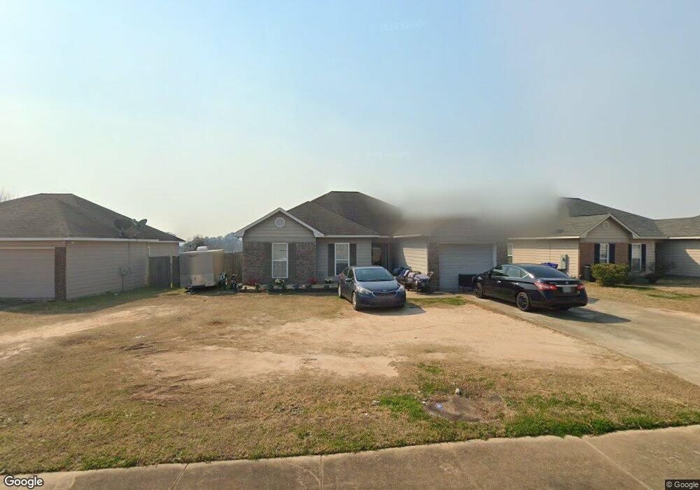
6130 Crossbow Dr Columbus, GA 31907
Eastern Columbus NeighborhoodEstimated Value: $176,000 - $185,000
3
Beds
3
Baths
1,494
Sq Ft
$121/Sq Ft
Est. Value
About This Home
This home is located at 6130 Crossbow Dr, Columbus, GA 31907 and is currently estimated at $181,192, approximately $121 per square foot. 6130 Crossbow Dr is a home located in Muscogee County with nearby schools including Forrest Road Elementary School, Fort Middle School, and Kendrick High School.
Ownership History
Date
Name
Owned For
Owner Type
Purchase Details
Closed on
Jul 2, 2021
Sold by
Crawford Tavarus L
Bought by
Brooks Kelvin Eugene and Brown Diana Denise
Current Estimated Value
Home Financials for this Owner
Home Financials are based on the most recent Mortgage that was taken out on this home.
Original Mortgage
$127,645
Outstanding Balance
$115,818
Interest Rate
2.9%
Mortgage Type
FHA
Estimated Equity
$65,374
Create a Home Valuation Report for This Property
The Home Valuation Report is an in-depth analysis detailing your home's value as well as a comparison with similar homes in the area
Home Values in the Area
Average Home Value in this Area
Purchase History
| Date | Buyer | Sale Price | Title Company |
|---|---|---|---|
| Brooks Kelvin Eugene | $130,000 | -- |
Source: Public Records
Mortgage History
| Date | Status | Borrower | Loan Amount |
|---|---|---|---|
| Open | Brooks Kelvin Eugene | $127,645 |
Source: Public Records
Tax History Compared to Growth
Tax History
| Year | Tax Paid | Tax Assessment Tax Assessment Total Assessment is a certain percentage of the fair market value that is determined by local assessors to be the total taxable value of land and additions on the property. | Land | Improvement |
|---|---|---|---|---|
| 2025 | $1,520 | $67,596 | $8,860 | $58,736 |
| 2024 | $1,518 | $67,596 | $8,860 | $58,736 |
| 2023 | $834 | $67,596 | $8,860 | $58,736 |
| 2022 | $1,583 | $52,000 | $7,720 | $44,280 |
| 2021 | $1,675 | $41,020 | $8,860 | $32,160 |
| 2020 | $1,675 | $41,020 | $8,860 | $32,160 |
| 2019 | $1,681 | $41,020 | $8,860 | $32,160 |
| 2018 | $1,681 | $41,020 | $8,860 | $32,160 |
| 2017 | $1,686 | $41,020 | $8,860 | $32,160 |
| 2016 | $2,323 | $56,316 | $7,200 | $49,116 |
| 2015 | $2,326 | $56,316 | $7,200 | $49,116 |
| 2014 | $2,329 | $56,316 | $7,200 | $49,116 |
| 2013 | -- | $56,316 | $7,200 | $49,116 |
Source: Public Records
Map
Nearby Homes
- 2672 Honeysuckle Dr
- 2942 Poppy Seed Loop
- 6028 Caribou Dr
- 2708 Courtland Ave
- 3041 Waddell Dr
- 6000 Caribou Dr
- 5906 Forrest Rd
- 3301 Musket Dr
- 6059 Nassau Cir
- 3027 Lansing Ave
- 2940 Urban Ave
- 6916 Bradshaw Dr
- 6636 Foxboro Dr
- 2525 Corineth Dr
- 5929 Gleneden Dr
- 5920 Gleneden Dr
- 5642 Boby Dr
- 5833 Gleneden Dr
- 2807 Doyle Ave
- 5644 Peggy Dr
- 6132 Crossbow Dr
- 6128 Crossbow Dr
- 6134 Crossbow Dr
- 6126 Crossbow Dr
- 6121 Caribou Dr
- 6136 Crossbow Dr
- 6119 Caribou Dr
- 6124 Crossbow Dr
- 6131 Crossbow Dr
- 6133 Crossbow Dr
- 6123 Caribou Dr Unit 24
- 6135 Crossbow Dr
- 6127 Crossbow Dr
- 6137 Crossbow Dr
- 6118 Crossbow Dr
- 6125 Crossbow Dr
- 2020 Arrow Point Ln
- 2012 Arrow Point Ln
- 2010 Arrow Point Ln
- 6139 Crossbow Dr