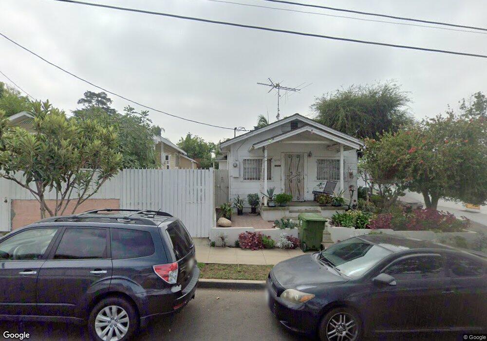
6132 Poppy Peak Dr Los Angeles, CA 90042
Estimated Value: $621,000 - $922,000
1
Bed
1
Bath
680
Sq Ft
$1,106/Sq Ft
Est. Value
About This Home
This home is located at 6132 Poppy Peak Dr, Los Angeles, CA 90042 and is currently estimated at $752,155, approximately $1,106 per square foot. 6132 Poppy Peak Dr is a home located in Los Angeles County with nearby schools including Annandale Elementary, Luther Burbank Middle School, and Eagle Rock High School.
Ownership History
Date
Name
Owned For
Owner Type
Purchase Details
Closed on
Oct 7, 1993
Sold by
Kvam Howell J and Kvam Delvina I
Bought by
Jinon Lagrimas A
Current Estimated Value
Home Financials for this Owner
Home Financials are based on the most recent Mortgage that was taken out on this home.
Original Mortgage
$49,000
Interest Rate
6.98%
Mortgage Type
Seller Take Back
Create a Home Valuation Report for This Property
The Home Valuation Report is an in-depth analysis detailing your home's value as well as a comparison with similar homes in the area
Home Values in the Area
Average Home Value in this Area
Purchase History
| Date | Buyer | Sale Price | Title Company |
|---|---|---|---|
| Jinon Lagrimas A | $61,000 | California Counties Title Co |
Source: Public Records
Mortgage History
| Date | Status | Borrower | Loan Amount |
|---|---|---|---|
| Closed | Jinon Lagrimas A | $49,000 |
Source: Public Records
Tax History Compared to Growth
Tax History
| Year | Tax Paid | Tax Assessment Tax Assessment Total Assessment is a certain percentage of the fair market value that is determined by local assessors to be the total taxable value of land and additions on the property. | Land | Improvement |
|---|---|---|---|---|
| 2025 | $1,259 | $103,642 | $84,967 | $18,675 |
| 2024 | $1,259 | $101,610 | $83,301 | $18,309 |
| 2023 | $1,235 | $99,618 | $81,668 | $17,950 |
| 2022 | $1,176 | $97,666 | $80,067 | $17,599 |
| 2021 | $1,157 | $95,752 | $78,498 | $17,254 |
| 2019 | $1,121 | $92,915 | $76,171 | $16,744 |
| 2018 | $1,094 | $91,094 | $74,678 | $16,416 |
| 2016 | $1,034 | $87,559 | $71,779 | $15,780 |
| 2015 | $1,018 | $86,244 | $70,701 | $15,543 |
| 2014 | $1,028 | $84,556 | $69,317 | $15,239 |
Source: Public Records
Map
Nearby Homes
- 6119 Strickland Ave
- 6134 Strickland Ave
- 6150 Strickland Ave
- 6155 Poppy Peak Dr
- 6048 Burwood Ave
- 6849 N Figueroa St
- 6050 Burwood Ave
- 6149 Annan Way
- 1522 N Mercury Dr
- 5847 Burwood Ave
- 523 Oleander Dr
- 5829 Tipton Way
- 5810 Burwood Ave
- 1425 Highgate Ave
- 1408 Highgate Ave
- 1465 Washburn Rd
- 1059 Glen Arbor Ave
- 1026 Oak Grove Dr
- 1726 La Loma Rd
- 1124 Highgrove Terrace
- 6130 Poppy Peak Dr
- 6136 Poppy Peak Dr
- 6126 Poppy Peak Dr
- 6140 Poppy Peak Dr
- 6131 Strickland Ave
- 6127 Strickland Ave
- 6135 Strickland Ave
- 6122 Poppy Peak Dr
- 6144 Poppy Peak Dr
- 6139 Strickland Ave
- 6123 Strickland Ave
- 6143 Strickland Ave
- 6118 Poppy Peak Dr
- 6148 Poppy Peak Dr
- 6147 Strickland Ave
- 6152 Poppy Peak Dr
- 6151 Strickland Ave
- 6154 Poppy Peak Dr
- 6910 N Figueroa St
- 6116 Strickland Ave