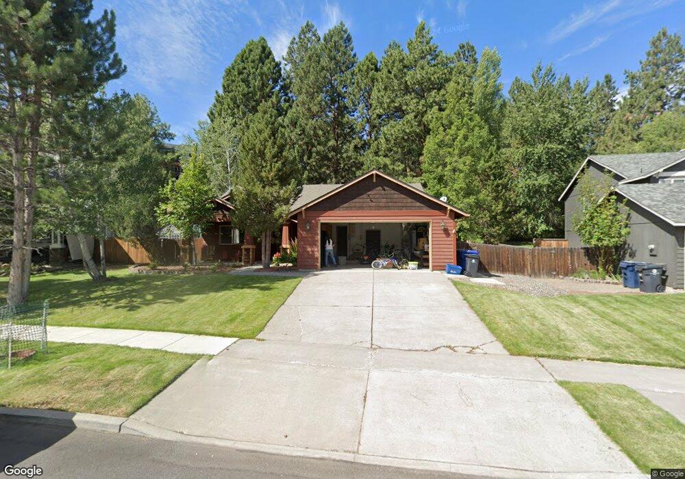
61363 Rock Bluff Ln Bend, OR 97702
Southwest Bend NeighborhoodEstimated Value: $630,450 - $669,000
3
Beds
2
Baths
1,553
Sq Ft
$419/Sq Ft
Est. Value
About This Home
This home is located at 61363 Rock Bluff Ln, Bend, OR 97702 and is currently estimated at $651,113, approximately $419 per square foot. 61363 Rock Bluff Ln is a home located in Deschutes County with nearby schools including Pine Ridge Elementary School, Cascade Middle School, and Bend Senior High School.
Ownership History
Date
Name
Owned For
Owner Type
Purchase Details
Closed on
Aug 13, 2014
Sold by
Lingle Joseph D
Bought by
Lingle Joseph D and Lingle Family Trust
Current Estimated Value
Purchase Details
Closed on
Aug 31, 2009
Sold by
Sweet Sharon A
Bought by
Lingle Joseph D
Home Financials for this Owner
Home Financials are based on the most recent Mortgage that was taken out on this home.
Original Mortgage
$168,800
Outstanding Balance
$109,496
Interest Rate
5.19%
Mortgage Type
New Conventional
Estimated Equity
$541,617
Purchase Details
Closed on
Sep 4, 2007
Sold by
White J Craig
Bought by
Sweet Sharon A
Home Financials for this Owner
Home Financials are based on the most recent Mortgage that was taken out on this home.
Original Mortgage
$291,200
Interest Rate
6.67%
Mortgage Type
Unknown
Create a Home Valuation Report for This Property
The Home Valuation Report is an in-depth analysis detailing your home's value as well as a comparison with similar homes in the area
Home Values in the Area
Average Home Value in this Area
Purchase History
| Date | Buyer | Sale Price | Title Company |
|---|---|---|---|
| Lingle Joseph D | -- | None Available | |
| Lingle Joseph D | $211,000 | Western Title & Escrow Co | |
| Sweet Sharon A | $364,000 | Amerititle |
Source: Public Records
Mortgage History
| Date | Status | Borrower | Loan Amount |
|---|---|---|---|
| Open | Lingle Joseph D | $168,800 | |
| Previous Owner | Sweet Sharon A | $291,200 |
Source: Public Records
Tax History
| Year | Tax Paid | Tax Assessment Tax Assessment Total Assessment is a certain percentage of the fair market value that is determined by local assessors to be the total taxable value of land and additions on the property. | Land | Improvement |
|---|---|---|---|---|
| 2025 | $4,067 | $240,720 | -- | -- |
| 2024 | $3,913 | $233,710 | -- | -- |
| 2023 | $3,628 | $226,910 | $0 | $0 |
| 2022 | $3,385 | $213,900 | $0 | $0 |
| 2021 | $3,390 | $207,670 | $0 | $0 |
| 2020 | $3,216 | $207,670 | $0 | $0 |
| 2019 | $3,126 | $201,630 | $0 | $0 |
| 2018 | $3,038 | $195,760 | $0 | $0 |
| 2017 | $3,015 | $190,060 | $0 | $0 |
| 2016 | $2,879 | $184,530 | $0 | $0 |
| 2015 | $2,801 | $179,160 | $0 | $0 |
| 2014 | $2,720 | $173,950 | $0 | $0 |
Source: Public Records
Map
Nearby Homes
- 19974 Covey Ln
- 61379 Sally Ln
- 19895 Porcupine Dr
- 20086 Porter Place
- 20080 Mount Hope Ln
- 20079 Elizabeth Ln
- 20017 Voltera Place
- 61521 Sunny Breeze Ln
- 61358 Huckleberry Place
- 61176 Larkwood Dr
- 0 Pinebrook Blvd Unit 220199740
- 19788 Chicory Ave
- 19745 Mount Bachelor Ct
- 19717 Mount Bachelor Dr Unit 421
- 19717 Mt Bachelor Dr Unit 330E
- 19717 Mount Bachelor Dr Unit 617
- 19717 SW Mount Bachelor Dr Unit 513
- 19717 SW Mount Bachelor Dr Unit 118
- 19717 SW Mount Bachelor Dr Unit 154
- 19717 SW Mount Bachelor Dr Unit 328E
- 61359 Rock Bluff Ln
- 61367 Rock Bluff Ln
- 61355 Rock Bluff Ln
- 19954 Covey Ln
- 19931 Powers Rd
- 61351 Rock Bluff Ln
- 19928 Heron Loop
- 19932 Heron Loop
- 61371 Rock Bluff Ln
- 19962 Covey Ln
- 19936 Heron Loop
- 19961 Powers Rd
- 61347 Rock Bluff Ln
- 61370 Rock Bluff Ln
- 19968 Covey Ln
- 19925 Powers Rd
- 61375 Rock Bluff Ln
- 19967 Powers Rd
- 19963 Covey Ln
Your Personal Tour Guide
Ask me questions while you tour the home.