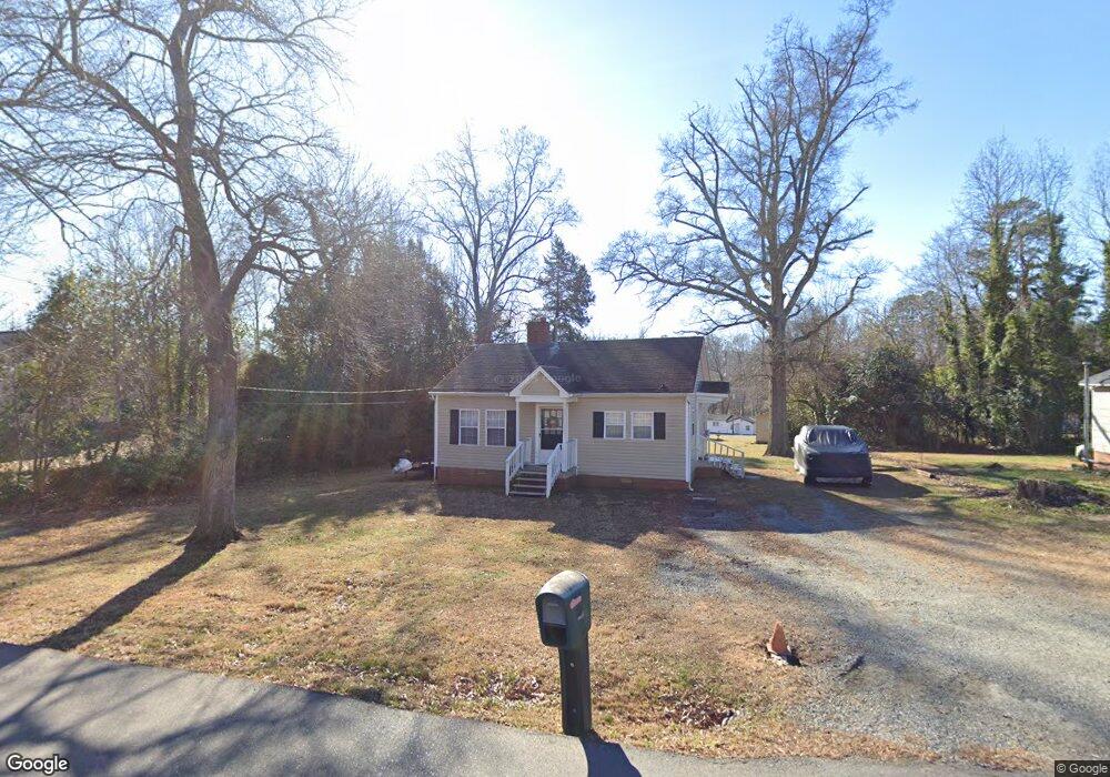
614 Martha Ave Lowell, NC 28098
Estimated Value: $145,000 - $181,000
2
Beds
1
Bath
780
Sq Ft
$212/Sq Ft
Est. Value
About This Home
This home is located at 614 Martha Ave, Lowell, NC 28098 and is currently estimated at $165,145, approximately $211 per square foot. 614 Martha Ave is a home located in Gaston County with nearby schools including Lowell Elementary School, Holbrook Middle School, and Ashbrook High School.
Ownership History
Date
Name
Owned For
Owner Type
Purchase Details
Closed on
Apr 1, 2014
Sold by
Buchanan Mark H
Bought by
Timmberman Charles N and Buchanan Denise
Current Estimated Value
Home Financials for this Owner
Home Financials are based on the most recent Mortgage that was taken out on this home.
Original Mortgage
$37,600
Outstanding Balance
$11,325
Interest Rate
4.36%
Mortgage Type
New Conventional
Estimated Equity
$153,820
Purchase Details
Closed on
Jan 25, 2010
Sold by
Buchanan Denise H and Buchanan Mark H
Bought by
Buchanan Mark H
Create a Home Valuation Report for This Property
The Home Valuation Report is an in-depth analysis detailing your home's value as well as a comparison with similar homes in the area
Home Values in the Area
Average Home Value in this Area
Purchase History
| Date | Buyer | Sale Price | Title Company |
|---|---|---|---|
| Timmberman Charles N | $47,000 | Chicago Title Insurance Co | |
| Buchanan Mark H | -- | None Available |
Source: Public Records
Mortgage History
| Date | Status | Borrower | Loan Amount |
|---|---|---|---|
| Open | Timmberman Charles N | $37,600 |
Source: Public Records
Tax History Compared to Growth
Tax History
| Year | Tax Paid | Tax Assessment Tax Assessment Total Assessment is a certain percentage of the fair market value that is determined by local assessors to be the total taxable value of land and additions on the property. | Land | Improvement |
|---|---|---|---|---|
| 2025 | $1,452 | $135,870 | $16,000 | $119,870 |
| 2024 | $1,452 | $135,870 | $16,000 | $119,870 |
| 2023 | $1,610 | $135,870 | $16,000 | $119,870 |
| 2022 | $851 | $60,330 | $16,000 | $44,330 |
| 2021 | $796 | $60,330 | $16,000 | $44,330 |
| 2019 | $766 | $60,330 | $16,000 | $44,330 |
| 2018 | $676 | $51,997 | $14,400 | $37,597 |
| 2017 | $676 | $51,997 | $14,400 | $37,597 |
| 2016 | $676 | $51,997 | $0 | $0 |
| 2014 | $542 | $41,703 | $10,500 | $31,203 |
Source: Public Records
Map
Nearby Homes
- 510 Mill St
- 812 N Main St
- 302 W 2nd St
- 211 Seigle St Unit 37-38
- 508 Hand Cir
- 00 W 1st St
- 514 Hand Cir
- 805 River Trail Rd
- 116 Kenworthy Ave
- Winslow Plan at Heritage Hall
- Riley Plan at Heritage Hall
- Wayne Plan at Heritage Hall
- Kipling Plan at Heritage Hall
- Calloway Plan at Heritage Hall
- Calgary Plan at Heritage Hall
- Wakefield Plan at Heritage Hall
- Bayside Plan at Heritage Hall
- Montcrest Plan at Heritage Hall
- Brodrick Plan at Heritage Hall
- Tate Plan at Heritage Hall
- 612 Martha Ave
- 618 Martha Ave
- 203 Caroline Ave
- 205 Caroline Ave
- 700 Martha Ave
- 209 Caroline Ave
- 617 Martha Ave
- 613 Martha Ave
- 604 Martha Ave Unit blk D L3 &p/2
- 621 Martha Ave
- 702 Martha Ave
- 200 Caroline Ave
- 701 Martha Ave
- 609 Martha Ave
- 305 Caroline Ave
- 110 Caroline Ave
- 206 Caroline Ave
- 703 Martha Ave
- 704 Martha Ave
- 108 Caroline Ave