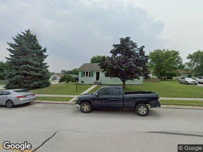
614 Poplar St Unit 98 Hanover, PA 17331
Estimated Value: $223,520 - $239,000
3
Beds
1
Bath
1,092
Sq Ft
$209/Sq Ft
Est. Value
About This Home
This home is located at 614 Poplar St Unit 98, Hanover, PA 17331 and is currently estimated at $228,130, approximately $208 per square foot. 614 Poplar St Unit 98 is a home located in Adams County with nearby schools including New Oxford Senior High School, St. Teresa of Calcutta Catholic School - McSherrystown Campus, and St. Teresa of Calcutta Catholic School - Conewago Campus.
Ownership History
Date
Name
Owned For
Owner Type
Purchase Details
Closed on
Oct 29, 2020
Sold by
Stotsky Timothy A and Hawkins Sandra
Bought by
Stotsky Timothy A and Hawkins Sandra
Current Estimated Value
Purchase Details
Closed on
Mar 22, 2018
Sold by
Stotsky Timothy A and Stotsky Laurie
Bought by
Stotsky Timothy A
Purchase Details
Closed on
Feb 12, 1990
Bought by
Stotsky Timothy A and Stotsky Laurie A
Create a Home Valuation Report for This Property
The Home Valuation Report is an in-depth analysis detailing your home's value as well as a comparison with similar homes in the area
Home Values in the Area
Average Home Value in this Area
Purchase History
| Date | Buyer | Sale Price | Title Company |
|---|---|---|---|
| Stotsky Timothy A | -- | None Available | |
| Stotsky Timothy A | -- | -- | |
| Stotsky Timothy A | $77,900 | -- |
Source: Public Records
Mortgage History
| Date | Status | Borrower | Loan Amount |
|---|---|---|---|
| Open | Stotsky Timothy A | $81,500 | |
| Closed | Stotsky Timothy A | $12,143 |
Source: Public Records
Tax History Compared to Growth
Tax History
| Year | Tax Paid | Tax Assessment Tax Assessment Total Assessment is a certain percentage of the fair market value that is determined by local assessors to be the total taxable value of land and additions on the property. | Land | Improvement |
|---|---|---|---|---|
| 2025 | $3,932 | $164,200 | $43,400 | $120,800 |
| 2024 | $3,632 | $164,200 | $43,400 | $120,800 |
| 2023 | $3,498 | $164,200 | $43,400 | $120,800 |
| 2022 | $3,391 | $164,200 | $43,400 | $120,800 |
| 2021 | $3,304 | $164,200 | $43,400 | $120,800 |
| 2020 | $3,309 | $164,200 | $43,400 | $120,800 |
| 2019 | $3,160 | $164,200 | $43,400 | $120,800 |
| 2018 | $3,086 | $163,800 | $43,000 | $120,800 |
| 2017 | $2,959 | $163,800 | $43,000 | $120,800 |
| 2016 | -- | $163,800 | $43,000 | $120,800 |
| 2015 | -- | $163,800 | $43,000 | $120,800 |
| 2014 | -- | $163,800 | $43,000 | $120,800 |
Source: Public Records
Map
Nearby Homes
- 657 Cricket Ln Unit 5
- 626 Linden Ave
- 700 Linden Ave
- 718 Linden Ave
- 502 South St Unit 1
- 12 Commerce St
- 355 North St
- 240 Stafford Dr Unit 96
- 510 High St
- 362 High St
- 126 3rd St
- 31 4th St
- 316 N Franklin St
- 65 Eagle Ln Unit 3
- 97 Flint Dr Unit 56
- 449 Carlisle St
- 555 Carlisle St
- 408 Frederick St
- 41 Squire Cir Unit 25A
- 106 Eichelberger St
- 614 Poplar St Unit 98
- 44 Caribou St Unit 99
- 620 Poplar St Unit 97
- 38 Caribou St Unit 100
- 608 Poplar St Unit 58
- 615 Poplar St Unit 74
- 93 Elk Dr Unit 57
- 626 Poplar St Unit 96
- 619 Poplar St Unit 75
- 607 Poplar St Unit 68
- 87 Elk Dr Unit 56
- 32 Caribou St Unit 101
- 78 Elk Dr Unit 113
- 248 S Jefferson St Unit 65
- 623 Poplar St Unit 76
- 110 Elk Dr Unit 73
- 254 S Jefferson St Unit 64
- 81 Elk Dr Unit 55
- 632 Poplar St Unit 95
- 109 Elk Dr Unit 69