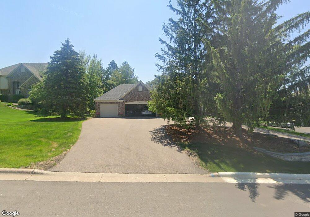
614 Sutcliff Cir Saint Paul, MN 55118
Estimated Value: $751,000 - $829,000
3
Beds
4
Baths
2,150
Sq Ft
$374/Sq Ft
Est. Value
About This Home
This home is located at 614 Sutcliff Cir, Saint Paul, MN 55118 and is currently estimated at $803,522, approximately $373 per square foot. 614 Sutcliff Cir is a home located in Dakota County with nearby schools including Somerset Elementary School, Heritage E-STEM Magnet School, and Two Rivers High School.
Ownership History
Date
Name
Owned For
Owner Type
Purchase Details
Closed on
Jun 10, 2019
Sold by
Folkes Robert J and Folkes Karen O
Bought by
Folkes Robert J and Folkes Karen O
Current Estimated Value
Purchase Details
Closed on
Jul 24, 2006
Sold by
Suga Masami
Bought by
Folkes Robert J
Purchase Details
Closed on
Jan 30, 2003
Sold by
Hayes James Partick and Hayes Patricia Ann
Bought by
Masami Suga and Gutzmann Jon M
Create a Home Valuation Report for This Property
The Home Valuation Report is an in-depth analysis detailing your home's value as well as a comparison with similar homes in the area
Home Values in the Area
Average Home Value in this Area
Purchase History
| Date | Buyer | Sale Price | Title Company |
|---|---|---|---|
| Folkes Robert J | -- | None Available | |
| Folkes Robert J | $656,000 | -- | |
| Masami Suga | $570,000 | -- |
Source: Public Records
Tax History Compared to Growth
Tax History
| Year | Tax Paid | Tax Assessment Tax Assessment Total Assessment is a certain percentage of the fair market value that is determined by local assessors to be the total taxable value of land and additions on the property. | Land | Improvement |
|---|---|---|---|---|
| 2024 | $7,236 | $772,200 | $180,600 | $591,600 |
| 2023 | $7,236 | $731,100 | $176,600 | $554,500 |
| 2022 | $6,930 | $742,500 | $176,100 | $566,400 |
| 2021 | $7,146 | $659,400 | $153,200 | $506,200 |
| 2020 | $6,690 | $669,200 | $145,900 | $523,300 |
| 2019 | $6,292 | $612,500 | $138,900 | $473,600 |
| 2018 | $5,960 | $556,300 | $129,800 | $426,500 |
| 2017 | $5,851 | $548,300 | $123,600 | $424,700 |
| 2016 | $5,783 | $524,400 | $117,700 | $406,700 |
| 2015 | $5,366 | $523,200 | $110,300 | $412,900 |
| 2014 | -- | $472,000 | $104,100 | $367,900 |
| 2013 | -- | $452,700 | $101,000 | $351,700 |
Source: Public Records
Map
Nearby Homes
- 606 Sutcliff Cir
- 1000 Winston Cir
- 641 Sibley Memorial Hwy
- 967 Cherokee Ave
- 955 Cherokee Ave
- 1174 Dodd Rd
- 1164 Dodd Rd
- 625 Ivy Falls Ave
- 801 Cherokee Ave
- 679 Maple Park Dr
- 750 Delaware Ave
- 1172 Ottawa Ave
- 8 Dorset Rd
- 822 Smith Ave S
- 672 Ivy Falls Ct
- 648 Sunset Ln
- 13XX Clement St
- 242 Annapolis St W
- 663 Smith Ave S
- 259 Curtice St W
- 622 Sutcliff Cir
- 995 Winston Cir
- 613 Winston Ct
- 990 Winston Cir
- 613 Sutcliff Cir
- 623 Sutcliff Cir
- 596 Sutcliff Cir
- 630 Sutcliff Cir
- 605 Sutcliff Cir
- 1000 Downing St
- 605 Winston Ct
- 588 Sutcliff Cir
- 994 Downing St
- 597 Sutcliff Cir
- 994 Winston Cir
- 990 Downing St
- 572 Miriam St
- 1006 Downing St
- 606 Sibley Memorial Hwy
- 610 Winston Ct