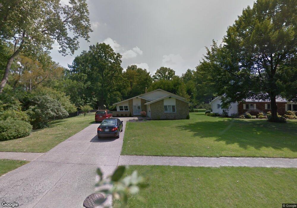
6149 Melshore Dr Mentor, OH 44060
Estimated Value: $281,000 - $316,000
3
Beds
3
Baths
1,368
Sq Ft
$221/Sq Ft
Est. Value
About This Home
This home is located at 6149 Melshore Dr, Mentor, OH 44060 and is currently estimated at $302,333, approximately $221 per square foot. 6149 Melshore Dr is a home located in Lake County with nearby schools including Fairfax Elementary School, Memorial Middle School, and Mentor High School.
Ownership History
Date
Name
Owned For
Owner Type
Purchase Details
Closed on
Sep 29, 2004
Sold by
Weber Steven R and Weber Michelle M
Bought by
Rexrode Bruce E
Current Estimated Value
Home Financials for this Owner
Home Financials are based on the most recent Mortgage that was taken out on this home.
Original Mortgage
$177,214
Outstanding Balance
$86,222
Interest Rate
5.93%
Mortgage Type
VA
Estimated Equity
$216,111
Purchase Details
Closed on
Oct 20, 1997
Sold by
Anderson Robert L and Anderson Joanne L
Bought by
Weber Steven R and Weber Michelle M
Home Financials for this Owner
Home Financials are based on the most recent Mortgage that was taken out on this home.
Original Mortgage
$105,600
Interest Rate
7.25%
Purchase Details
Closed on
Aug 18, 1997
Sold by
Lieber Doris Irene
Bought by
Anderson Robert L and Anderson Joanne L
Purchase Details
Closed on
Nov 15, 1991
Bought by
Lieber Doris I Trustee
Create a Home Valuation Report for This Property
The Home Valuation Report is an in-depth analysis detailing your home's value as well as a comparison with similar homes in the area
Home Values in the Area
Average Home Value in this Area
Purchase History
| Date | Buyer | Sale Price | Title Company |
|---|---|---|---|
| Rexrode Bruce E | $173,400 | Enterprise Title | |
| Weber Steven R | -- | Enterprise Title Agency Inc | |
| Anderson Robert L | $132,000 | Enterprise Title Agency Inc | |
| Lieber Doris I Trustee | -- | -- |
Source: Public Records
Mortgage History
| Date | Status | Borrower | Loan Amount |
|---|---|---|---|
| Open | Rexrode Bruce E | $177,214 | |
| Previous Owner | Weber Steven R | $105,600 |
Source: Public Records
Tax History
| Year | Tax Paid | Tax Assessment Tax Assessment Total Assessment is a certain percentage of the fair market value that is determined by local assessors to be the total taxable value of land and additions on the property. | Land | Improvement |
|---|---|---|---|---|
| 2025 | -- | $95,630 | $33,120 | $62,510 |
| 2024 | -- | $95,630 | $33,120 | $62,510 |
| 2023 | $7,548 | $72,640 | $23,560 | $49,080 |
| 2022 | $3,346 | $72,640 | $23,560 | $49,080 |
| 2021 | $3,356 | $72,640 | $23,560 | $49,080 |
| 2020 | $3,243 | $61,550 | $19,960 | $41,590 |
| 2019 | $3,349 | $61,550 | $19,960 | $41,590 |
| 2018 | $3,319 | $58,970 | $29,390 | $29,580 |
| 2017 | $3,400 | $58,970 | $29,390 | $29,580 |
| 2016 | $3,239 | $58,970 | $29,390 | $29,580 |
| 2015 | $2,954 | $58,970 | $29,390 | $29,580 |
| 2014 | $2,861 | $56,280 | $29,390 | $26,890 |
| 2013 | $2,864 | $56,280 | $29,390 | $26,890 |
Source: Public Records
Map
Nearby Homes
- 8096 Munson Rd
- 8031 Munson Rd
- 6067 Collins Rd
- 0 Collins Rd
- 6270 Cumberland Dr
- 5998 Collins Rd
- 8285 Munson Rd
- 5976 Silver Ct
- 6239 Dunbar Dr
- 8352 Quail Point Ln Unit 8352
- 6082 Andrews Rd
- 6218 Center St Unit 6218
- 6484 Elmwood Rd
- 5817 Fenwood Ct
- 8420 Bartley Ln Unit C
- 8431 Hendricks Rd
- 6595 Devonshire Ct
- 7641 Fern Dr
- V/L Andrews Rd
- 6452 Brooks Blvd
- 6161 Melshore Dr
- 6169 Melshore Dr
- 6139 Melshore Dr
- 6173 Barry Ct
- 6144 Melshore Dr
- 6160 Melshore Dr
- 6175 Barry Ct
- 6166 Melshore Dr
- 6187 Melshore Dr
- 6132 Melshore Dr
- 6172 Melshore Dr
- 6154 Cumberland Ct
- 8088 Munson Rd
- 6177 Barry Ct
- 6146 Cumberland Ct
- 6160 Cumberland Ct
- 8104 Munson Rd
- 8072 Munson Rd
- 6180 Melshore Dr
- 6193 Melshore Dr
Your Personal Tour Guide
Ask me questions while you tour the home.