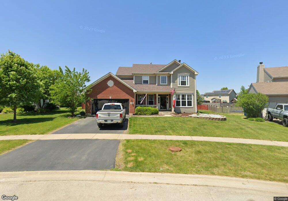
615 Creekside Cir Minooka, IL 60447
Estimated Value: $377,000 - $389,000
--
Bed
--
Bath
2,332
Sq Ft
$164/Sq Ft
Est. Value
About This Home
This home is located at 615 Creekside Cir, Minooka, IL 60447 and is currently estimated at $381,755, approximately $163 per square foot. 615 Creekside Cir is a home with nearby schools including Minooka Primary Center, Aux Sable Elementary School, and Minooka Junior High School.
Ownership History
Date
Name
Owned For
Owner Type
Purchase Details
Closed on
Jun 24, 2016
Sold by
Mccallum Edward W and Mccallum Judy
Bought by
Budzyn Don
Current Estimated Value
Home Financials for this Owner
Home Financials are based on the most recent Mortgage that was taken out on this home.
Original Mortgage
$213,750
Outstanding Balance
$170,508
Interest Rate
3.64%
Mortgage Type
New Conventional
Estimated Equity
$211,247
Create a Home Valuation Report for This Property
The Home Valuation Report is an in-depth analysis detailing your home's value as well as a comparison with similar homes in the area
Home Values in the Area
Average Home Value in this Area
Purchase History
| Date | Buyer | Sale Price | Title Company |
|---|---|---|---|
| Budzyn Don | $225,000 | Fidelity National Title Insu |
Source: Public Records
Mortgage History
| Date | Status | Borrower | Loan Amount |
|---|---|---|---|
| Open | Budzyn Don | $213,750 |
Source: Public Records
Tax History Compared to Growth
Tax History
| Year | Tax Paid | Tax Assessment Tax Assessment Total Assessment is a certain percentage of the fair market value that is determined by local assessors to be the total taxable value of land and additions on the property. | Land | Improvement |
|---|---|---|---|---|
| 2024 | $9,024 | $112,502 | $20,282 | $92,220 |
| 2023 | $8,225 | $102,545 | $18,487 | $84,058 |
| 2022 | $7,059 | $95,346 | $17,189 | $78,157 |
| 2021 | $6,754 | $90,255 | $16,271 | $73,984 |
| 2020 | $6,583 | $86,337 | $15,565 | $70,772 |
| 2019 | $6,209 | $79,942 | $14,412 | $65,530 |
| 2018 | $6,284 | $77,706 | $14,251 | $63,455 |
| 2017 | $6,102 | $74,204 | $13,609 | $60,595 |
| 2016 | $5,700 | $69,656 | $12,775 | $56,881 |
| 2015 | $4,866 | $63,318 | $11,613 | $51,705 |
| 2014 | $4,417 | $59,824 | $10,972 | $48,852 |
| 2013 | $4,573 | $60,630 | $11,120 | $49,510 |
Source: Public Records
Map
Nearby Homes
- 825 Grant Dr
- 1404 Plantain Dr
- 324 Wabena Ct
- 1074-1080 Clover Dr
- 1420 Marigold Ln
- 278,279,280,281 Clover Cir
- Lots 298-301 Clover Cir
- 1935 Waters Edge Dr
- 605 High Grove Dr
- 1118 Burns Ln
- 1941 Waters Edge Dr
- 1413 Sedge Pass
- 1468 Sedge Pass
- 1448 Sedge Pass
- 802 Joanne Dr
- 314 Golden Rod Dr
- 1224 Burns Ln
- 703 Stillwater Ct
- 246 Prairie Ridge Dr
- 601 Edgewater Dr
- 1301 Creekside Cir
- 613 Creekside Cir
- 611 Creekside Cir
- 1303 Creekside Cir
- 1214 Creekside Cir
- 632 Brita Ct
- 640 Maplewood Dr
- 1305 Creekside Cir
- 1304 Creekside Cir
- 609 Creekside Cir
- 700 Maplewood Dr
- 636 Maplewood Dr
- 704 Maplewood Dr
- 632 Maplewood Dr
- 633 Brita Ct
- 624 Brita Trail
- 1301 Megan Ct
- 1306 Creekside Cir
- 1307 Creekside Cir
- 708 Maplewood Dr