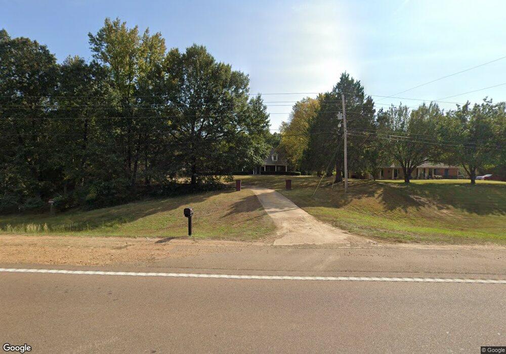
615 Highway 6 W Oxford, MS 38655
Estimated Value: $102,000 - $737,000
5
Beds
4
Baths
3,824
Sq Ft
$111/Sq Ft
Est. Value
About This Home
This home is located at 615 Highway 6 W, Oxford, MS 38655 and is currently estimated at $425,625, approximately $111 per square foot. 615 Highway 6 W is a home located in Lafayette County with nearby schools including Central Elementary School, Bramlett Elementary School, and Della Davidson Elementary School.
Ownership History
Date
Name
Owned For
Owner Type
Purchase Details
Closed on
Jun 4, 2025
Sold by
Rubin Lublin Llc and Greer Kayla Erin
Bought by
Federal National Mortgage Association
Current Estimated Value
Purchase Details
Closed on
Jul 30, 2021
Sold by
Rubin Lublin Llc and Lovier Heather
Bought by
Federal National Mortgage Association
Home Financials for this Owner
Home Financials are based on the most recent Mortgage that was taken out on this home.
Original Mortgage
$417,100
Interest Rate
2.93%
Mortgage Type
New Conventional
Create a Home Valuation Report for This Property
The Home Valuation Report is an in-depth analysis detailing your home's value as well as a comparison with similar homes in the area
Home Values in the Area
Average Home Value in this Area
Purchase History
| Date | Buyer | Sale Price | Title Company |
|---|---|---|---|
| Federal National Mortgage Association | $250,000 | None Listed On Document | |
| Federal National Mortgage Association | $250,000 | None Listed On Document | |
| Greer Kayla Erin | -- | None Available |
Source: Public Records
Mortgage History
| Date | Status | Borrower | Loan Amount |
|---|---|---|---|
| Previous Owner | Greer Kayla Erin | $417,100 |
Source: Public Records
Tax History Compared to Growth
Tax History
| Year | Tax Paid | Tax Assessment Tax Assessment Total Assessment is a certain percentage of the fair market value that is determined by local assessors to be the total taxable value of land and additions on the property. | Land | Improvement |
|---|---|---|---|---|
| 2024 | $422 | $6,936 | $0 | $0 |
| 2023 | $422 | $25,674 | $0 | $0 |
| 2022 | $2,254 | $25,674 | $0 | $0 |
| 2021 | $825 | $25,674 | $0 | $0 |
| 2020 | $792 | $25,474 | $0 | $0 |
| 2019 | $792 | $25,474 | $0 | $0 |
| 2018 | $792 | $25,474 | $0 | $0 |
| 2017 | $792 | $25,474 | $0 | $0 |
| 2016 | $699 | $23,735 | $0 | $0 |
| 2015 | -- | $23,735 | $0 | $0 |
| 2014 | -- | $23,735 | $0 | $0 |
Source: Public Records
Map
Nearby Homes
- 1025 Nuttall Oak Dr
- 1029 Nuttall Oak Dr
- 1034 Nuttall Oak Dr
- 1028 Nuttall Oak Dr
- 1032 Nuttall Oak Dr
- 8009 Lake Cove
- 698 Mississippi 6
- 8003 Lake Cove
- 8005 Lake Cove
- 11017 Covington Way
- TBD Cr 105
- 12012 Water Ridge Dr
- 120 Merion Blvd
- 4005 Pintail Cove
- 2210 Longspur Point
- 6115 Canvas Back Dr
- 2212 Longspur Pointe
- 309 Norbury Cove
- 456 Highway 6 W
- 0 County Road 309
- 615 Ms-6
- 615 Mississippi 6
- 645 W Hwy Unit 6
- 500 Cumberland Place
- 617 Highway 6 W
- 502 Cumberland Place
- 506 Cumberland Place
- 506 Cumberland Place
- 504 Cumberland Dr
- 502 Cumberland Dr
- 504 Cumberland Place
- LOT 43 Cumberland Dr
- 44 Cumberland Dr
- 62 Cumberland Dr
- LOT 34 Cumberland Dr
- LOT 32 Cumberland Dr
- LOT 27 Cumberland Dr
- LOT #2 Cumberland Dr
- PTLot 50 Cumberland Dr
- 501 Cumberland Place